LG유플러스가 U+드론 관제시스템을 이용해 천연가스 배관망 매설지역을 실시간으로 감시함으로써 리스크를 미리 예방하는 사회기반시설 정밀점검 시연에 성공했다. 이번 시연은 드론의 실용화 및 조기 상용화를 촉진하기 위해 드론 분야에서 일정 기간 규제 없이 신규 비즈니스 모델을 발굴하고 안전성 테스트 등을 자유롭게 수행하는 국토교통부의 드론 규제 샌드박스 시범사업의 일환으로 이뤄졌다. LG유플러스는 비가시권 자율비행을 기반으로 3D지도·상공전파지도·상공기상정보를 이용한 천연가스 배관망 매설지역 실시간 촬영, 실시간 매설지역 감시와 불법공사 중단 요청, 지반변위 탐지 등 시연을 통해 해당 지역을 잠재적 피해로부터 보호하는 시연을 진행했다.
차량 접근 어려운 매설지역 장애 확인
관제시스템 통해 드론포트 가능성도 확인
LG유플러스는 지난 5일, U+드론 관제시스템을 이용해 천연가스 배관망 매설지역을 실시간으로 감시함으로써 리스크를 미리 예방하는 ‘사회기반시설 정밀점검’ 시연에 성공했다고 9일 밝혔다.
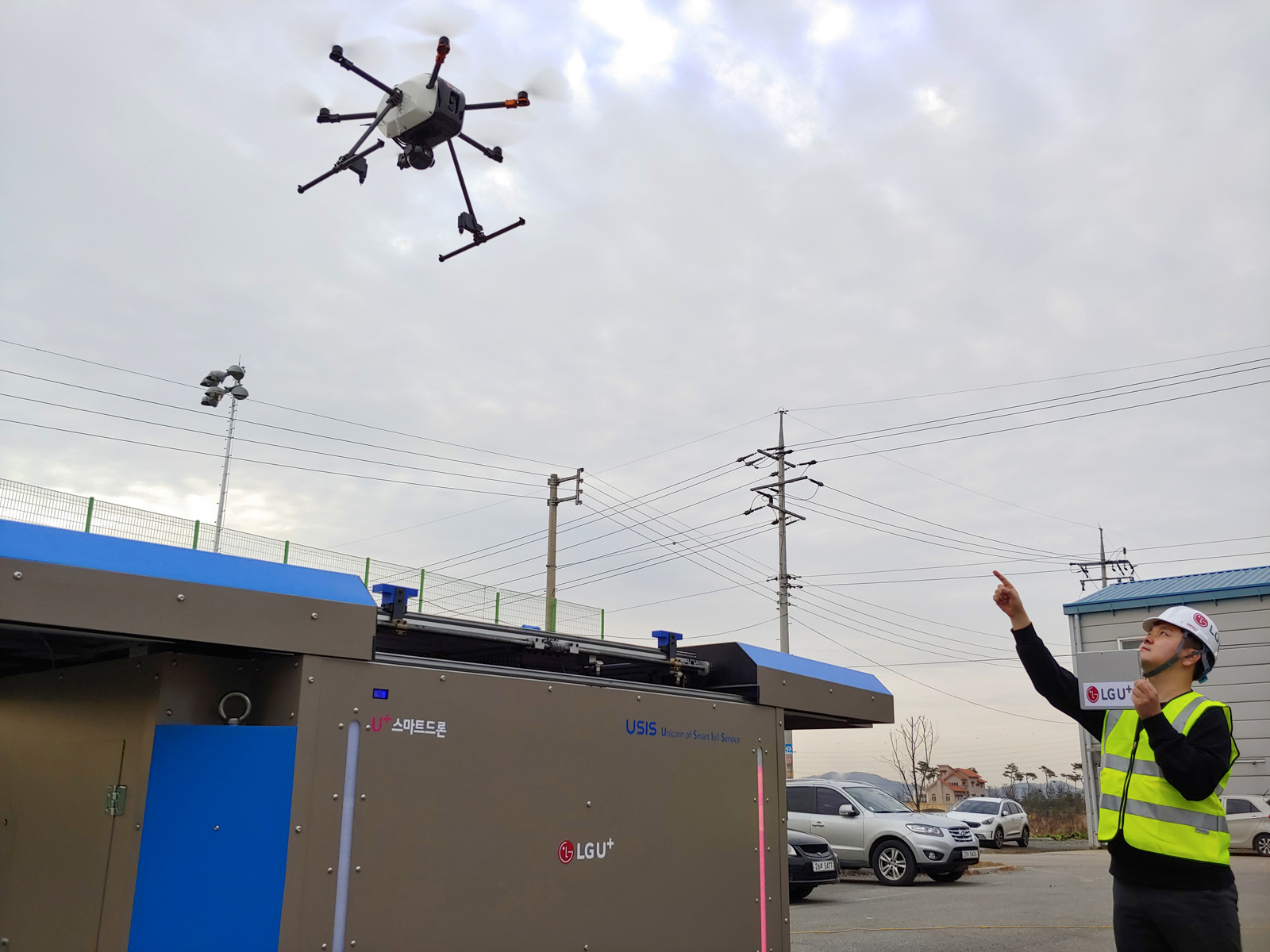
LG U+가 드론을 이용한 사회기반시설 정밀점검 시연에 성공했다
이번 시연은 드론의 실용화 및 조기 상용화를 촉진하기 위해 드론 분야에서 일정 기간 규제 없이 신규 비즈니스 모델을 발굴하고 안전성 테스트 등을 자유롭게 수행하는 국토교통부의 '드론 규제 샌드박스 시범사업’의 일환으로 이뤄졌다. LG유플러스는 한국가스공사, 한국가스기술공사, 한화정밀기계, 이노팸 등과 컨소시엄을 구성했다.
LG유플러스는 비가시권 자율비행을 기반으로 ▲3D지도·상공전파지도·상공기상정보를 이용한 천연가스 배관망 매설지역 실시간 촬영 ▲실시간 매설지역 감시와 불법공사 중단 요청 ▲지반변위 탐지 등 시연을 통해 해당 지역을 잠재적 피해로부터 보호하는 시연을 진행했다.
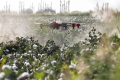
전국에는 약 5,000km의 천연가스 배관망이 매설되어 있다. 배관망 점검 업무 중 차량의 접근이 어려운 취약지역이 있어 드론의 필요성이 대두되는 상황이다.
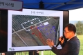
LG유플러스는 이번 시연을 위해 대전광역시에 위치한 한국가스기술공사 관제실에 U+드론 관제시스템을 설치하고, 실제 드론 비행은 충청북도 청주시에 위치한 약 2.8km 길이의 천연가스 배관망 매설지역에서 이뤄졌다.
시연은 먼저, 3D지도·상공전파지도·상공기상정보를 이용해 천연가스 배관망 매설지역 주변을 실시간으로 감시한다. 3D지도를 이용하면 드론의 경로 설정 시 고도별 장애물 존재 여부를 확인하는 2D지도의 한계를 극복할 수 있다.
또 상공의 LTE 신호 세기를 측정하여 시각적으로 나타내는 상공전파지도를 통해 신호 세기가 약한 곳을 피해 경로를 설정할 수 있으며, 상공기상정보를 통해 풍속의 영향을 최소화할 수 있어 드론의 안전비행이 가능하다.
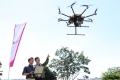
시연에 활용된 드론은 배관망 매설지역 인근에 위치한 드론포트에서 이륙한 것이 특징이다. 이번에 설치된 드론포트는 본부 관제실의 관제시스템과 연동되어 원격관제가 가능하도록 했으며 무선 충전 기능도 갖췄다. 이번 시연을 통해 드론포트의 가능성도 확인했다.
다음으로, U+드론 클라우드 관제시스템에 연동된 드론이 배관망 매설지역 주변을 실시간으로 감시한다. 드론에 장착된 FHD 카메라로 촬영, 객체검출 딥러링 엔진으로 불법 공사지역에 있는 굴삭기를 인식, 관제시스템에 팝업을 통해 알림을 준다.
한국가스기술공사 관제실은 관제시스템을 통해 전달받은 굴삭기 위치정보를 활용하여 VoLTE 스피커가 장착된 새로운 드론을 출동시킨다. 굴삭기를 향해 공사를 중지하라는 음성을 지속적으로 송출하며, 굴삭기가 공사를 중지하면 드론은 관제시스템 명령을 받고 복귀한다.
마지막으로, 드론을 통해 지반변위 발생지역을 탐지했다. 시범사업에서 제작된 무기준점 매핑 드론은 고도 80m 높이에서 14m/s의 속도로 비행하면서 천연 가스관 매설지역 주변을 지속적으로 촬영한다. 촬영된 영상은 이노팸의 지반변위 탐지 솔루션을 이용해 처리 및 분석하여 싱크홀, 산사태, 토지유실 등 지반의 변화를 감지한다.
LG유플러스 미래서비스담당 서재용 상무는 “상용화되면 드론이 감시할 지역을 먼저 식별하고 해당 지역을 실시간으로 감시해 불법 공사를 중단시키고 지반변위 발생지역을 사전에 탐지하는 등 하나의 체계가 구축된다”라며 “잠재 리스크를 효과적으로 예방하게 될 것”이라고 말했다.
이날 시연에 함께 참가한 한국가스공사 관계자는 “전국 천연가스 배관망 매설지역 중 사람의 접근이 불가능한 지역이 있기에 드론에 대한 니즈가 갈수록 확대되고 있다”라며 “이번 LG유플러스와의 실증 시연을 통해 드론의 실용성을 확인하였으며, 지속적으로 해당 사업을 개선 및 보완하여 성공적으로 사업화되어 천연가스 배관망 매설지역뿐 아니라 다양한 사회기반시설 정밀점검에 있어 편의성과 안전성을 높이길 바란다”라고 말했다.