

Sky Command
I appreciate you sharing this text, but I notice it appears to be a project name/title rather than content requiring translation from Korean to English. "Project 天眼 : SKY COMMANDER" contains: - "Project" (already in English) - "天眼" (Chinese characters meaning "Heavenly Eye" or "Sky Eye") - "SKY COMMANDER" (already in English) This appears to be either: 1. A project title that's already partially in English 2. Content that may not be Korean source material Could you please provide the full Korean text you'd like translated? If you have Korean content related to this project, I'm ready to translate it into English following the technical-industry register guidelines you've outlined.
주요 기능
콘테스트 프로젝트 진행 상황
각 Quest를 단계적으로 완성하는 프로젝트입니다.
Quest 1: 4WD 로봇 섀시 조립 및 기초 구동 테스트
2026.07.28사진에 나타난 것처럼 하얀색 기본 프레임에 4개의 바퀴와 DC 모터를 결합해 4륜 구동 뼈대를 완성했습니다. 섀시 상단에 모터 구동을 위한 제어보드를 고정하고, 4개의 모터에서 나오는 전원선을 각 출력 단자에 맞게 연결하여 배선 작업을 마쳤습니다. 이후 Python 의 gpiozero 라이브러리를 활용해 모터 제어코드를 작성하여 WASD 키보드 입력 신호에 따라 로봇이 전후진 및 좌우 회전을 수행하는지 테스트 하였습니다.
Quest 2: 구동계 쏠림 트러블 슈팅
2026.08.03조립 완료 후 직진 명령을 인가하는 기초 주행 테스트에서 로봇이 일직선으로 가지 못하고, 우측으로 휘어지는 현상이 발생했습니다. 문제의 원인들을 분석한 결과 보급형 DC 모터의 미세한 RPM의 물리적 편차가 원인으로 좌우 마찰력 차이를 만들어내 좌측 모터가 우측 모터보다 더 빠르게 회전하여 우측으로 밀리는 상태임을 확인했습니다. 이에 하드웨어 조절만으로 태생적인 편차를 잡을 수 없어 모터에 인가되는 PWM Duty Cycle를 비대칭으로 설정함으로써 좌측과 우측 모터의 속도를 완벽히 일치하도록 만들어냈습니다.
Quest 3: HSV 기반 장애물 인식 및 좌표 변환
2026.08.07BGR 영상을 조명에 덜 민감한 HSV 공간으로 변환 후 파란색 영역만 장애물로 추출하도록 임계값을 설정하였습니다. 후에 노이즈를 제거하여 장애물의 형태만 깔끔하도록 나타나게 이진화 마스크로 분리했습니다. 그리고 카메라 렌즈를 통해 보이는 2차원 영상 좌표가 원근감에 의해 실제 거리와 큰 거리 차이가 발생하였습니다. 이에 영상 상의 장애물 픽셀 좌표를 2D grid map 좌표로 mapping하는 변환 연산을 수행했습니다.
Quest 4: Aruco 마커 인식 기반 위치 및 각도 인식
2026.08.14로봇의 정확한 위치 인식을 위해 상단에 Aruco 마커를 부착하고, 상공 중앙 카메라로 이를 검출하여 실시간 위치 좌표를 추적했습니다. 또한, 마커의 기울기를 통해 회전 각도를 산출하여 로봇의 좌, 우회전 동작 및 주행 방향 판단의 기초를 마련했습니다.
Quest 5: 상공 중앙 카메라 및 PID 제어 기반 목표 지점 직선 주행
2026.08.18중앙 카메라 기반 PID제어로 목표 지점까지의 직선 운동을 구현했습니다. PID제어의 개념을 적용하여 목표 지점을 클릭했을 때 직선 경로를 생성하고, 해당 선과 ArUco마커로 인식되는 로봇의 위치 및 각도 차이를 줄여나가는 방식으로 직선 이동 네비게이션을 완성했습니다.
Quest 6: A*알고리즘 적용
2026.09.21중앙 카메라(웹 캠) 실시간 스트리밍 화면의 특정 영역을 클릭하면 해당 픽셀의 좌표를 추출해 A* 알고리즘의 최종 목표점으로 전달되도록 구성하였습니다. 주행 공간 바닥에 부착된 파란색 마스킹 테이프를 회피해야 할 장애물로 규정하여 클릭된 목표점, 로봇의 현재 위치 그리고 장애물(파란색 마스킹 테이프) 데이터를 종합하여 A*알고리즘에 입력했습니다. 장애물 영역은 비용을 무한대로 처리하여 이동이 불가능 하도록 처리하였고, 테이프를 밟지 않고 우회하는 최단 경로를 실시간으로 연산하였습니다.
Quest 7: HSV 인식 한계 극복을 위한 학습 모델 기반 탐지 시스템
2026.09.09초기에 HSV 색상 임계값을 통해 장애물을 탐지하려고 했으나 주변 조명의 미세한 변화로 인해 인식이 어려워 다른 방법을 찾아봤습니다. 이후 물체의 고유한 형태와 패턴을 인식할 수 있도록 인공지능 기반 객체 탐지 시스템으로 개편했습니다. Roboflow 플랫폼을 활용해 3D프린터를 이용해 만든 크레모아와 군인 피규어를 다양한 각도에서 이미지 데이터를 수집하고 (크레모아-Enemy, 군인-Ally)으로 라벨링 한뒤, YOLOv8 알고리즘을 활용해 탐지 모델을 학습했습니다. 이후 학습된 모들을 ONNX 포맷으로 변환하여 경량화한 후 OpenCV 프레임워크와 결합하여 주행 중에 객체의 클래스를 실시간으로 추출하도록 만들었습니다.
Quest 8: 초음파 센서 주행 로직 최적화 및 실시간 전술 모니터링 UI 연동
2026.09.14경로 탐색의 정확도 향상을 위해 초음파 센서 물체 감지 시 A* 알고리즘 기반으로 경로 재탐색을 구현하였으나, 실전 적용 시 프레임 저하 등의 이유로 효과적이지 않음을 확인했습니다. 이를 개선하기 위해 후진 후 공간을 확보해 회전하여 재탐색을 수행하는 방식으로 전환하였으며, 시험 결과 안정적으로 작동함을 검증했습니다. 또한 라즈베리파이 온보드 AI가 Enemy, Ally를 감지하면 제어 모니터에 알림을 전송하여 경고음 출력 및 실시간 UI 애니메이션이 맵에 동작하는 시스템을 완성했습니다.
Quest 9: AI 객체 인식 모델 기반 가습기 및 전자석 통합 제어
2026.09.20라즈베리파이의 자체 핀 출력 만으로는 가습기나 전자석을 직접 구동하기에 제약이 있어 중간에 릴레이 모듈을 배치였습니다. AI가 실시간으로 군인을 아군으로 인식하고, 필요에 따라 시스템이 특정 GPIO핀에 HIGH신호를 보내면 릴레이 모듈을 통해 가습기 모듈에 전원이 인가되어 약 5초 동안 시야를 차단하는 연막을 전개하도록 구현했습니다. 그리고 아군 조우시 필요에 따라 물자 지원을 할 수 있도록 설계하였습니다. 평상시 주행할 때는 전자석 모듈에 지속적으로 전원을 공급해 보급품을 매달고 이동하지만 아군이 식별된 정확한 위치에서 필요에 따라 전자석의 전원을 차단하여 보급품을 투하하는 메커니즘을 완성했습니다.
Quest 10: 실측 기반 로봇 보호 케이스 설계 및 3D 출력
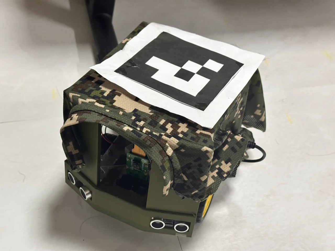
2026.09.28외부 충격 보호 및 ArUco 마커 고정 미흡 문제, 센서 고정 미흡에 따른 배선 이탈 등의 문제를 해결하기 위해 Fusion 360을 활용해 로봇의 실측 치수 기반 케이스를 설계했습니다. 이를 통해 하드웨어의 내구성을 확보하고 센서 및 마커의 고정 안정성을 높였습니다.
최종 정리
최종 요약
■ Project Introduction
 1. Planning Background and Implementation
(Problem Definition)
The problem with modern tactical unmanned robots is that despite advanced technology, control methods still rely on manual operation. To deploy existing military unmanned vehicles in operations, significant time and cost are spent training control operators. Additionally, in real combat, having the operator carry a controller and pilot while viewing a first-person perspective is not only difficult, but also results in loss of combat effectiveness such as neglect of forward observation.
(Intuitive Interface Found in StarCraft)
We have experienced and trained with a very convenient and efficient unmanned resource control method through screens for decades. Real-time strategy games like StarCraft move tactical units with a single mouse click on the minimap without complex joysticks. Project Cheonan: Sky Commander was planned to establish a 'single-click based tactical control interface' by applying popular and intuitive user experience to real military technology.
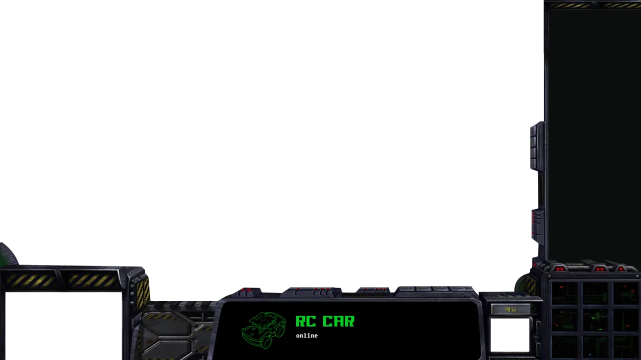
(Realization of Tactical Minimap)
Aerial vision sensing technology and ground actuator control and algorithms are organically combined to provide operators with convenience and an intuitive HRI environment. When a reconnaissance observer (web camera) in the airspace above the operation area captures the battlefield, the overhead third-person perspective video is displayed on the operator's (central manager's) monitor. This video is projected in the form of a 'minimap' within a game, allowing a wide field of view to be secured in the operation area. When the operator (central manager) clicks on a region requiring support or an allied position on the monitor screen, OpenCV converts 2D pixel coordinates on the screen to coordinates in real space in real-time and transmits them to the robot. Upon receiving these coordinates, the robot uses the A* algorithm and object detection through AI learning models to autonomously bypass obstacles and move to the target point. Therefore, the operator (central manager) is freed from the burden of manual machine operation, allowing them to focus on the military's tactical decision-making and operations instead of investing time and cost in equipment control, creating an optimal environment.
2. Key Functions and Operational Capabilities(A* Algorithm and PID Control)
The overhead central camera (web camera) positioned at the top is utilized like a satellite or drone to secure the entire image of the operation area and implement destination setting by mouse click. When the destination is entered, the A* algorithm calculates in real-time the shortest path that avoids obstacles (blue cones) such as enemy barricades or minefields. Subsequently, the current position of the robot is identified using ArUco markers, and PID control is applied to drive precisely to the target point without deviating from the path.
(Optimization of Mechanical Avoidance Maneuvers)
Initially, it was designed so that when an ultrasonic sensor in the front detects a sudden obstacle, the A* algorithm would be rerun to recalculate the path. However, severe frame drop phenomena were observed during the recalculation process. To resolve this, instead of software-based path recalculation, a mechanical physical avoidance logic was created where the robot reverses for a certain period and then rotates by a specific angle. This significantly reduced system computational load, increasing avoidance and safety in sudden situations.
(AI Model Learning for Blind Spot Concealment Threat Identification)
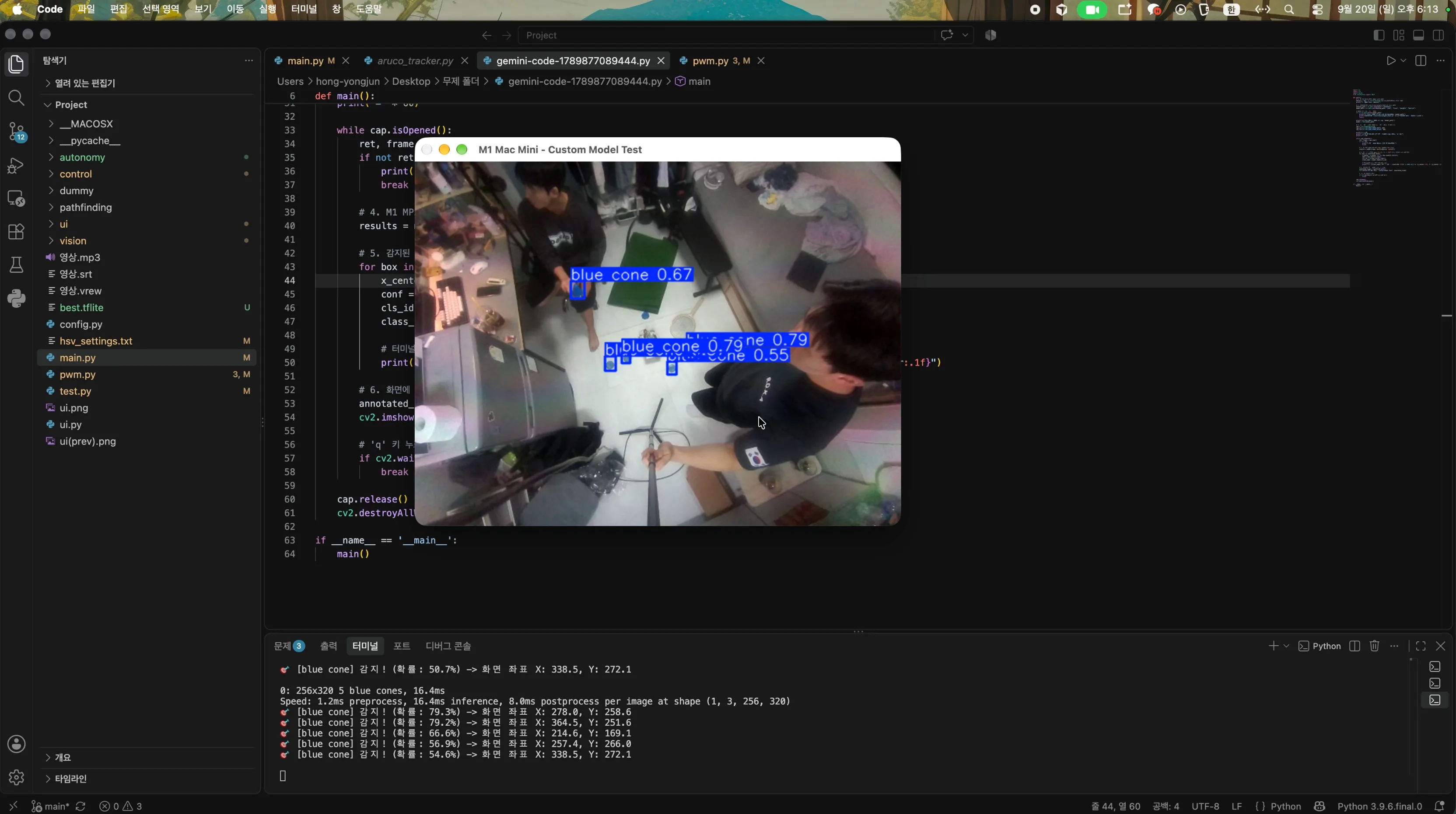
Using only the overhead central camera (web camera) and ultrasonic sensor makes it difficult to identify traps such as anti-personnel mines hidden outside the camera's field of view or enemy ambush situations. To identify situations existing outside the camera's view, a camera module was attached to a Raspberry Pi to inspect areas not visible to the overhead central camera (web camera—satellite or drone), such as caves and interiors. Additionally, the existing OpenCV HSV color recognition had limitations in distinguishing allied and enemy forces based solely on color. To overcome this, the Roboflow platform was used to build and train a YOLOv8 dataset with cremoroa (threat elements) labeled as 'Enemy' and soldier figures (protection targets) labeled as 'Ally', acquiring object detection capability. Furthermore, when cremoroa is detected, an alarm sound is transmitted to the control monitor along with a real-time UI animation that operates on the map, completing a complete system.
(ONNX Quantization)
To run the trained deep learning model without latency in the limited Raspberry Pi 5 onboard environment, model weights were converted to ONNX format for quantization. As a result, a system was completed that enables real-time monitoring without latency in response to sudden situations.
(Multi-Actuator Based Tactical Execution)
Beyond simply achieving situational awareness, an embedded control system was built to translate judgment results into physical actions on actual hardware. When the AI model identifies isolated allied soldiers, GPIO signals from the Raspberry Pi activate relay modules. When needed, a humidifier module deploys smoke screens to block enemy vision, and the electromagnet module power is shut off to drop supplies, enabling complex tactical scenarios to be executed without delay as designed.
(Real-Time Remote Control UI and Alarm System)
A control system was configured to enable remote operators to understand the object detection results from deployed robots in the field. When onboard AI detects threats (cremoroa) or allies (soldiers), they are transmitted to the control monitor via wireless communication, and the control infrastructure was completed with UI animation and alarm sound output.
(Establishment of Dual Camera Hybrid Control System)
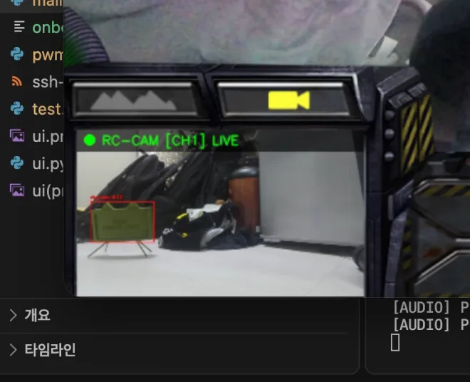
To overcome the limitation of being able to drive only in areas visible to the overhead central camera (web camera), a dual vision system was adopted. Unlike the overhead central camera (web camera) dedicated to AI computation, a Raspberry Pi dedicated camera was configured independently to provide operators with unrestricted, seamless real-time streaming vision. When emergencies occur that cannot be controlled by the overhead central camera (web camera), to resolve them, operators can immediately take control with the WASD keyboard without latency and operate manually, with this functionality added.
(Frame Mounting and Hardware Integration Optimization)
To mount multiple cameras, humidifiers, breadboards, Raspberry Pi, and other components in a limited space, a 3D printer was used to design and manufacture custom frames, integrating the hardware configuration.
3. Troubleshooting(Poor ArUco Marker Recognition Rate)
Initially, the plan was to guide the RC car based on drone GPS data, but due to budget constraints and limitations of indoor test spaces, the system architecture was redesigned. Accordingly, the system was converted to a vision-based control system where the RC car position is tracked in real-time using ArUco markers with the top web camera, and movement commands are issued from the central control PC. However, technical limitations arose due to characteristics of general wide-angle web cameras: insufficient light in low-light environments, motion blur occurring during driving, and dramatic decrease in long-distance recognition rate. To overcome this, a 4-stage image preprocessing pipeline was established that adjusts brightness, gamma, contrast, and saturation step-by-step. As a result, continuity and robustness of marker tracking could be secured even in changing lighting conditions and long-distance driving environments.
(Frame Drop Due to Ultrasonic Sensor Computational Overload)
Initially, when an ultrasonic sensor detected a sudden obstacle during driving, the robot's response speed decreased dramatically and video frames became choppy. When a sudden obstacle was detected, the system was designed to conduct path research through the A* algorithm. The cause was that real-time A* recalculation in the Raspberry Pi environment was causing overload. Therefore, software-based path recalculation was changed to hardware-based physical avoidance. When obstacles enter within a certain distance of the ultrasonic sensor, motor control is applied to avoid collision: reverse for a certain period and then rotate by a specific angle, with this maneuver logic applied in code. This dramatically reduced system computation, preventing serious frame drop and enabling immediate obstacle (blue cone) avoidance.
(Limitations of HSV Object Recognition)
Initially, OpenCV HSV color masking technique was used for sudden situations and enemy detection. However, the method was vulnerable to lighting changes and frequently produced errors in identifying objects with complex shapes. To resolve this, deep learning object recognition was applied. Image data was collected with cremoroa labeled as 'Enemy' and soldier figures labeled as 'Ally' using Roboflow, the YOLOv8 model was trained, and for smooth processing on Raspberry Pi, it was quantized to ONNX format and installed. Therefore, an AI system was built that accurately detects without depending on changes in lighting or angles through real-time edge inference.
■ Major Achievements and Characteristics
1. Autonomous Driving Path Generation Based on PID Control and A* Algorithm
Real-time position and angle tracking based on ArUco markers and PID control were implemented to reduce errors between the linear section path and actual path. Additionally, by applying the A* algorithm, the robot draws a path avoiding obstacles that are recognized along the straight line to the target point, and operates in the sequence of aligning angles according to the drawn path and moving straight following the path search line. In other words, PID control converges the difference between the path and ArUco marker recognition angle to zero, and once the angle is aligned, the distance (error) between the ArUco marker and target point is converged to zero as the robot moves toward the target.
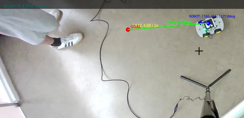
When the A* algorithm is applied to PID control, the optimal path avoiding obstacles to the target point is searched, and the robot moves while converging angle difference and distance to zero following the line as shown in the photo below.
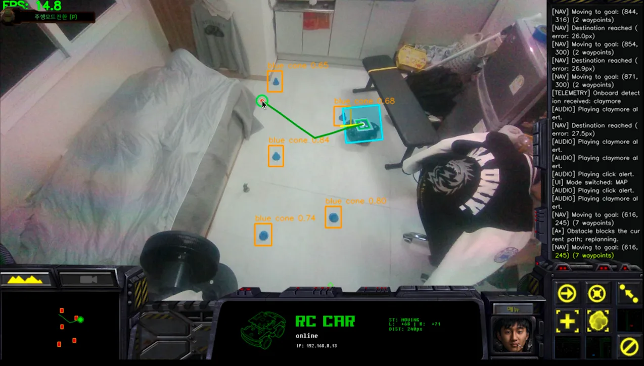
2. Dual Vision-Based Hybrid (Autonomous + Manual) Control System
Since the overhead central camera (web camera) recognizes ArUco markers, uncontrollable situations can arise when ArUco markers are not recognized due to camera angle issues, fog, or blind spots. To prepare for this situation, a manual operation mode was added that converts the front camera (Pi camera module) to a first-person perspective for direct manipulation. Since conversion is done through the UI in the lower left portion of the central control monitor, rapid switching and response are possible even in urgent situations.
3. Real-Time Object Recognition (YOLOv8) and Tactical Proactive Response
A custom dataset based on Roboflow (Enemy (cremoroa) and Ally (soldiers)) was trained with the YOLOv8 model and quantized to ONNX format to complete a real-time object detection environment.
Simultaneously with AI identifying Enemy or Ally, the location of the corresponding object is visualized in real-time on the central control monitor map, and alarm sounds and UI animation notifications are implemented to intuitively deliver information.
■ Future Improvement Plans
<Multi-Unit Simultaneous Control>
During the planning stage, a plan was established to control at least 2-3 RC cars, but only one RC car could be produced due to budget constraints. Currently, a control interface for a single robot has been built, but in the future, like 'StarCraft', multiple robots will be controlled by dragging with the mouse to assign coordinates at once, and the system will be expanded into a multi-agent swarm driving control network where robots share positions with each other to maintain formation and move.
<Mapping Technology for Standalone Robots>
The current project uses a global vision method where an overhead control camera positioned in the air overlooks the entire terrain and directs the path. While this may be effective in wide field environments, it has limitations where autonomous driving is impossible in unknown environments such as indoor urban areas, bunkers, etc., where drone or satellite vision cannot reach. To overcome this limitation, control through the Raspberry Pi camera that was previously used is possible outside the control camera's area, but has the limitation of not knowing the surrounding situation and only seeing what is in front. However, if a small 2D LiDAR sensor camera is mounted on the robot body itself, this limitation can be overcome. By introducing SLAM technology that scans and maps the surroundings independently to identify location, the system will be upgraded to a fully autonomous reconnaissance platform capable of self-mapping and exploration beyond manual operation using a Raspberry Pi dedicated camera in areas unreachable by the control camera.
<Implementation of Air-Ground Complex Control System>
The initial plan for this project was to actually deploy a drone to secure a global field of view. At the current stage, a fixed overhead web camera is implemented as an aerial command post role. In the future, actual small reconnaissance drones and ground reconnaissance robots will be linked through a wireless communication network. This will evolve so that the drone flies over the operation area in real-time, scans the map and transmits targets, and the ground robot receives them and executes tactics.
https://github.com/HOMEYONGJUNE/Sky-Command (Source code is submitted on GitHub due to file size limitations)
프로젝트 소개
목표 및 제작 동기
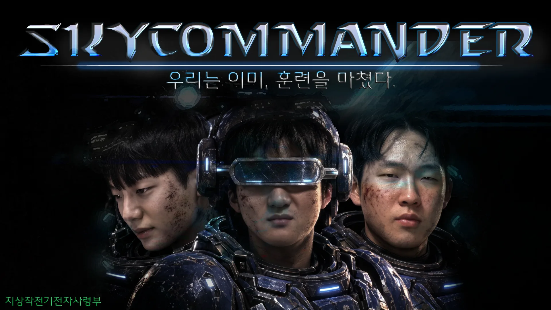
[We Have Already Trained]
The greatest engineering contradiction in modern tactical unmanned resources (robots, drones) is that "technology has become advanced, yet control methods still rely on manual piloting." To deploy existing military UGVs (unmanned ground vehicles) in operations, enormous time and training costs are consumed in training specialized operator soldiers. Moreover, in actual combat, operators must carry heavy dedicated controllers, view first-person screens, and precisely manipulate joysticks, resulting in extremely high operational difficulty. Additionally, operator soldiers are exposed to danger due to inattention to forward observation, inevitably resulting in loss of critical combat capability.
However, we have already experienced and trained for decades through screens an extremely simple and efficient unmanned resource control method. When playing real-time strategy games such as League of Legends and StarCraft, we freely moved tactical units with just one right-click on the minimap without complex joysticks. This project aims to elevate this popular and intuitive user experience to real military and industrial technology, establishing a "Single-Click Tactical Interface" that deploys actual unmanned robots to operational zones in just one second. Furthermore, by organically combining aerial vision sensing technology and ground actuator control algorithms, we provide command with overwhelming convenience and an intuitive HRI (human-robot interaction) environment.
Realization of tactical minimap: A reconnaissance observer above the operational area captures the battlefield. This real-time image, which has undergone OpenCV-based distortion correction and homography transformation, is projected onto the command center monitor in the form of StarCraft's "tactical minimap."
1-Click coordinate mapping and wireless transmission: A commander right-clicks on the tactical minimap at isolated areas requiring support or friendly positions. The system converts the clicked screen's 2D pixel coordinates (x, y) into actual 2D absolute plane coordinates (X, Y) in physical space in real-time and wirelessly transmits them to the ground robot.
Autonomous mission execution of unmanned support units (UGV): Upon receiving coordinates, the ground robot autonomously avoids obstacles through built-in pathfinding algorithms (A-star and DWA) without manual operator control. Upon arrival at the designated location, it completes critical support missions such as tactical smoke screening and unmanned resource resupply in accordance with command center orders.
[Expected Effects]
■1. Low-cost/high-efficiency effect: By using general-purpose drone assets and open-source software libraries instead of military equipment costing hundreds of millions of won, costs are reduced, and operation is enabled by combining inexpensive ultrasonic sensors, providing excellent value for money.
■2. Reduction of casualty effect: In disaster sites such as battlefields under fire or shelling, rather than directly supplying materials, materials are reliably transported remotely, preventing loss of life while increasing efficiency of rescue operations and mission success.
■3. Real-time remote control effect: Data is collected through drones in terrain or environments difficult for humans to access, and by immediately visualizing it on the control GUI, terrain conditions, presence or absence of obstacles, and enemy movements can be understood in real-time from remote locations.
■4. Reconfiguration capability: In actual battlefields, the environment changes fluidly due to road washouts and enemy movements. Unlike robots moving in fixed environments, since commanders monitor the control screen in real-time, mission paths can be corrected and reconfigured according to changing situations, selecting the safest and most efficient route.
■5. Simplification of control mechanism: The existing manual control mechanism focuses on driving itself, such as moving forward or turning, with limitations in understanding the overall environment. In this system, by setting the destination coordinates with a single click and having the robot take full responsibility for driving, operations are simplified, and commanders can concentrate on command duties rather than driver roles, increasing operational efficiency.
■6. Reduction of operational proficiency requirements: The existing manual control method required heavy hardware controllers, limiting operation to trained operators who had undergone professional intensive training. However, in this system, anyone can operate it by simply understanding the minimap, providing high versatility. Any personnel at the scene can immediately take over missions, improving operational flexibility and reducing training time and budget.
프로젝트 컨셉
본 제안 시스템은 상단의 글로벌 비전 자원과 지상의 무인 모빌리티(UGV) 간의 유기적인 데이터 융합을 위해 [비전 센싱 ➔ 좌표 매핑 및 통신 ➔ 내비게이션 연산 ➔ 하드웨어 구동]의 4단계 프로세스로 구현됩니다.
■[1단계] 천장 카메라를 활용한 전장 미니맵 구현 (입력 단계)
실험 환경: 4m × 3m 크기의 실험실 방 천장에 일반 광각 웹캠을 고정하여 전체 트랙을 한눈에 볼 수 있도록 세팅합니다.
영상 왜곡 보정: 광각 카메라 특성상 외곽이 둥글게 휘는 왜곡이 생기는데, 이를 OpenCV 라이브러리를 활용해 똑바로 펴주는 전처리 작업을 합니다. 그 후, 화면을 위에서 정면으로 내려다보는 듯한 평평한 '게임 속 미니맵' 형태로 변환합니다.
■ [2단계] 마우스 클릭 좌표 추출 및 무선 통신 연동 (통신 단계)
화면-실제 좌표 변환: 지휘관이 노트북 모니터 화면(미니맵)에서 원하는 위치를 마우스 우클릭하면, 프로그램이 클릭된 화면의 픽셀 위치(x, y)를 실제 방 바닥의 미터 단위 위치(X, Y)로 계산해 냅니다.
데이터 전송: 제어 컴퓨터(노트북)에서 계산된 이 2차원 목적지 좌표 값은 Wi-Fi나 블루투스 무선 통신을 통해 지상에 있는 RC카(로봇)로 실시간 전송됩니다.
■ [3단계] ROS기반의 자율주행 및 장애물 회피 (연산단계)
최단 경로 탐색: 로봇의 메인 두뇌인 라즈베리 파이는 노트북으로부터 목적지 좌표를 받자마자, 로봇 운영체제인 ROS에 내장된 A-Star알고리즘을 돌려 고정된 벽이나 상자를 피해 가는 가장 빠른 길을 찾아냅니다. 딥러닝을 통해 학습한 장애물(파란색 고깔)을 상공 중앙 카메라(웹캠)로 객체 탐지 하여 회피하도록 설계합니다. 돌발 상황을 마주할 경우에는 초음파 센서를 이용해 A* 알고리즘으로 재탐색하여 로봇의 현재 좌표를 인식해 궤도를 보정하며 목적지까지 안정적으로 주행을 완수합니다.
■ [4단계] 바퀴 구동(PID 제어): 라즈베리 파이가 계산한 이동 방향과 속도 명령은 단독으로 제어합니다. 라즈베리파이는 바퀴에 달린 엔코더 센서 값을 읽어오며 오차를 줄이는 PID제어를 통해 정확한 목표 위치까지 RC카를 굴립니다.
사각지대 방지 및 미션 수행: 상공 중앙 카메라(웹 캠)의 화소 밖의 사각지대 영역은 라즈베리파이 전용 카메라를 이용해 수동 조작하여 주행합니다. 적군(크레모아)에 도착하면 경보음과 함께 애니매이션 Ui 를 화면에 띄워 위치를 표시하고, 아군에게 도착하면 전자석 모듈을 이용해 보급품을 아래로 떨어뜨리거나, 릴레이 모듈을 가동하여 연막 장치를 원격으로 가동합니다.
[개발 역량]
학부수업내 회로이론, 기초 회로 실험, 객체지향 프로그래밍 교육을 충실히 이행하여 전공에 기반이 되는 임베디드 하드웨어 및 소프트웨어 설계 역량을 습득하였습니다. 이번 Advanced Mobility Global Contest를 통해서 습득한 지식을 확장하고 실제 환경에서 활용할 수 있는 수준으로 끌어내기 위한 공부를 진행 및 계획하고 있습니다. 현재 프로젝트 구현을 위해서 전자공학을 바탕으로 물리적인 움직임과 ai를 결합에 도전하고자 합니다. 현재는 먼저 맵 구현을 위한 opencv를 활용한 2D 렌더링(특징점 추출) 실현을 목표로 스터디를 진행하고 있습니다. 또한 인식한 맵을 바탕으로 가장 최적의 경로를 찾기위한 센서(Lidar, 초음파, 카메라 등) 기반환경 인식 방법, 자율주행 및 장애물을 회피하며 목적지까지 이동하는 기술(Path Planning&Local Planning)에 적용되는 경로계획 알고리즘(A 알고리즘, DWA)및 라이브러리 사용 방법을 추가적으로 프로젝트를 진행하면서 습득할 예정입니다. 또한 저희는 아두이노 설계 및 구현 경험을 통해서 기본적인 제어 루프 설계 능력을 갖추고 있습니다. 저희가 가진 임베디드 설계 및 구현 능력을 바탕으로 안정적인 피지컬 제어를 구현할 예정입니다.
[지원 동기]
저희는 같은 실험 과목을 이수하여 회로구성에 대해서 고민하고 오차를 함께 분석하는 과정을 겪으며 호흡을 맞추기 시작했습니다. 실험실에서 회로를 결선하고, 계측기를 다루면서 단순히 학업적 동료의 관계를 넘어선 유대감을 쌓았습니다. 함께 식사를 하던 도중 서로 군 시절 담당했던 병과에 대한 이야기가 나오게 되었고 군용으로 다뤘던 장비가 다소 난이도가 높았고 투입시키기에도 열악하다는 생각을 하게 되었습니다. 이어서 '현실의 첨단 무인 로봇을 게임속 유닛처럼 지도에 단 한번의 클릭으로 움직이면 좋지 않을까?' 라는 의문을 품게 되었습니다. 이를 해결하기 위해 무선 네트워크 사양과 라즈베리파이와 같은 하드웨어 및 센서 지식을 융합하면 실현할 수 있겠다는 확신이 들었습니다. 따라서 우리가 평소에 하는 게임에서 경험했던 사용자 경험(UI)를 실제 국방 기술 및 보급 시스템에 적용할 수 있도록 구현해보고자 이번 대회에 지원하게 되었습니다.
저희는 이미 현실의 전장으로 훈련을 마쳤습니다. 현실에서 피부로 느낀 모든 것을 녹여 이론이 아닌 실제로 완벽히 구동하는 원클릭 전술 UGV 시스템을 완성해내겠습니다. 실험과목을 함께하며 회로 오류와 소프트웨어 버그를 수없이 해결해왔고 이러한 검증된 팀워크를 바탕으로 프로젝트 수행 과정에서 발생할 돌발 변수와 예외 상황을 그 어떤 팀보다 신속하고 유연하게 해결하겠습니다. 저희는 군 전역자들로서 실제 전술 환경에서의 애로 사항을 누구보다 깊이 이해하고 있습니다. 기존의 무겁고 복잡한 수동 조종 방식에서 탈피하여, 훈련이 필요없는, 누구에게나 익숙한 ‘단일 클릭 제어 인터페이스’라는 새로운 인간 로봇 상호작용의 패러다임을 제안하고 예상치 못한 변수들을 극복해나가며 저희의 설계 역량을 증명해보이겠습니다.
주요 기능
- 전역 비전 기반 Ponit and Click 네비게이션 — 상공 전역 카메라 영상 기반의 UI를 통해 사용자가 직관적으로 이동 목표점을 지정하면, 실시간 위치 추적과 A*알고리즘을 이용한 경로탐색 ,객체 탐지 기반 장애물 회피를 병행하여 안전하게 목표지점까지 이동하는 네비게이션 기능
- 듀얼 비전 기반 하이브리드(자율+수동) 제어 시스템 — 중앙 카메라의 전역 장애물 탐지와 파이 카메라의 시점 영상을 결합해, 자율주행 중 예외 상황 발생 시 원격 제어기로 즉시 변환하여 조종할 수 있는 비상 수동 개입 기능을 제공합니다.
- 실시간 객체 인식(YOLOv8) 및 전술적 능동 대응 — ONNX로 경량화된 AI모델이 Enemy(크레모아)와 Ally(군인)를 실시간 식별하여, 탐지 시 중앙 관제 모니터 맵에 해당 위치를 알람음과 함께 실시간 표시(식별 및 경보)합니다. 상공 카메라에서는 한정된 정보만을 수집하지만 RC카의 온보드 비전 Ai를 이용하면 시야의 사각지대를 줄여 더 많은 정보를 전장에서 수집하여 더 유연하게 돌발상황에 대처할 수 있습니다.또한 상황에 따라 가습기 모듈을 활용한 연막 전개 및 전자석 모듈 제어를 통한 보급품 투하 기능을 수행합니다.
댓글 0개
아직 댓글이 없습니다. 첫 댓글을 남겨보세요!