

.png)

C-ITX, Vehicle Location Information Identified Down to the Centimeter Level
 Published2019.12.09 15:31
LG U+ and the National Geographic Information Institute under the Ministry of Land, Infrastructure and Transport signed a 'Memorandum of Understanding for RTK Service Activation' on December 9th to advance the next-generation intelligent transportation system (C-ITS), and have begun technical efforts to explore technology and service cooperation measures.
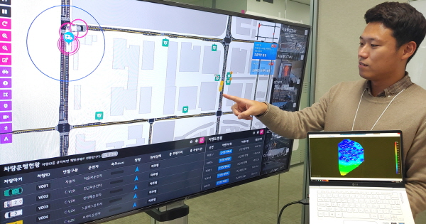
▲ An LG U+ official reviewing an autonomous driving control screen capable of precise location confirmation <Photo=LG U+>
According to the agreement, both parties will form a working-level consultation group starting January 2020 and begin full-scale discussions on ▲direct linkage of real-time observation raw data ▲RTK service technology testing and sharing ▲satellite-based service and technology development plans, etc.
Through this, the direction is to advance the precision positioning (RTK) technology through a precision map platform (Dynamic Map) and to pursue the evolution of the C-ITS business.
RTK is a technology that secures more accurate location by correcting GPS errors, which can occur up to 30 meters, based on reference stations. It is a method in which error correction information for the position measured by GPS is generated from a reference station with absolute position values such as latitude, longitude, and altitude, and then transmitted to the vehicle.
In autonomous mobile entities, the positioning results are calculated with correction information through an internal RTK reception terminal and utilized in movement paths or driving strategies. RTK is evaluated as a key technology in the autonomous driving industry as it can precisely identify location information down to the centimeter (cm) level, where even minor contact is not tolerated.
Earlier, LG U+ introduced RTK technology to its 5G autonomous driving demonstration project in September.
Kang Jong-o, Executive Director of Future Technology at LG U+, stated, "The key to the future mobility industry depends on how accurately real-time location information can be identified in a communication environment with minimal delay," and added, "We will continue to seek cooperation with major institutions to accelerate the construction of next-generation smart transportation environments such as C-ITS and autonomous driving infrastructure."
Meanwhile, LG U+ completed the construction of nationwide service by applying RTK technology to its internal cloud at the end of July, and is currently focusing on securing substantial information to strengthen the safety of autonomous vehicles.
RTK technology reduces error and improves accuracy as the number of satellites providing information increases. Therefore, the RTK server built by LG U+ supports all available satellites from the United States, Russia, Europe, China, and Japan. Additionally, the company is testing DR functionality based on inertial measurement sensors (IMU) to enable positioning even in environments where reception is difficult, such as tunnels and overpasses.
Related news
.jpg)
LG U+ Improves 5G Speed and Quality… Applies COMP Technology to Commercial Network
LG Uplus is applying COMP technology, which eliminates frequency interference in the boundary areas between 5G base stations, to a 5G commercial network for the first time in the world. Through COMP technology, approximately 20% improvement in download speed has been achieved in boundary areas between base stations where speed quality had previously degraded. LG Uplus plans to first apply the COMP function to the Seoul metropolitan area and then expand it nationwide.
2019.11.20by 최인영 기자
SKT, AWS to Promote 5G MEC Business Starting Next Year
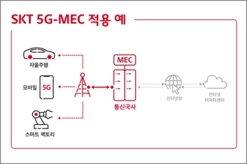
SK Telecom is advancing 5G-based MEC business in cooperation with Amazon Web Services. The two companies plan to jointly launch 5G MEC business starting in 2020. They plan to introduce 5G MEC services targeting customers in distribution, gaming, media, manufacturing and other sectors.
2019.12.05by 이수민 기자
U+ Achieves 1Gbps Download Speed with 5G In-Building Equipment
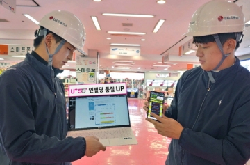
LG U+ has improved 5G download speeds by deploying IBWave, an in-building design specialized tool that predicts user coverage by considering building interior structures, interior materials, and residential spaces, in indoor environments. By implementing download speeds of 1 Gbps or higher through 5G in-building equipment, the service speed has been improved by an average of 37%.
2019.12.10by 최인영 기자
A single misaligned light means 'defect'… Vehicle interior lighting now guarded by semiconductors and software
Automotive interior lighting is moving beyond its role as 'auxiliary lighting.' As it becomes a core element of user experience (UX) that expresses brand identity through color and animation while reflecting driver preferences, the LED interior ambient lighting market is growing rapidly. In connection with this, we met in advance with Choi Young-jae, Research Director at Dabo Corporation, who will present a technical webinar session on "Intelligent LED Interior Lighting Solutions Illuminating Future Vehicles," to hear about market trends and changes in design requirements.
2026.08.28by 명세환 기자
TI Unveils Multi-Axis Coreless Current Sensor TMCS2100-Q1 for HEV/EV Traction Inverters
Texas Instruments has unveiled the TMCS2100-Q1, a multi-axis coreless Hall-effect current sensor for HEV and EV traction inverters. By simultaneously measuring horizontal and vertical magnetic fields through multi-axis sensing technology, it achieves up to 20 times higher accuracy compared to conventional single-axis sensors, while the busbar-unmodified design provides mechanical design flexibility. It simultaneously meets the high-accuracy requirements and miniaturization driven by the expansion of 800V architectures.
2026.08.27by 배종인 기자











