



Drones to Create Public Market through Application in River Surveying
 Published2017.12.15 10:35
Starting March of next year, drones will be put to full-scale use in investigating rivers and surrounding topography as well as monitoring their conditions.
The Ministry of Land, Infrastructure and Transport is establishing basic river plans targeting national and local rivers nationwide in accordance with the River Act, and drones are scheduled to be utilized in river surveying operations such as river topography surveys and riverbed change surveys next year.
To this end, a riverbed surveying pilot project will be launched starting this month, and the field applicability and utility of the standard execution procedures and cost estimates currently under development will be verified.
The pilot project will be conducted across 7 sections of the main channels and tributaries of the Han River, Nakdong River, Geum River, and Yeongsan River by each of the 5 regional Land and Infrastructure Administration offices.
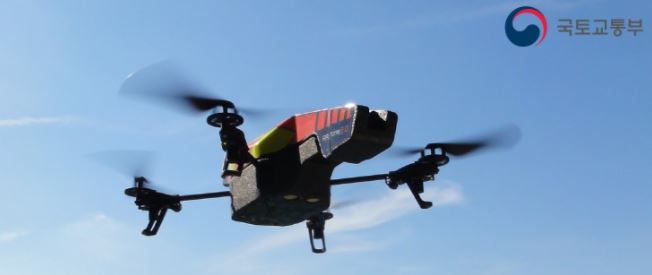
As a result of holding competitions last year to evaluate the feasibility of drone application in river surveying following the mandate for regional Land and Infrastructure Administration offices to conduct riverbed change surveys (held in Nov. '16 and Jun. '17), technological capabilities exceeding the required accuracy of digital maps (1:1,000) were proven.
Additionally, drones developed by domestic companies have been confirmed to be competitive with foreign-made drones in areas such as flight time (90 minutes) and cruising distance (80 km).
When drones are fully utilized starting March next year for basic river plan establishment and other purposes, a new public sector market of approximately 32 billion won annually is projected to be created, comprising basic river plan establishment (10 billion won), periodic riverbed change surveys (2 billion won), river monitoring (10 billion won), small stream management (10 billion won, by local governments), and the like.
The Ministry of Land, Infrastructure and Transport plans to actively support the utilization of drones not only in river surveying but also in related services such as water quality monitoring, emergency photography of flood-affected areas, and safety management of facilities such as dams and levees.
An official from the Ministry of Land, Infrastructure and Transport stated, "Drones are a core field of the Fourth Industrial Revolution that creates new added value in existing industries, and it is expected that economical and efficient task execution will become possible in the river sector as well."
Furthermore, Professor Kim Dong-soo from Dankook University projected that "through securing a leading position in the drone service market for rivers, even occupying just 1% of the entire water industry market would generate economic effects of 6 billion dollars."
Related news
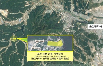
The country's eighth drone-only flight zone will be created.
The Ministry of Land, Infrastructure and Transport will establish the eighth domestic drone-exclusive flight zone in the Ulsan region. The newly established drone-exclusive flight zone is located in Habjam-ri, Samdong-myeon, Ulju-gun, Ulsan Metropolitan City, with an altitude of 150 meters above ground and an area of approximately 52,000 square meters, equivalent to the size of five soccer fields. Within the drone-exclusive flight zone, drones can be freely operated regardless of weight. South Korea currently has seven drone-exclusive flight zones established in Cheongna, Miho Stream, Gimhae, and other locations, with this being the first in the Ulsan region.
2017.10.20by 김지혜 기자
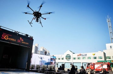
SKT Uses ICT Technology at Disaster Sites
SK Telecom and Gangwon Fire Department announced that they have agreed to effectively support firefighting activities through ICT. This is to overcome geographical constraints using ICT in consideration of Gangwon Province's terrain, which is surrounded by forests covering 82% of its area. First, SK Telecom will provide Gangwon Fire Department with a "Public Safety Solution" that combines 230 units of wearable special terminals (hereinafter body cameras), 4 command drones, and a real-time video control system called "T Live Caster." Gangwon Fire Department plans to deploy the equipment to the Special Rescue Team and 16 fire stations under its jurisdiction, and will systematically respond to various disasters and accidents from the control center based on video footage sent from firefighters at the scene. In addition, SK Telecom and Gangwon Fire Department plan to enhance the solution through ultra-high-speed and ultra-low-latency 5G communication to identify disaster situations more quickly and respond appropriately to various disasters and accidents.
2017.11.20by 김지혜 기자
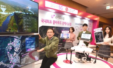
LG U+ Enters Drone Business with Cloud Command and Control System
LG U+ announced the commercialization of a 'drone command and control system' that enables operators at a command center to remotely pilot drones in distant locations and perform missions, marking its full-scale entry into the drone business led by autonomous flying drones. On the 21st, LG U+ held a press briefing at its Yongsan headquarters in Seoul and introduced the 'U+ Smart Drone Cloud Drone Command and Control System,' which enables stable drone operation for disaster monitoring, surveying, and logistics transportation even in non-line-of-sight areas or at night through telecommunications networks. The Ministry of Land, Infrastructure and Transport introduced the 'Drone Special Approval System' from November 10th. With this, flights during nighttime and operations beyond visual line of sight become possible when safety standards are met.
2017.11.21by 김지혜 기자

Nvidia invests $5 billion in Intel
NVIDIA and Intel, leaders in global AI computing technology, are now forging ahead in providing cutting-edge solutions through NVLink-based architecture integration. NVIDIA and Intel have officially announced a strategic partnership and stated that they will jointly develop customized data center and personal computing products to accelerate diverse applications and workloads ranging from hyperscale to enterprise and consumer markets, thereby laying the foundation for the next generation computing era.
2025.09.22by 배종인 기자
.jpg)
Applied Materials Launches Environmental Protection Campaign to Mark World Cleanup Day
Applied Materials Korea (CEO Park Kwang-seon) is carrying out environmental cleanup activities with employees and their families around the Dongtan Sinricheon area on the occasion of World Cleanup Day, evolving into a company that engages with the local community beyond technological innovation.
2025.09.22by 명세환 기자











