



CSR's SiRFstarV™ Architecture Successfully Confirms Position via Galileo Satellite
 Published2014.05.27 09:59
May 27, 2014 – CSR ( http://www.csr.com ), a global provider of innovative semiconductor ICs and software solutions for location awareness, multimedia, and cloud connectivity, announced today that its location platform, the SiRFstarV™ architecture, has successfully verified location using Galileo satellites.
CSR’s industry-leading SiRFstarV™ 5ea quad GNSS receiver successfully captured signals from a total of four Galileo satellites currently in orbit and used this to determine its location over the German region.
The European Commission recently mandated the installation of an Automatic Emergency Call (or eCall) system via the Galileo system in light vehicles. The eCall system automatically sends emergency rescue messages in the event of an accident, and the European Commission aims for the system to be fully operational across all EU countries by the end of 2015. CSR’s SiRFstarV is one of the few GNSS (Global Navigation Satellite Systems) receivers capable of supporting the Galileo satellite eCall system.
At least four satellites are required to calculate a location, including latitude, longitude, and altitude. Since the four satellites of the Galileo observation system can currently observe the Earth's surface simultaneously for only two to three hours a day at specific times, position verification is also possible only during those times. Meanwhile, the time frame for position verification is expected to expand once the European Space Agency deploys more satellites and ground stations begin operations.
Full positioning, navigation, and time services using the Galileo system are expected to become available in 2018. Automotive industry manufacturers are embarking on design work to release solutions supporting the Galileo system, such as the SiRstarV, in time for 2018.
Anthony Murray, Senior Vice President of the Business Group at CSR, stated, “This positioning is an important first step for the CSR and SiRFstarV architecture. It demonstrates our technological capabilities in supporting major satellite observation systems, including the U.S. GPS, Russia’s GLONASS, China’s BeiDou Navigation Satellite System (BDS) known as Compass, and Europe’s Galileo.”
Anthony Murray, Senior Vice President, further emphasized, “CSR has been anticipating the deployment of the Galileo satellite navigation system and has been developing SiRFstarV with this in mind. CSR’s improved GNSS architecture will not only meet the mandatory eCall system installation mandate through a feature-rich core platform but also support software upgrade capabilities, enabling the full utilization of future Galileo systems.”
CSR's SiRFstarV architecture provides real-time positioning services based on GPS, Galileo, GLONASS, BDS, or COMPASS satellites. In addition, CSR enables continuous positioning in all environments, including urban canyons, tunnels, and underground parking lots, by providing SiRFDRive® technology, which fuses MEMS (geomagnetic, accelerometer, and gyroscope sensors), vehicle sensor data, and GNSS measurements.

관련뉴스
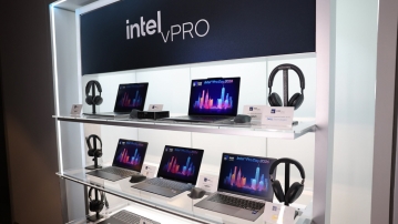
Intel Unveils Next-Generation 'Core Ultra Series 3' and vPro Platform for Enterprise PCs
인텔이 차세대 기업용 PC를 위한 ‘인텔 코어 Ultra 시리즈 3’와 최신 vPro 플랫폼을 공식 발표하며, 기업용 노트북부터 고성능 워크스테이션까지 폭넓은 수요 충족에 나섰다.
2026.03.26by 배종인 기자
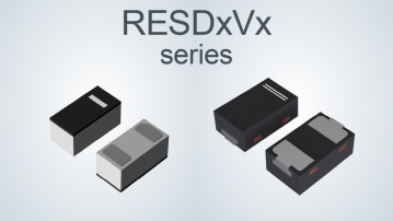
ROHM Launches ESD Protection Diode Compatible with High-Speed Interfaces of 10Gbps or Higher
반도체 전문 기업 로옴(ROHM)이 10Gbps를 넘어서는 차세대 고속 데이터 통신 환경에 대응할 수 있는 ESD(정전기 방전) 보호 다이오드 ‘RESDxVx 시리즈’를 개발하며, 고속 인터페이스에서 요구되는 신호 품질 유지와 IC 보호 성능을 동시에 끌어올렸다.
2026.03.26by 배종인 기자
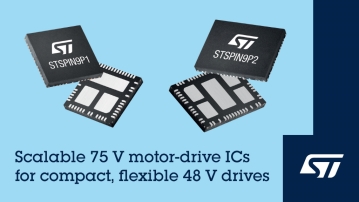
ST Launches 75V Drive IC Targeting 48V Industrial Motor Driving
ST마이크로일렉트로닉스가 48V급 산업용 구동 시스템 설계에 맞춘 75V 모터 드라이브 IC ‘STSPIN9P’ 시리즈를 공개했다. 새 제품군은 하프 브리지와 풀 브리지 구조로 구성돼 모터 종류와 출력 조건에 따라 설계를 확장할 수 있도록 한 것이 특징이다. 전원 회로와 보호 기능, 전류 감지 회로를 칩에 통합해 시스템 구성을 단순화했으며, 최대 500W급 애플리케이션까지 대응하도록 설계됐다. 회사는 레퍼런스 디자인과 데모 보드도 함께 제공해 산업 자동화, 로보틱스, 펌프, 팬, 조명, 섬유 기계 등에서 개발과 평가를 지원할 계획이다.
2026.03.26by 배종인 기자
Nordic supports security updates for the entire lifecycle of IoT devices at a single fixed cost
Nordic Semiconductor, a global leader in low-power wireless connectivity solutions, has unveiled a single fixed-cost licensing model that delivers FOTA (Firmware Over-the-Air) and device management capabilities throughout the device lifecycle via nRF Cloud, and introduced a new firmware update solution to prepare for the enforcement of the European Union's Cyber Resilience Act (CRA).
2026.03.26by 배종인 기자

Practical Training in Low-Noise, Low-Power Circuit Design All in One Place… Training Fee Support
고감도 아날로그 회로와 센서 기반 시스템 설계 역량을 강화할 수 있는 ‘2026 고급 엔지니어 실무 마스터 클래스’가 오는 4월16일 서울 가산동 e4ds 컨퍼런스 센터에서 열린다. 이번 과정은 온라인이 아닌 오프라인 유료 실습 교육으로 진행되며, 현장 중심의 심화 학습을 원하는 엔지니어를 대상으로 한다. 이번 교육은 텍사스 인스트루먼트(Texas Instruments)가 교육비를 지원해 정가 25만원에서 10만원 할인 된 15만원에 참가할 수 있다.
2026.03.26by 배종인 기자











