


Intel Unmanned Aerial Team: Hidden Contributor to Tubbs Wildfire Recovery
 Published2017.11.14 07:57
The wildfire that occurred in the Calistoga area of California in October resulted in approximately 40 fatalities and the loss of approximately 5,700 homes and buildings, with 190,000 acres of land completely destroyed.
To address the unprecedented scale of recovery, local residents of Santa Rosa and Intel's unmanned aerial team captured and produced images of the affected areas using Intel Falcon 8+ drones for accurate location-based damage assessment, drawing attention.
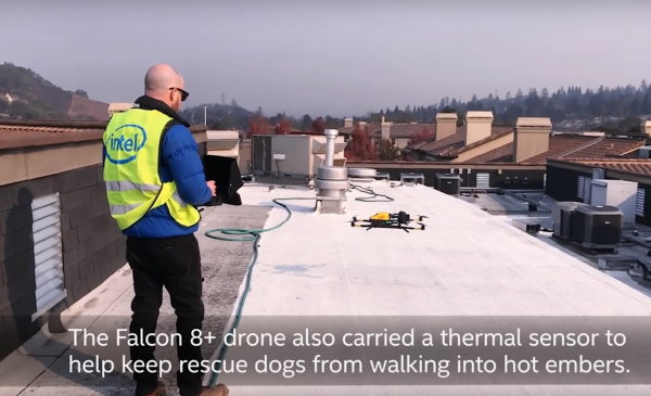
Intel unmanned aircraft pilot Andrew launching the Falcon 8+ for on-site verification
Andrew, an Intel unmanned aircraft pilot, equipped drones with temperature sensors to minimize risks for Sonoma County firefighters operating in the field, monitoring and transmitting real-time temperature data by location. Through snapshot mapping of the affected areas, he provided real-time video and photographic data enabling determination of which regions required the most urgent emergency recovery efforts.
Intel's Falcon 8+ drone is capable of flying up to 4,000 meters, and the FCC version enables video transmission up to 500 meters.
The AscTec navigation sensor utilizing triple-redundant inertial measurement units (IMU) applies barometers, compasses, accelerometers, and gyroscope sensors simultaneously, enabling stable flight and accurate collection of surrounding environmental data.

Comments
Related news
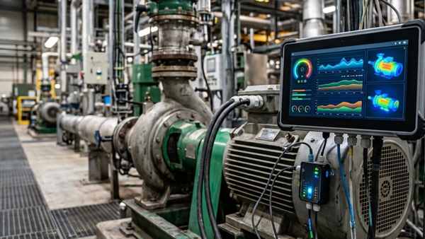
[Technical Contribution] Mouser: "AI Agents Help Accelerate and Standardize Industrial Field Maintenance Operations"
Abhishek Jadhav from Mouser Electronics discusses how to leverage agentic AI for predictive maintenance in industrial automation.
2026.10.23by 편집부
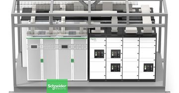
Schneider Electric Unveils Modular Power Solution for AI Data Centers
Schneider Electric has launched prefabricated power modules and power skids for AI data centers, jointly developed with NVIDIA. Based on the GB300 NVL72 reference design, the solution applies standardized design and factory pre-fabrication methods to build power infrastructure in as little as 6 months. Galaxy VXL UPS technology is integrated, with capacity options ranging from 2MW to 2.5MW.
2026.10.23by 배종인 기자

Dassault Systèmes and Vertiv Announce AI Factory Design and Construction Collaboration
Dassault Systèmes and Vertiv announced their collaboration on AI factory design and construction. By combining the virtual twin-based 3DEXPERIENCE platform with Vertiv's infrastructure solutions, the entire system is validated in a virtual environment before actual construction. Through this approach, they aim to accelerate the design process by up to 10 times and reduce infrastructure construction timelines by up to 50%.
2026.10.23by 명세환 기자
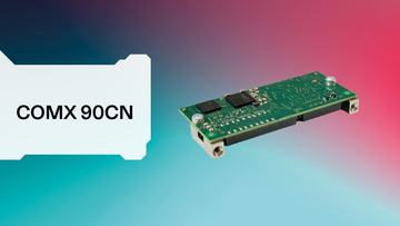
Hilscher Launches 'comX 90CN' Embedded Module Without Connector Integration
Hilscher has launched the 'comX 90CN' embedded communication module without connector integration. Designed in a compact 30×70mm form factor, this module features a structure where network connectors are separately connected to the baseboard, enabling flexible mechanical design for industrial equipment. Based on netX 90, it supports major industrial Ethernet protocols including PROFINET, EtherCAT, and EtherNet/IP, and incorporates security features such as hardware-based encryption and secure boot.
2026.10.19by 배종인 기자

Korea Institute of Machinery and Materials, Duwon University of Science and Technology, and Duwon Heavy Industries Sign MOU on Manufacturing AI Transformation Industry-Academy-Research Collaboration
The Korea Institute of Machinery and Materials has partnered with Duwon University of Science and Technology and Duwon Heavy Industries to establish an industry-academy-research collaboration system in response to AI transformation in the manufacturing sector. An industry-academy-research collaboration center will be established at the Anseong Campus, joint research in the mobility, aerospace, and defense sectors will be promoted, and specialized workforce development tailored to field demands will be pursued through the establishment of the AI Mobility Machinery Department starting in the 2027 academic year.
2026.10.19by 배종인 기자











