


A 10cm resolution aerial image map of the entire country has been produced.
 Published2019.07.17 09:28
| Its wide application in public sector policy formulation and implementation
| Also provides lidar, radar, and thermal infrared imaging
With the release of a national map implemented at 10cm resolution, the development of various spatial information utilization applications is expected to accelerate.
Sam-A Shipping announced on the 17th that it had succeeded in producing a high-precision aerial image map of the entire country with a resolution of 10 cm, maximizing the image map's discernibility.
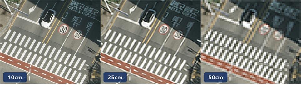
A 10cm resolution refers to the spatial resolution at which a 10cm object is recognized as a single pixel. Aerial imagery maps are maps created by correcting for various distortions in the subject, making it appear as if viewed vertically from the sky.
The aerial image map produced this time has been accurately positioned and has been corrected for distortion and ups and downs of terrain features, and can be installed and utilized in various spatial information systems.
Sam-A Shipping conducted a total of 470 flights, covering over 120,000 km, to photograph the entire country, which covers over 100,000 km2, at a resolution of 10 cm. More than a year was invested in the follow-up correction work for the production of the aerial image map.
Sam-A Shipping expressed its hope that this high-precision aerial image map will be incorporated into various geographic information systems (GIS) and used for policy formulation and implementation in various public sectors.
Sam-A Shipping plans to release its aerial imagery map platform, Sky Map, to the public around August. The maps available to the public will be available at a 25cm resolution.
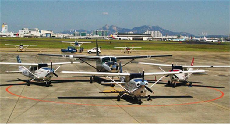
Sam-A Hangup CEO Gil Young-ok said, “We will continue the national land image data construction project through Korea Aerial Photography Co., Ltd., which we recently established with investment from Sam-A Hangup,” and “We will develop a specialized and comprehensive aerial photography business that utilizes not only optical images but also lidar, radar images, and thermal infrared images, utilizing manned and unmanned aircraft, helicopters, and satellite images.”
Meanwhile, LiDAR (Light Detection And Ranging) fires laser pulses from an aircraft and measures the distance to objects by receiving the reflected pulses from ground objects. It is similar to radar using lasers.
Comments
Related news
LG U+, "Stride" to Make Drone-based Precise Inspection of Social Infrastructure a Reality
LG Uplus successfully demonstrated precision inspection of social infrastructure by using its U+ drone control system to monitor natural gas pipeline burial areas in real-time, thereby preventing risks in advance. This demonstration was conducted as part of the Ministry of Land, Infrastructure and Transport's drone regulatory sandbox pilot project, which promotes the practical implementation and early commercialization of drones by allowing companies to discover new business models and freely conduct safety tests without regulatory restrictions for a specified period in the drone sector. Based on beyond-visual-line-of-sight autonomous flight, LG Uplus conducted demonstrations including real-time imaging of natural gas pipeline burial areas using 3D maps, airspace radio maps, and airspace weather information, real-time monitoring of burial areas and requests to stop illegal construction, and ground displacement detection, thereby protecting the relevant area from potential damage.
2018.12.11by 이수민 기자
SKT and Seoul Metropolitan Government Usher in the Era of Fully Autonomous Driving with 5G and AI
SK Telecom's B2B Business Division Head Choi Il-kyu and Seoul City's Urban Transportation Director Koh Hong-seok signed an agreement on technology development and demonstration for high-precision road map technology for the autonomous driving era. Both parties agreed to cooperate in developing real-time HD map update technology for the next-generation intelligent transportation system demonstration project section by equipping 5G ADAS on 1,700 city buses and taxis. Based on this, they plan to undertake road facility management system and traffic safety service development projects as well. Through this agreement, Seoul is expected to become the world's first city to apply 5G technology in the public transportation sector.
2019.05.26by 이수민 기자
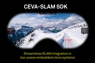
CEVA Announces SLAM SDK for Low-Power Embedded Systems
CEVA has announced the CEVA-SLAM software development kit to provide convenient development of SLAM (Simultaneous Localization and Mapping) applied to mobile devices, AR/VR headsets, robots, autonomous vehicles, and camera-based devices. Available for the CEVA-XM intelligent vision DSP and NeuPro AI processor product families, CEVA-SLAM integrates hardware, software, and interfaces to significantly lower the entry barrier for companies seeking to implement SLAM in low-power embedded systems.
2019.06.05by 이수민 기자
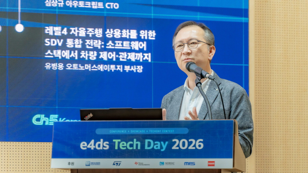
[e4ds Tech Day 2026 ⑨] Sim Sang-gyu, Autocrypt CTO: "In the Physical AI Era, Automotive Security Must Extend Beyond the Vehicle"
At e4ds Tech Day 2026, Sim Sang-gyu, CTO of Autocrypt, explained automotive cybersecurity strategies in the era of Physical AI and SDV (Software-Defined Vehicle). Automobiles are evolving as part of an ecosystem connected to AI, cloud, chargers, IoT, and robots, and he emphasized that the scope of security must expand beyond the vehicle interior to the entire connected environment. In particular, AI model tampering, adversarial attacks, OTA updates, and EV charger hacking were identified as major threats. He explained that response measures require zero trust, AI model integrity protection, intrusion detection, Security by Design and Default, and full lifecycle security management, and that proactive security system establishment beyond regulatory compliance is critical for securing future mobility competitiveness.
2026.10.12by 배종인 기자

Practical HIL Construction Strategy for Automotive and Off-Highway Controller Validation
As vehicle E/E architecture transitions to zonal structures and shifts to software-defined vehicles (SDV), the number of controllers (ECUs) requiring validation and software complexity are surging dramatically. Meanwhile, real vehicle testing cannot provide repeated verification under identical conditions and entails lead time and safety concerns. This white paper explains the principles of HIL (Hardware-in-the-Loop) validation and the structure of the NI platform composed of PXI, SLSC, and VeriStand, and through two actual implementation cases—Camera Record & Replay HIL for In-Cabin Monitoring Controller (ICMU) and Forklift Controller (VCU) HILS—describes how controller-level regression testing becomes possible. Additionally, it explicitly states application boundaries and limitations, such as lack of A2B support.
2026.10.12by 편집부











