



Velodyne Lidar Provides Lidar Technology for Karta's Stencil 2-32 Mobile Mapping System
 Published2019.07.18 13:51
| Can help with urban planning, parking and traffic management
| Allvision Utilizes U.S. On-Street Parking Occupancy Analysis
Velodyne Lidar announced on the 16th that its Light Detection And Ranging (LiDAR) technology has been integrated into Kaarta's 'Stencil 2-32' land surface mapping solution.
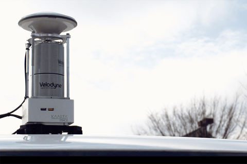
Built-in lidar sensor
Stencil 2-32 accurately surveys the ground surface to map curbs, manholes, signs, posts and other features at a lower cost than traditional mobile mapping systems. The stencil platform can aid in urban planning for infrastructure improvements, as well as parking and traffic management.
The 3D data generated by Stencil 2-32 can be utilized in a variety of applications, including Building Information Modeling (BIM), geospatial data analysis, and cataloging tools.
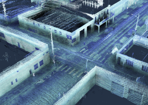
We conducted a curb occupancy analysis in Pittsburgh, USA.
Allvision in the US was able to use data from an autonomous vehicle developer, along with Stencil 2-32, to analyze curb occupancy in Pittsburgh's Strip District, an area known for its high demand for on-street parking.
The solution, called Allvision Parkview, allows city planners to monitor parking behavior to improve traffic planning and curb management.
“The addition of Stencil 2-32 expands Kaarta’s product line for mobile lidar scanning across a wide range of mapping applications,” said Kevin Dowling, CEO of Kaarta. “Velodyne’s compact, low-noise lidar sensors have the long-range capability and wide field of view to create systems that are flexible, accurate and fast from image capture to response.”
Stencils include 3D mapping and real-time It has integrated position estimation capabilities, providing capabilities not possible with fixed scanning systems.
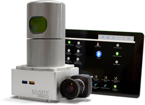
Equipped with Velodyne Lidar's HDL-32E sensor
The Stencil 2-32 features a Velodyne HDL-32E lidar sensor with a range of up to 100 meters and a data rate of 720,000 points per second.
Carta uses advanced robotics technology that combines data input from various sensors, including lidar, video odometry, and an inertial measurement unit (IMU), to process that data in real time.
In some applications, the value of data can be enhanced by using Global Navigation Satellite System (GNSS) positioning and wheel odometer sensors.
“The combination of Velodyne’s lidar and Kaarta’s advanced 3D mapping and localization algorithms creates a portable system that can quickly and easily map detailed surfaces,” said Aaron Morris, founder and CEO of Allvision. “The ability to quickly gather accurate, up-to-date geospatial information has countless applications.”
Stencil 2-32 is the latest in Carta's stencil product line., this product line includes the Stencil 2-16, a versatile, low-cost mobile mapping platform using the Velodyne Puck sensor. Its ease of use, wide range of applications, and streamlined workflow make it ideal for infrastructure inspectors, surveyors, engineers, architectural designers, facility planners, security personnel, and more.
“Kartah and Allvision demonstrate how Velodyne’s computer perception data can be fully leveraged for inventory, tracking and monitoring to plan and manage the future of assets,” said Mike Jellen, President and CCO, Velodyne Lidar.
Comments
Related news
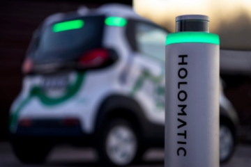
Velodyne Lidar supplies lidar sensors to Chinese HoloMatic, which developed autonomous valet parking solution
Velodyne Lidar has supplied lidar sensors to HoloMatic's smart valet parking solution, HoloParking, which eliminates the burden on drivers of spending time searching for parking spaces. Unlike parking assistance systems, HoloParking does not require the vehicle to be driven to the parking spot itself. When a vehicle uses HoloParking, it can find a parking space on its own and complete parking without human supervision.
2019.02.11by 이수민 기자
Velodyne Launches LiDAR Solution for Autonomous Vehicles via NVIDIA DRIVE Platform
Velodyne Lidar is launching a surround-view lidar solution on the NVIDIA DRIVE autonomous driving platform that collects rich perception data during testing and validation phases. This solution realizes accurate localization and path planning through real-time 360-degree perception. The characteristics of Velodyne sensors can be verified in NVIDIA DRIVE Constellation, an open and scalable simulation platform that enables large-scale, precise hardware-in-the-loop testing. The DRIVE Sim software of this solution emulates sensors such as lidar to implement a highly reliable virtual environment and generates data to be input to autonomous vehicles.
2019.03.21by 이수민 기자
ADI-First Sensors Commit to Mass Supply of LiDAR Solutions
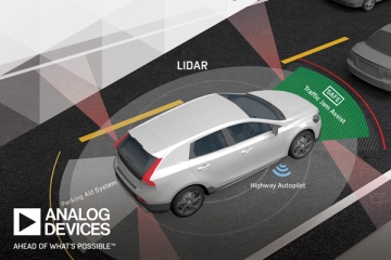
Analog Devices will collaborate with First Sensor AG to develop autonomous sensing products for unmanned vehicles, aerial and underwater transportation systems used across various industrial sectors including transportation, agriculture, and manufacturing. As part of this collaboration, the two companies will develop products that reduce the lidar signal chain. Through this product, manufacturers seeking to incorporate sensing and recognition technologies into autonomous safety systems will be able to achieve superior system performance while reducing system size, weight, power consumption, and cost. The two companies also plan to develop additional lidar products for automotive and industrial manufacturing applications.
2019.07.05by 이수민 기자
[e4ds Tech Day 2026 ⑨] Sim Sang-gyu, Autocrypt CTO: "In the Physical AI Era, Automotive Security Must Extend Beyond the Vehicle"
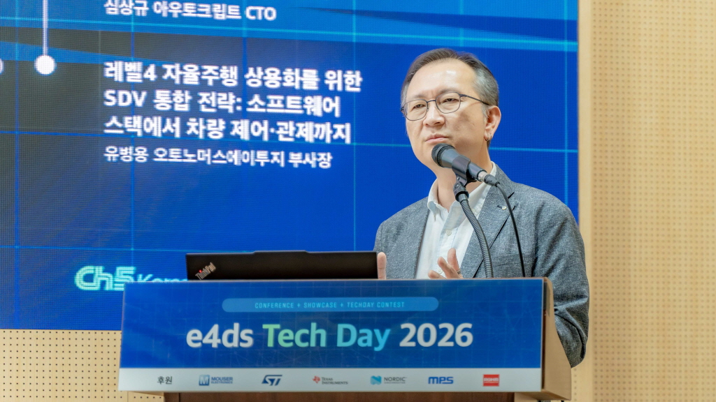
At e4ds Tech Day 2026, Sim Sang-gyu, CTO of Autocrypt, explained automotive cybersecurity strategies in the era of Physical AI and SDV (Software-Defined Vehicle). Automobiles are evolving as part of an ecosystem connected to AI, cloud, chargers, IoT, and robots, and he emphasized that the scope of security must expand beyond the vehicle interior to the entire connected environment. In particular, AI model tampering, adversarial attacks, OTA updates, and EV charger hacking were identified as major threats. He explained that response measures require zero trust, AI model integrity protection, intrusion detection, Security by Design and Default, and full lifecycle security management, and that proactive security system establishment beyond regulatory compliance is critical for securing future mobility competitiveness.
2026.10.12by 배종인 기자

Practical HIL Construction Strategy for Automotive and Off-Highway Controller Validation
As vehicle E/E architecture transitions to zonal structures and shifts to software-defined vehicles (SDV), the number of controllers (ECUs) requiring validation and software complexity are surging dramatically. Meanwhile, real vehicle testing cannot provide repeated verification under identical conditions and entails lead time and safety concerns. This white paper explains the principles of HIL (Hardware-in-the-Loop) validation and the structure of the NI platform composed of PXI, SLSC, and VeriStand, and through two actual implementation cases—Camera Record & Replay HIL for In-Cabin Monitoring Controller (ICMU) and Forklift Controller (VCU) HILS—describes how controller-level regression testing becomes possible. Additionally, it explicitly states application boundaries and limitations, such as lack of A2B support.
2026.10.12by 편집부











