



Ice Eye Begins Full-Scale Satellite Service Customer Support
 Published2022.07.21 13:39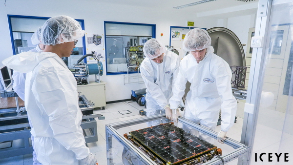
ICEYE, an Earth observation company that operates the world's largest SAR (Synthetic-Aperture Radar) satellite constellation, has established a dedicated business division for satellite sales and customer satellite management, and has begun full-scale customer support.
IceEye recently announced the establishment of a new dedicated business unit to support complete satellite missions for customers requiring independent SAR capabilities in Earth orbit.
Governments and multinational corporations can purchase their own radar imaging satellites with the necessary capabilities from IceEye and operate them independently, or choose to have IceEye manage them on their behalf.
“We are developing leading electronics, satellite engineering and orbital dynamics calculation technologies to build high-performance, small and affordable SAR satellites to meet the imaging needs of our customers worldwide,” said Rafal Modrzewski, co-founder and CEO of iCEye. “We are particularly focused on addressing the strong market demand for differentiated, unique products.”
The new business unit will be led by Steve Young, who previously served as Vice President of Business Development and Sales at IceEye and has extensive experience in the space and aviation sectors.
Before joining IceEye, Steve Young worked at BAE Systems He served as an executive at Systems.
In 2015, he served as Head of Business Development and Sales at Surrey Satellite Technology Limited (SSTL), and later co-founded Earth-i, a NewSpace company providing high-resolution satellite imagery.
He was appointed a Fellow of the Royal Aeronautical Society in 2011.
IceEye already supports complete satellite missions for several customers worldwide, including two satellites acquired by the Brazilian Air Force, launched in May 2022. The Brazilian Air Force will own and operate the satellites for environmental and national security purposes. Because parts of South America are nearly always covered by clouds, radar imaging satellites are the only viable solution for reliably capturing the necessary data.
Additionally, in December 2021, IceEye partnered with Canada's MDA to provide SAR satellites for the next-generation commercial Earth observation system called CHORUS. The IceEye satellites will operate in the same terrestrial orbit as MDA's wide-area C-band SAR satellites, providing cross-cue operation between the two satellites.
Unlike existing Earth observation satellites, IceEye's radar imaging satellites, each weighing only about 100 kilograms, can produce high-resolution images of the Earth multiple times a day, under all lighting and weather conditions. These images can be collected from extremely large areas, up to thousands of square kilometers, or from small, precise points of interest. Images in high-resolution acquisition mode are sharp enough to discern even the smallest changes in the ground, such as footprints in a field or tire tracks in sand.
Comments
Related news
European Patent Applications Surpass 200,000 for the First Time… South Korea Maintains 5th Place, Led by Batteries and Telecommunications
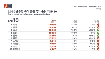
According to the European Patent Office (EPO)'s 'Technology Dashboard 2025', European patent applications last year reached 201,974, surpassing 200,000 for the first time. Korean companies and inventors filed 14,355 applications, representing a 9.5% increase from the previous year and maintaining 5th place by country. Battery, digital communication, and semiconductor technologies led the growth, with Samsung ranking as the top EPO applicant for the second consecutive year and LG reaching 3rd place. The presence of major domestic cities such as Seoul, Suwon, and Yongin was also confirmed. It was also revealed that Korea's European patent strategy is expanding beyond individual technologies to span the entire industry.
2026.03.24by 명세환 기자

SK Telecom First Applies AI-Based Network Operations at Gwanghwamun K-Pop Concert
SK Telecom announced that it applied an AI-based network operation system for the first time at a large-scale K-pop concert held in the Gwanghwamun area of Seoul on March 21st, managing communication quality throughout the event. Mobile data usage during the three hours before and after the concert reached 12.15TB, approximately doubling compared to the same time slot the previous weekend. SK Telecom monitored traffic using the AI system 'A-One' in five-minute and 50-meter units to respond to potential overload situations, while also operating temporary communication facilities and on-site personnel in parallel. This case is interpreted as confirmation of the practical applicability of AI-based autonomous network operation in an environment where demand from dense events and foreign users increases simultaneously.
2026.03.23by 명세환 기자
ETRI Develops 200Gbps Photodetector… Initiates Localization of Optical Receivers for AI Data Centers
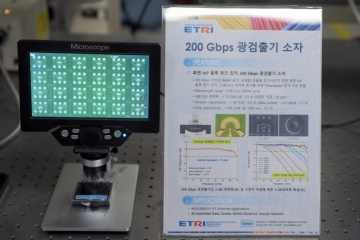
The Electronics and Telecommunications Research Institute (ETRI) has developed a photodetector device that processes optical signals of approximately 200Gbps per channel for the first time in Korea. This device is a component that converts optical signals into electrical signals and determines the reception performance of AI data centers and 5G/6G communication networks. ETRI achieved bandwidth of 70GHz or higher and optical responsivity of 0.75A/W or higher, and integrated an indium phosphide lens on the rear of the chip to enhance optical reception efficiency and alignment convenience. The technology was presented at OECC 2025 and was recently published in the international academic journal 'Optics Express'.
2026.03.19by 명세환 기자

SKT and Ericsson Expand Joint Research on AI Networks… Preparing for 6G Beyond 5G Advancement
SK Telecom and Ericsson are expanding AI-based mobile network collaboration. On the 19th, the two companies signed a memorandum of understanding covering 5G advancement through 6G standardization, and agreed to undertake joint research and verification in the areas of AI-RAN, open and autonomous networks, security, and future communication technologies. This collaboration is interpreted as a move to enhance current 5G operational efficiency while preparing for a 6G environment where AI becomes embedded throughout the network. The scope also includes network operations automation, multi-vendor environment response, energy efficiency improvements, and review of communication-sensing fusion technology.
2026.03.19by 배종인 기자
SKT Receives International Standard for AI Data Center Interconnection Structure… Establishes Operating System Standards
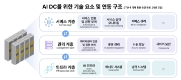
SK Telecom's proposed AI data center interworking architecture has received final approval as an international standard at the International Telecommunication Union Telecommunication Standardization Sector (ITU-T) conference. The core of this standard is the classification of AI data centers into three layers—service, management, and infrastructure—and the organization of signaling requirements between layers. As AI service proliferation increases the importance of interworking among various systems within data centers such as computation, power, cooling, storage, and security, this standard is significant in that it presents a common architecture for operations and service delivery. SK Telecom stated that it initiated the relevant standardization project in 2024 and achieved this approval following approximately two years of discussion.
2026.03.18by 명세환 기자











