


[Planning - Autonomous Vehicles⑥] Precision Road Maps, the Last Puzzle Piece for the Autonomous Vehicle Era
 Published2017.06.05 11:33
뒤져진 국내 기술과 표준화 정하는 일 시급해
꿈이 현실이 됐다, 라는 말이 가장 잘 어울리는 기술이 있다면 바로 그것은 자율주행 자동차일 것이다. 자동차를 부르면 알아서 달려오고, 또 스스로 목적지까지 주행한다. 자율차는 주행 중 장애물을 인식해 피하고 주인에게 각종 편의와 정보를 제공한다. 완전 자율주행차의 상용화는 좀 시간이 걸리겠지만 소위 말하는 ‘반 자율주행차’ 기술은 갈수록 고도화되고 있다. 이제 자율주행 기능을 갖춘 자동차 광고도 쉽게 볼 수 있을 정도로 우리 생활 깊숙이 다가왔다. 본지는 앞으로 11회에 걸쳐 자율주행차 기획을 연재한다. 자율주행차 산업 트렌드를 시작으로 레이더, 라이다, 카메라센서 등 반도체 부품, 통신, 정밀지도, SW플랫폼, 인공지능, 보안, K-City 서비스 등을 다룬다. 독자 여러분의 많은 성원을 부탁 드린다. <편집자 주>
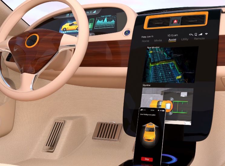
현재 자동차 업계를 대표하는 이들 업체가 했던 행동의 공통점은 무엇일까. 바로 ‘지도’이다. 히어라는 업체는 대표적인 디지털 지도 전문 기업이고 현대자동차가 자평했던 최고의 기술도 지도이며, 테슬라도 3D 지도의 아쉬움을 지적했다.
최근 라이다나 레이더와 같은 최첨단 ‘센서’ 기술이 급속히 발전하고 있는데도, 왜 자율주행을 위한 ‘정밀 지도’의 필요성이 제기되고 있을까. 업계에서는 카메라, 통신, 센서가 모두 먹통일 때 동아줄이 되어줄 수 있는 ‘또 하나의 센서’로 지도를 언급하고 있다.
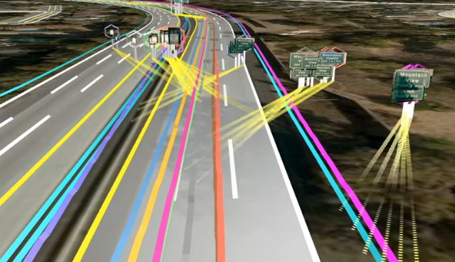
Here의 HD Map 기술이 위치 기반 주변을 인식하고 있는 모습 (출처: Here 블로그)
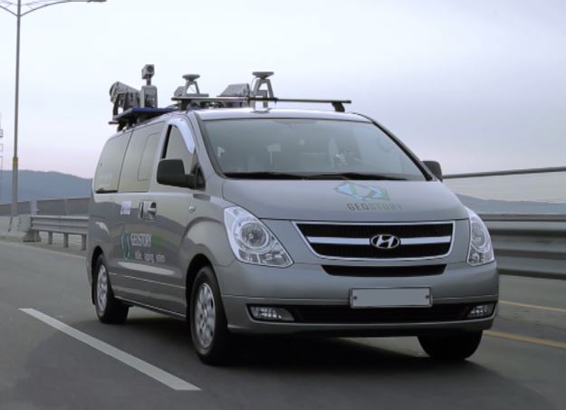
MMS 차량이 정밀도로지도를 구축하는 모습 (출처: 국토지리정보원)
자동차에 들어가는 지도는 세가지로 볼 수 있다. 우선, 기본 도를 기반으로 GPS와 카메라로 제작한 △내비게이션의 항법지도 △모바일맵핑시스템(Mobile Mapping System; MMS)을 활용한 ADAS지도 △정밀도로지도(또는 HD Map)다.
내비게이션은 수십 미터(m) 반경내 정확도를 제공하며, ADAS 지도는 여기에 도로 경사와 곡률정보가 추가된 정보를 제공한다. 운전자에게 감속과 가속 구간에 대한 정보를 알려주는 지도다. 현재 정밀도로지도는 25cm 반경을 인지해 차량이 1차선에 있는지, 2차선에 있는지 구분할 수 있다.
정밀도로지도는 MMS를 이용한 측량, 3차원 데이터 수집, 데이터 보정, 3차원 LAS 생성, 객체도화 작업, 정위치 편집 및 구조화 순으로 만들어진다. MMS는 GPS와 라이다(Lidar), 관성측정장치(Inertial Navigation System; INS), 카메라가 부착된 차량으로 지도를 만든다. GPS는 1~30초 간격으로 신호를 받고, INS는 0.05도~0.1도 정도의 분해능을 가진 장비가 사용된다. INS는 GPS가 잡히지 않을 때 가속도를 통해 위치정보를 잡아줄 수 있다. 이렇게 구성된 데이터는 지도로 가공된다. 3차원 데이터를 수집하고, 보정해 객체도화 작업을 거쳐 위치정보를 포함한 점군 형태의 LAS지도가 만들어진다. 이 중 규제선, 도로경계선, 정지선, 터널, 교량, 지하도로, 안전표시, 노면표시, 신호 등을 포함한 지도를 구성하면 정밀도로지도가 된다.
국토지리정보원, 여의도 포함해 9개 구간 471km 지도 구축
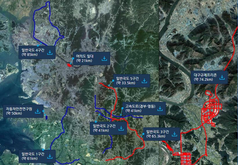

이처럼 첨단 기술과 많은 데이터를 필요로 하는 정밀도로지도 개발은 쉽지 않다는 데 그 어려움이 있다. 지도 개발에 따른 기술력과 예산, 한 대에 10억원에 이르는 MMS 차량의 가격 등도 부담으로 작용한다. 이에 국내에서는 국토지리정보원에서 2015년부터 지도를 제작해 공개해왔다. 지난 4월 30일에 공개한 여의도와 대구 규제 프리존을 포함해 총 9개 구간 471km의 정밀도로지도를 구축했다. 이와 더불어 국토지리정보원은 2020년까지 자율주행 레벨 3(조건부 자율주행) 상용화에 맞춰 국가적 필요와 수요가 있는 지역에 대한 정밀도로지도를 구축하고 표준화 및 기술 개발 등을 중점 추진할 계획이라고 밝혔다.
민간 기업으로는 MMS를 갖추고 정밀지도를 구축한 현대엠엔소프트가 유일하다. 내비게이션 지니(Gini)와 위치기반서비스를 제공해온 현대엠엔소프트는 전국 2차선 이상 주요 도로에 고정밀 지도를 구축하고 일부구간 국토지리정보원의 지도와 함께 지도를 구축하고 있다.
세계적인 업체 HERE는 정밀지도 기술을 이끌고 있는 사례라 할 수 있다. HERE의 지도는 3개의 레이어로 구성된다. ▲기본이 되는 HD Map은 10~20cm내 정확도로 3D도로정보를 차량 위치정보와 회전반경, 차선구분, 차로 변경과 추월 등 운행을 지원한다. ▲또한 실시간 동적 정보는 HD Live Map에서 교통상황과 기상환경, 교통사고 정보 등을 제공하고 센서 데이터와 통합해 데이터를 수집한다. ▲운전자 운행패턴을 분석한 Humanizied Driving Layer는 커브구간에 자동으로 속도를 조절해 안전성과 신뢰성을 높여줘 장거리 운전에 적합하다.
HERE는 북미와 유럽에서 생산되는 차량의 80%에 지도를 공급하고 있다. 히어의 대표 에드자르드 오버빅(Edzard Overbeek)은 올해 CES에서 엔비디아와 협약을 맺으며 “인공지능을 활용해 Live Map의 개발을 가속화할 계획이다. 자율주행 지도에서 가장 중요한 정확도를 충족하기 위해 최신 지도가 필요한데, 센서를 활용해 실시간 데이터를 모으는 일은 Audi, BMW, Daimler가 할 것”이라고 밝혔다.
HERE는 북미와 유럽을 너머 국내에서도 지도를 구축하고 있는 것으로 알려졌다. 국토지리정보원의 이용관 사무관은 “히어가 국내에서도 MMS 차량으로 지도를 구축하고 있다는 건 이미 예전부터 들려오는 이야기”라고 말했다.
도로공사, 표준에 대한 연구 진행중
정밀도로지도에 대한 표준화 문제도 부각되고 있다. 지도가 자율주행에서 중요한 역할을 하지만 국제적 표준이 마련되지 않았기 때문이다. 국제 표준이 일부 적용되고 있긴 하지만, 각 업체들이 표준을 만들어 특정 업체의 이익이 반영될 수 있어 조심스러운 움직임이다. 2016년 지능형교통시스템(Intelligent Transport Systems; ITS)에는, LDM(Local Dinamic Map)에 대한 개념 표준 ISO / TC 204가 발의된 바 있다.
한국건설기술연구원의 ICT 융합연구소의 최현상 공학박사는 "아직 국내가 국제 표준화와 기술 동향에 뒤져 있다."고 말했다. 유럽에서는 LDM을 표준으로 적용하고 있고 국내에서도 ITS협회의 제안으로 도로공사에서 LDM에 대한 연구를 진행중이다.
■인터뷰
이용관 사무관 / 국토지리정보원 지리정보과

Q. 국내에서는 구글에도 지도 반출을 허가하지 않았는데 해외 기업이 국내 정밀 도로지도를 구축할 수 있나요.
A. 보안, 필요합니다. 아직 정밀도로지도에 표준이 마련되지 않아 지도를 공개하기 전 저희도 고민이 많았습니다. 처음엔 직접 정보원을 방문하여 지도를 가져갈 때 가공된 벡터지도만 배포했어요. 지금은 인터넷으로도 사용처를 적은 후 다운받을 수 있고 보안에 주의를 기울인다는 협의를 통해 LAS데이터도 제공하고 있습니다.
Q. 보안에는 프라이버시도 해당되는 건가요.
A. LAS데이터에는 영상정보가 포함되어 있으나 보안 문제가 엮일 수 있어 영상을 제외하고 공개하고 있습니다. 이를 요청해온 곳도 있었으나 문제가 될 수 있는 일부 구간은 삭제한 후 제공했습니다.
Q. 지도를 제공한 업체들은 지도를 어떻게 쓰고있나요.
A. 연구기관, 회사, 각종 공공기관에서 지도를 받아갔지만 아직 연구 단계입니다. 저희는 연구 수준을 끌어올리기 위해 지도를 제작하기 시작했으니 연구를 규제하진 않습니다. 유통단계에 이른다면 보안관련 제재를 가할 수 있겠죠. 현재로서는 연구가 진행되며 지도가 부족한 점이나 필요한 데이터를 물어가며 지도를 보완해가고 있습니다.
Q. 지난 달 공개한 여의도는 9개 구간 중 유일한 도심지인데, 어려운 점이 없었나요?
A. MMS 차량은 위성 정보를 수신해서 위치 보정을 하게 되는데, 고층빌딩 사이에 교란이 일어나 위치 잡기가 좀 어려웠습니다. 지도는 정확도를 높이기 위해 측량점으로 위치를 보정하는데 이런 도심지의 특성에 맞춰 좀 더 많은 측량점을 찍었어요. 도심지에서 자율주행차량을 연구해온 서울대와 함께 연구를 진행하기도 했습니다. 서울대의 자율주행차 스누버는 여의도에서 자율주행차를 운행할 계획이고요.
Q. 과제가 2020년까지라고 들었습니다. 새로 구축되는 구간은 어디인가요.
A. 올해는 영동고속도로에서 평창 올림픽경기장까지 이어지는 구간과 세종시와 판교제로시티입니다. 평창 동계올림픽 구간에 자율주행을 시범 서비스로 보여줄 계획이라 지도도 구축 예정이고요. 이외에도 계획은 있지만 연구 상황에 따라 바꿔 나가야 한다고 생각해요. 기술 개발도 지속적으로 이뤄져야 하고요. 어떤 식으로 정리가 될지 확언할 수 상황입니다.
Q. 자율주행차 시대에 국토지리정보원의 역할은 무엇인가요.
A. 저희 목표는 자율주행차의 연구를 어느 정도 수준 이상으로 끌어 올려 상용화 시키는 거예요. 민간 업체에서도 지도를 제작하고 있고, 저희와 중복된 부분도 있어요. 다만, 저희가 제작하는 지도는 'LAS데이터까지' 열려 있습니다.
Comments
Related news
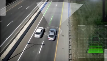
[Planning - Autonomous Vehicles ③] Camera, Lidar “Cars finally have eyes”
As commercialization of Level 3 autonomous driving technology begins, interest in advanced driver assistance systems is also increasing. ADAS systems serve as a foundation for autonomous vehicles, and while they initially primarily functioned to inform drivers of road conditions through notifications, they have recently advanced to the level of automatically controlling the steering wheel, brakes, and other components. The Genesis EQ900 is equipped with advanced driver assistance systems (ADAS) including Advanced Smart Cruise Control (ASCC), Blind Spot Detection (BSD), Autonomous Emergency Braking (AEB), Driver Attention Alert (DAA), Smart High Beam (SHBA), and front seat pre-active seatbelts. The new i30 wagon incorporates ADAS technologies such as Adaptive Cruise Control (ACC), AEB, and Lane Keeping Assist System. For these ADAS systems to operate, detection through cameras, lidar, and radar sensors is essential. When examining ADAS system installation by vehicle type, except for some small vehicles, either cameras alone or a combination of radar and stereo cameras are applied. Cameras can cover a range of up to 100m ahead, surround view, and rear areas. They function in a role that provides intuitive assistance to drivers by enabling actual visual observation. For autonomous driving, a minimum of 5 or more camera sensors per vehicle must be installed to achieve 360-degree full coverage detection.
2017.04.24by 김지혜 기자
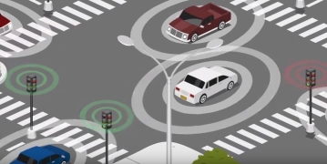
[Planning-Autonomous Vehicles④] Free WAVE Communications, Together with Cellular, Takes Responsibility for Vehicle Communications
Even if autonomous vehicles are equipped with the most advanced sensor capabilities, ambient environmental information is necessary to handle unexpected situations for complete autonomous driving. Sensors and cameras have limitations when going over hills or crossing bridges with dense fog. This is why vehicle-to-vehicle communication (V2V) as well as vehicle-to-everything communication (V2X) are necessary. Vehicle communication typically uses DSRC, WAVE (802.11p), WLAN (802.11a), and similar standards. DSRC (Dedicated Short Range Communication) is a bidirectional communication method for exchanging various services and information between roadside base stations and vehicle terminals, making it the most suitable communication method for ITS (Intelligent Transport System). WAVE (Wireless Access in Vehicular Environment), known as vehicular wireless communication (IEEE 802.11p), is medium- to short-range wireless data communication that supports public safety and private communication through roadside and inter-vehicle communication. This high-speed vehicular wireless communication technology supports V2V and V2I (vehicle-to-infrastructure) in high-speed driving situations, enabling emergency transmission of hazard information on roads and vehicles ahead, safety services that prevent rear-end collisions, and can be utilized in building various next-generation intelligent transportation systems such as multi-lane non-stop tolling services through vehicle network technology. In February this year, the U.S. National Highway Traffic Safety Administration (NHTSA) made vehicle-to-vehicle communication technology (V2V) mandatory on newly released vehicles. By 2022, all new vehicles in the United States are expected to be equipped with V2V technology. Hyundai Motor announced plans to equip WAVE terminals on three vehicle models by the end of 2019, and the Ministry of Land, Infrastructure and Transport is operating testbeds following the Seoul-Sejong Smart Highway project with a C-ITS (Cooperative Intelligent Transport Systems) project between Daejeon and Sejong.
2017.05.08by 김자영 기자
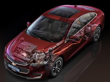
[Planning-Autonomous Vehicles⑤] 'Running SW' Artificial Intelligence Cars, Software Dominates
Vehicles with electrified systems are commonly referred to as "running semiconductors." However, as the importance of software that drives these electronic devices grows, it may now be appropriate to call automobiles "running software." Whereas the previous trend was to install various functions for vehicle stability and convenience, with accompanying software (SW) to operate them, automobiles are increasingly becoming software-centric. Vehicle software can be divided into electronic component SW platforms and infotainment platforms. In the electronic component SW platform, AUTOSAR (automotive open system architecture), an open-standard automotive software, is at the center. AUTOSAR comprises 9 core partners with approximately 50 member companies, including BMW, Bosch, Continental, Daimler, Ford, GM, Peugeot Citroën, Toyota, and Volkswagen as core partners, consisting of 7 OEM companies and 2 Tier 1 suppliers. The purpose of AUTOSAR is to address the growing complexity of software as electronic devices increase, and to reduce costs by enhancing software reusability.
2017.05.22by 김지혜 기자
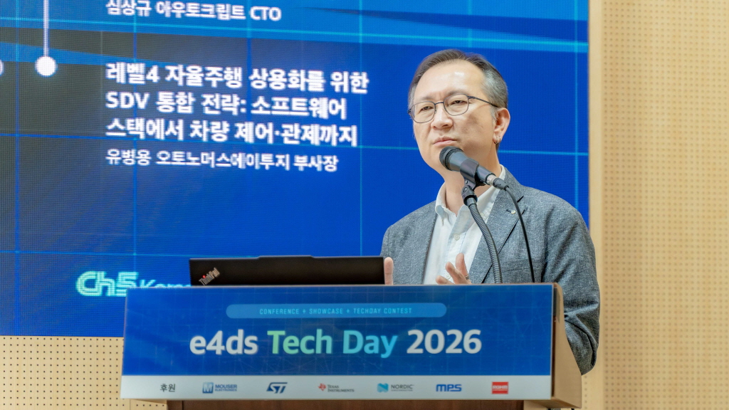
[e4ds Tech Day 2026 ⑨] Sim Sang-gyu, Autocrypt CTO: "In the Physical AI Era, Automotive Security Must Extend Beyond the Vehicle"
At e4ds Tech Day 2026, Sim Sang-gyu, CTO of Autocrypt, explained automotive cybersecurity strategies in the era of Physical AI and SDV (Software-Defined Vehicle). Automobiles are evolving as part of an ecosystem connected to AI, cloud, chargers, IoT, and robots, and he emphasized that the scope of security must expand beyond the vehicle interior to the entire connected environment. In particular, AI model tampering, adversarial attacks, OTA updates, and EV charger hacking were identified as major threats. He explained that response measures require zero trust, AI model integrity protection, intrusion detection, Security by Design and Default, and full lifecycle security management, and that proactive security system establishment beyond regulatory compliance is critical for securing future mobility competitiveness.
2026.10.12by 배종인 기자

Practical HIL Construction Strategy for Automotive and Off-Highway Controller Validation
As vehicle E/E architecture transitions to zonal structures and shifts to software-defined vehicles (SDV), the number of controllers (ECUs) requiring validation and software complexity are surging dramatically. Meanwhile, real vehicle testing cannot provide repeated verification under identical conditions and entails lead time and safety concerns. This white paper explains the principles of HIL (Hardware-in-the-Loop) validation and the structure of the NI platform composed of PXI, SLSC, and VeriStand, and through two actual implementation cases—Camera Record & Replay HIL for In-Cabin Monitoring Controller (ICMU) and Forklift Controller (VCU) HILS—describes how controller-level regression testing becomes possible. Additionally, it explicitly states application boundaries and limitations, such as lack of A2B support.
2026.10.12by 편집부











