



FLIR Systems Launches Thermal Imaging Camera Drone Kit
 Published2017.07.24 11:08
안전사고 및 재난 구조 활동, 산불 현장 관측, 건물 지붕 검사 등에 응용

사고나 재난 상황 외에도 주거용이나 상업용 건물 지붕의 단열재 상태, 누수나 침수 또는 그 밖에 다른 원인에 의한 손상, 수리 후 완전한 수리 여부 등을 확인하는 데에도 효과적이다.

플리어 관계자는 “기존에는 홍수나 산불 같은 재난 또는 사고 현장 조사를 위해 헬기를 동원해야 했으며, 건물 지붕 검사를 위해서도 작업자가 일반 카메라를 손에 들고 높은 사다리를 타고 건물을 오르내려야 했지만 플리어의 공중검사 키트를 이용하면 그러한 비용이나 위험을 감수할 필요가 없다”고 설명했다.
Comments
Related news
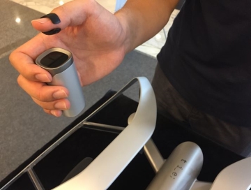
This Is Engineering is working on an easy-to-control drone controller.
Operating a drone is not an easy skill. You grip the remote controller with both hands and your head is set on "straight ahead," yet the aircraft barely moves forward. Since you've already bought it, it's too early to give up. You tell yourself that "the practice process is also fun." At this point, there's good news that an intuitive controller operable with just one hand has been developed. By moving a ring equipped with sensor functionality over the main controller, you can control the drone's takeoff, landing, and direction. DisDisEngineering plans to launch a toy drone in the second half of this year and a professional drone extension in the first half of next year.
2017.07.19by 김자영 기자
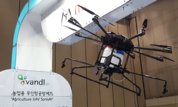
How to raise the lagging domestic drone industry to the world's top 5
On the 18th, amendments to the Aviation Safety Act and Aviation Business Act were passed through the National Assembly as part of efforts to establish institutional support for drone industry development. As a result, commercial nighttime flights and beyond-visual-line-of-sight operations, which had previously been prohibited, will now be possible. With the global drone market size expected to reach 6 billion dollars (approximately 6.87 trillion won) this year and grow to over 11.2 billion dollars (approximately 12.83 trillion won) by 2020, China currently dominates 90% of the small drone market. In contrast, South Korea's drone industry commercialization remains behind. The Ministry of Land, Infrastructure and Transport held a public hearing with the Korea Transport Institute and the Korea Aerospace Research Institute to gather opinions on the 'Basic Plan for Drone Industry Development.'
2017.07.20by 김지혜 기자
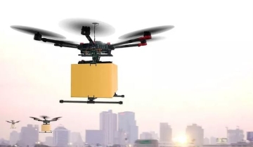
"If we follow China's lead in small drones, we will fail." The Korean industrial drones that we should focus on are
"Drones are important in terms of enabling the development of core technologies for the future aviation industry. Therefore, a national master plan is necessary." Song Ki-han, Director of the Korea Transport Institute, stated this on the 19th at a public hearing on the drone industry development master plan, explaining the current status, market outlook, fostering targets, and strategies for the domestic drone industry. In response, the public hearing proceeded with industry, academia, and research experts offering advice on content that should be supplemented in the plan. The drone industry master plan addresses the need for government-wide support based on a mid- to long-term master plan in the drone industry, which is still in a growth phase. The targets include expanding the market size to 4.1 trillion won by 2026, entering the world's top 5 in technological competitiveness, and commercializing 60,000 industrial drones.
2017.07.24by 김지혜 기자
.jpg)
SalePoint Signs Multi-Year Partnership Agreement with AWS… Promoting Identity Security that Integrates Even AI Agents
Sailpoint has entered into a multi-year strategic partnership agreement with AWS and is moving forward with establishing an integrated governance system that manages both human and non-human identities together. The plan is to consistently manage access permissions in an environment where AI agents are increasing as work execution entities, while applying the principle of least privilege and automated policy enforcement. The two companies plan to jointly expand capabilities to manage the identities of various entities, including AI agents, within a single layer in the AWS environment. This collaboration is interpreted as a move to design security and governance together in corporate environments where AI adoption is expanding.
2026.03.26by 배종인 기자
.png)
Databricks Unveils Open AI Security Monitoring 'Lakewatch'
Databricks entered the security market on March 24 by unveiling LakeWatch, an open-source agentic SIEM. The core functionality of this product is to integrate and analyze security, IT, and business data in a single environment to support AI-based threat detection and investigation. The company explained that it reduces the limitations of existing security operations centers, which have had to forgo some data due to high cost structures, and enables large-scale data analysis and automation based on open formats and ecosystems. LakeWatch is currently offered as a private preview, with Adobe and Dropbox mentioned as early customers. Databricks also announced an expanded partnership with Anthropic as well as the acquisition of Antimatter and SiftD.ai.
2026.03.26by 배종인 기자











