



Technology to identify low-altitude drones is emerging.
 Published2017.09.21 10:33
The Electronics and Telecommunications Research Institute (ETRI) is developing technology to identify drones in the sky and prevent illegal drone operations in order to establish a low-altitude air traffic control system at an altitude of about 150 meters (m) above the ground.
The research team announced that they have begun developing security technologies and illegal activity suppression technologies related to drone identification, authentication, encryption of information exchanged, countermeasures against hacking, and privacy protection such as photography for a low-altitude unmanned aerial vehicle traffic management system.
Accordingly, the Ministry of Science and ICT, the Ministry of Land, Infrastructure and Transport, and other ministries are promoting the "Low-Altitude Unmanned Aerial Vehicle Traffic Management Surveillance Technology Development and Demonstration Test Project" as a multi-ministry project to establish and develop a traffic management system for the rapidly increasing number of unmanned aerial vehicles.
With the explosive growth of low-altitude unmanned aerial vehicles (UAVs) and related services, such as drone delivery, expected in the future, establishing a traffic management system for low-altitude UAVs is essential.
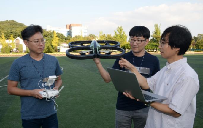
Once the traffic management system is established by the research team, it is expected to have positive functions such as setting flight routes for safe flights, preventing flights to unauthorized areas, avoiding collisions between drones, monitoring the flights of unauthorized drones, and suppressing illegal activities and privacy invasions using drones.
The research team is developing ▲an identification authentication module ▲a module for authentication and encryption of drones ▲technology to prevent forgery of drone flight path and no-fly zone information ▲malicious code detection and response technology ▲technology to protect the privacy of collected video information, etc., to identify drones and prevent forgery of identification.
Once this technology is developed, it will be approvedIn the case of drones, after selecting a flight path, it can automatically determine whether flight is possible, and safe flight is also possible.
Additionally, it will enable those seeking to use low-altitude drones for commercial purposes to automatically identify security zones. The research team anticipates that this will allow for the systematization of drone-related regulations through technological development.
"This technology can counter security threats that may arise when operating low-altitude unmanned aerial vehicles (UAVs) such as drones," said Kang Yoo-seong, project leader at ETRI's Information Security Research Center. "It will help minimize damage and privacy violations caused by drones."
Comments
Related news
[Reporter's Notebook] Will the 10-Year Drone Policy Plan Succeed in Popularizing Drones Without Leaving Hobby Drones Behind?
At major exhibitions like 'World IT Show' and 'K Drone Summit', drones are consistently featured. While agricultural and industrial drone exhibitions are also present, the greatest interest is drawn by consumer drones such as 'drone battles', 'drone racing', and 'drone soccer'. This interest in drones continued at the public hearing on the Basic Plan for Drone Industry Development hosted by the Ministry of Land, Infrastructure and Transport and the 2017 Republic of Korea Drone Policy Forum. Kim, who operates a hobby/leisure drone enthusiast club, stated, "At the last public hearing, I proposed that hobby/leisure drones be considered as well. However, at the policy forum, hobby/leisure drones were excluded again." He expressed curiosity about why the medium to long-term plan for Korea's domestic drone industry is unilaterally focused solely on industrial applications. Drones, identified as a core task and key topic of the Fourth Industrial Revolution, initially started with military applications. They are expected to expand beyond the civilian market for hobbies and filming to include applications in safety inspections, surveillance/surveying, and cargo transportation. The domestic market is also showing a trend of increasing private demand, centered on filming and agricultural uses.
2017.09.01by 김지혜 기자
The Backlash of IoT Security: Intact Drones Crash and Moving Cars Stop
There have been cases where refrigerators opened and closed multiple times a day, vacuum cleaners that traverse throughout the home, and TVs that people sit facing have been hacked. In 2014, when IoT security was being discussed, Proof Point, an American security company, revealed that malicious emails were being sent three times a day in units of 100,000 to not only enterprises and individuals but also home appliances. It goes beyond simply receiving them—hackers can control cameras attached to devices. The cameras in vacuum cleaners and TVs can become the eyes of hackers, allowing them to photograph every corner of the home.
2017.09.07by 김자영 기자
[Discussion] I was wondering what business models there are for making money with drones.
Drones, recognized as a core task of the Fourth Industrial Revolution. When drones are discussed domestically, market activation is an inevitable topic. The Ministry of Land, Infrastructure and Transport has decided to place greater emphasis on industrial drones rather than hobbyist drones. So what kind of business should small and medium enterprises and startups pursue using drones? Under the theme of "Drones Emerging as a New Business," a discussion session was held at the Seoul Industrial Promotion Agency in Sangam to explore what kind of business can actually be conducted using drones and what issues need to be addressed to revitalize the industry. First, experts discussed recommended sectors that small and medium enterprises should consider challenging. Lee Hyun-jong, CEO of RoboLink, stated, "Ten years ago, we focused on developing our own products. Now we operate in integration with domestic and international drone partner companies," and advised, "The focus is burning on hardware development, but it is difficult to compete with China in the hardware sector. Rather than asking what kind of drone to build, shift your attention toward the software side."
2017.09.19by 김지혜 기자

Nvidia invests $5 billion in Intel
NVIDIA and Intel, leaders in global AI computing technology, are now forging ahead in providing cutting-edge solutions through NVLink-based architecture integration. NVIDIA and Intel have officially announced a strategic partnership and stated that they will jointly develop customized data center and personal computing products to accelerate diverse applications and workloads ranging from hyperscale to enterprise and consumer markets, thereby laying the foundation for the next generation computing era.
2025.09.22by 배종인 기자
.jpg)
Applied Materials Launches Environmental Protection Campaign to Mark World Cleanup Day
Applied Materials Korea (CEO Park Kwang-seon) is carrying out environmental cleanup activities with employees and their families around the Dongtan Sinricheon area on the occasion of World Cleanup Day, evolving into a company that engages with the local community beyond technological innovation.
2025.09.22by 명세환 기자











