



LG U+ Enters Drone Business with Cloud Command and Control System
 Published2017.11.21 17:05
Korea's First Drone Remotely Controllable from Remote Locations Using LTE Network
LG U+ announced the commercialization of a 'drone command and control system' that enables operators at a command center to remotely pilot drones in distant locations and perform missions, marking its full-scale entry into the drone business led by autonomous flying drones.
On the 21st, LG U+ held a press briefing at its Yongsan headquarters in Seoul and introduced the 'U+ Smart Drone Cloud Drone Command and Control System,' which enables stable drone operation for disaster monitoring, surveying, and logistics transportation even in non-line-of-sight areas or at night through telecommunications networks.
The Ministry of Land, Infrastructure and Transport introduced the 'Drone Special Approval System' from November 10th. With this, flights during nighttime and operations beyond visual line of sight become possible when safety standards are met.
Choi Joo-sik, head of LG U+'s FC (Future and Converged) division, stated, "Existing drones had to be controlled via WiFi or RF, and operators had to follow them while maintaining distance regardless of where they were flying. Being able to do this via LTE is a domestic first. Drones can be launched from anywhere across the country, and flight direction and route adjustments are possible depending on wind conditions," he said.
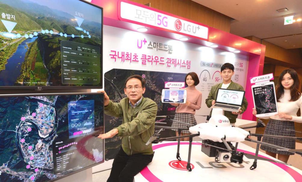
At the event, LG U+ conducted a demonstration flight at Sangam Sky Park in which an autonomous drone was remotely launched from the Yongsan headquarters to locate a missing child reported in Sangam-dong within three minutes and connect the child to safety personnel.
Kwon Yong-hun, head of the drone team, said, "There is no better solution than drones for quickly searching open areas like Sangam Sky Park, which spans about 20 soccer fields," and added, "We anticipate that the use of the cloud drone command and control system will significantly increase in social contribution fields such as locating missing children."
During the drone's flight, the cloud drone command and control system displayed information in real time such as signal strength around Sky Park, the drone's flight speed, and battery level, as well as weather information including wind direction, wind speed, and temperature. Additionally, latitude and longitude information along the drone's flight path was displayed.
Kwon Yong-hun, head of the drone team, said, "The biggest advantage is that as long as a telecommunications network is connected, anyone can easily operate the drone with a single touch through the command and control system without distance restrictions," and added, "In the 5G era, clearer 8K-grade ultra-high-definition video can be transmitted without delay, so the scope of applications will expand further."
LG U+ partnered with Prodrone to develop drones suitable for the cloud drone command and control system. Additionally, through collaboration with TerraDrone, LG U+ is developing a system capable of stable control even in non-line-of-sight areas and plans to continuously enhance it.
The drone command and control system allows drones to be launched and controlled from remote locations hundreds of kilometers away without distance restrictions as long as a telecommunications network is available. Photos and video footage captured during flight can also be checked in real time. In addition, it is possible to check weather information, temperature, wind direction, and wind speed, and to set routes by confirming signal strength.
LG U+ identified eight service areas utilizing this system: surveying, safety inspection, agriculture, transportation/logistics, environmental monitoring, security, aerial photography, and advertising/promotion. The company plans to apply it to activities such as surveying construction and civil engineering projects or coastal lines, and delivering packages to islands and remote mountainous areas.
Division Head Choi Joo-sik said, "We plan to prepare 3D maps equipped with necessary information for drone flight, such as information on transmission towers," and announced that the company will sequentially enhance the airspace radio frequency map and real-time drone navigation guidance system.
Comments
Related news
Implementation of Drone Special Approval System Enables Night Operations and Long-Distance Transport
Drone utilization becomes possible in areas that have not been previously used, such as nighttime broadcast coverage, aerial performances, and parcel delivery to remote island areas. The Ministry of Land, Infrastructure and Transport will implement systems to foster drone industry development, including regulatory improvements and establishment of support measures, starting November 10. The newly introduced 'Drone Special Approval System' is a system that, upon compliance with safety standards, reviews and permits on a case-by-case basis nighttime operations and flights beyond visual line of sight (BVLOS) that had been previously prohibited.
2017.11.10by 김지혜 기자
'KT 5G Drone Racing World Masters' held at Seoul Plaza
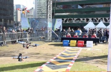
KT announced that it successfully concluded the "2017 KT 5G Drone Racing World Masters" held at Seoul Plaza in front of Seoul City Hall on the 11th. The KT 5G Drone Racing World Masters is an international drone racing competition hosted by KT at the "DRONES IN SEOUL 2017" event organized by the Seoul Metropolitan Government. This drone racing competition was notably held at Seoul Plaza, a no-fly zone within Seoul, marking the first such event in South Korea, which drew a large number of spectators. The competition featured 12 top-tier domestic players and 4 top-tier international players from countries including the United States and Japan, who engaged in thrilling matches. Following the main tournament conducted as a 16-player bracket, players Kang Chang-hyun, Kim Min-chan, Son Young-rok, and Oka (Japan) advanced to the finals to compete for the championship.
2017.11.13by 김지혜 기자
SKT Uses ICT Technology at Disaster Sites
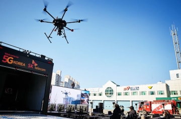
SK Telecom and Gangwon Fire Department announced that they have agreed to effectively support firefighting activities through ICT. This is to overcome geographical constraints using ICT in consideration of Gangwon Province's terrain, which is surrounded by forests covering 82% of its area. First, SK Telecom will provide Gangwon Fire Department with a "Public Safety Solution" that combines 230 units of wearable special terminals (hereinafter body cameras), 4 command drones, and a real-time video control system called "T Live Caster." Gangwon Fire Department plans to deploy the equipment to the Special Rescue Team and 16 fire stations under its jurisdiction, and will systematically respond to various disasters and accidents from the control center based on video footage sent from firefighters at the scene. In addition, SK Telecom and Gangwon Fire Department plan to enhance the solution through ultra-high-speed and ultra-low-latency 5G communication to identify disaster situations more quickly and respond appropriately to various disasters and accidents.
2017.11.20by 김지혜 기자
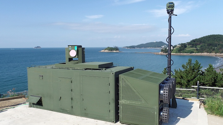
Hanwha Systems' Laser Air Defense Weapon 'Cheonkwang' Achieves 100% Drone Interception Success
Hanwha Systems' laser air defense weapon 'Cheonkwang' demonstrated its operational performance by intercepting 3 drones with 100% success rate during the Army's future warfare training. With an operational cost of approximately 2,000 won per shot, it enables low-cost operation and, when deployed alongside a 30kW high-energy laser gun, is drawing attention as a next-generation air defense measure against the increasing threat of small drones and unmanned aerial vehicles in modern battlefields.
2026.10.15by 배종인 기자
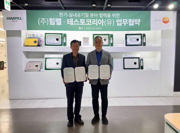
Testo Korea and Himple Sign MOU in Indoor Air Quality Sector
Testo Korea, a specialist in measurement equipment, and Himple, a ventilation appliance manufacturer, have signed an MOU to cooperate in the fields of indoor air quality management and ventilation performance verification. Testo Korea's high-precision air volume measurement equipment will be applied to Himple's "Breathing House Diagnosis" service, and measurement solutions including testo 417 and testo 625 will be showcased at the HARFKO 2026 exhibition with experiential programs to be operated.
2026.10.15by 배종인 기자











