


LG Uplus and Seocho-gu respond to disaster sites with real-time video transmission technology.
 Published2018.02.20 12:08
LG Uplus announced that it has built a real-time disaster site video transmission system using drones in Seocho-gu, Seoul to enhance the crisis management response capabilities of local governments in the event of various disasters such as large-scale fires and earthquakes, which have recently emerged as social issues.
This system relays disaster scene footage captured by a camera installed on a drone to a local government control center via a smartphone linked to the drone and an LTE-only network. For video broadcasting, the 'Industrial Direct Cam' application, which serves as a platform for transmitting video from a smartphone to an LTE network, is utilized, and drone-captured video can be viewed in real time through various devices such as control smartphones, PCs, and IPTVs.
LG U+ explained that it plans to provide local governments with a remote drone control system beyond visual line of sight, in accordance with the revised Aviation Safety Act, as well as a system where managers directly control drones within the line of sight.
While many local governments have introduced drones to strengthen their disaster response capabilities, the footage stored on the drone controller's SD card had to be manually transferred to the control PC for confirmation, limiting their ability to respond quickly and in real time when a disaster occurs.
.jpg)
However, Seocho-gu has established LG U+'s real-time disaster site video transmission system, enabling real-time disaster site video confirmation and group calls between staff members to quickly share the situation and establish countermeasures.
Seocho-gu plans to operate a real-time drone video transmission system for disaster sites for the next five years, and is considering introducing additional related devices so that the system can be utilized at autonomous centers under its jurisdiction, such as district offices, in addition to the district office situation room and two urban safety divisions.
To build this system, the two sides have been conducting various tests since October of last year, including building a dedicated LTE network and testing the connection between drones and industrial cam apps. Based on the successful implementation and operation of the Seocho-gu disaster management system, LG U+ plans to expand the system to the metropolitan area and each local government.
Meanwhile, LG U+ was the first in Korea to introduce a cloud drone control system last year that enables stable drone flights for disaster surveillance, surveying, and logistics transport even in non-visual areas or at night through a communication network. Last month, the company also launched a total LTE drone service that provides everything from water drones and customized LTE drones to cloud control and comprehensive insurance using an LTE control system.
LG U+ plans to develop a 3D map, an aerial radio map, and a real-time drone route guidance system this year, while also entering the public sector through a total LTE drone service.
Comments
Related news
Smart technologies like IoT and drones are improving railway safety.
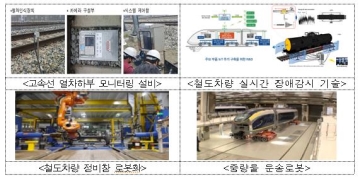
Through the Internet of Things (IoT), train conditions are monitored in real-time to prevent train failures in advance, and drones are utilized to manage facilities in dangerous sections such as bridges and transmission towers. The Ministry of Land, Infrastructure and Transport has established a "Basic Plan for Building a Smart (SMART) Railway Safety Management System (2018-2027)" to proactively introduce fourth industrial revolution technologies in the railway safety field and improve the level of railway safety. Although the number of accidents and fatalities in the railway safety field has been decreasing, the rate of decrease has reached its limit, making it difficult to achieve safety improvements through conventional safety management methods alone. Accordingly, this plan has been established to improve safety management methods by utilizing advanced technologies.
2018.01.17by 김지혜 기자
Smart City/Autonomous Vehicle/Drone Deregulation Accelerates Growth
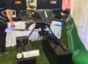
The Ministry of Land, Infrastructure and Transport has announced the direction and tasks for regulatory innovation regarding △smart cities △autonomous vehicles △drones, which are leading innovation growth initiatives. As new technologies and industries are being introduced, there are concerns about safety and security. Taking these points into consideration, measures have been reviewed to establish safety standards and enable their timely introduction. In particular, in the process of establishing these systems, the Ministry plans to have opportunities for exchanging opinions with the private sector, including industry and civic organizations, in order to build public consensus.
2018.01.23by 김지혜 기자
Drones are also used in the aviation sector for airport inspections, bird control, and more.
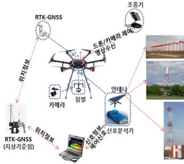
Drones are expected to be utilized in airport facility management and bird control and other aviation-related fields. The Ministry of Land, Infrastructure and Transport and Incheon International Airport Corporation announced that they will establish and promote measures for drone utilization in six aviation operations: navigation facility inspection, bird control, airport perimeter security, obstacle limitation surface management, aviation obstruction light management, and drone countermeasures. Navigation safety systems, by virtue of their characteristics as equipment that radiates radio waves into the air using radio frequencies, had limitations in performing inspections through manual measurement of radio waves from the ground by personnel.
2018.02.09by 김지혜 기자
Korea Instrument, KOLAS Accredited Calibration Agency First to Simultaneously Acquire ISO/IEC 27,001·27,701
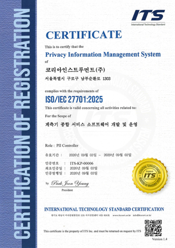
Korea Instrument has become the first among KOLAS accredited calibration agencies to simultaneously acquire ISO/IEC 27,001 and ISO/IEC 27,701 certifications. Through its proprietary platforms CWIZ Enterprise and CWIZ Partners, the company has embedded information security and personal data protection requirements across all business processes including customer information, equipment data, and calibration reports, with plans to continuously advance its management system through regular audits and security inspections.
2026.10.12by 배종인 기자
TeamViewer One, IT Incident Automation Workflow and Resolution Center Enhanced
TeamViewer has added IT incident automation capabilities and an advanced Resolution Center to its integrated digital workplace management platform 'TeamViewer ONE'. Recurrent service disruptions, configuration errors, and capacity shortages are automatically handled according to preset policies, and device status verification through script deployment can be managed in a unified interface, significantly reducing repetitive tasks for IT teams.
2026.10.12by 배종인 기자











