


Public surveying using drones begins
 Published2018.04.03 10:17
The way has been opened for the full-scale utilization of drones in public surveying.
The Ministry of Land, Infrastructure and Transport announced that it has completed the institutionalization of public surveying using drones and has officially launched the system.
Public surveying is a type of surveying that manages quality through strict work standards to ensure the accuracy of survey results necessary for public safety and the management of public facilities, and can be utilized as a basis for other surveys. The introduction of drones into the public surveying sector is significant in that it establishes an institutional foundation for survey results using drones to be recognized as credible survey results.
The National Geographic Information Institute under the Ministry of Land, Infrastructure and Transport has been promoting the introduction of drone surveying by establishing production standards for spatial information, such as image maps and digital maps based on drone imagery, and verifying surveying accuracy through various pilot projects. Furthermore, it has established work standards and performance evaluation criteria to maintain the reliability of public surveying through strict quality control, while simultaneously contributing to the revitalization of the drone industry and spatial information by creating public demand through the introduction of new drone surveying technologies.
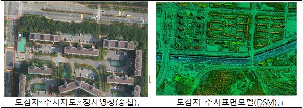
Conducting public surveying using drones enables faster result acquisition and cost reduction compared to surveying using conventional manned aircraft.
Since drones fly at lower altitudes compared to manned aircraft, they are less affected by weather conditions such as clouds, allowing for rapid filming and shortening the overall surveying period. Additionally, costs such as aircraft maintenance are lower, so it is expected that costs will be reduced by about 30% compared to manned aircraft.
National Geographic Information InstituteIt is predicted that aerial and ground surveying, amounting to 28.3 billion won and accounting for about 17% of the domestic public surveying market worth approximately 165 billion won annually, will be converted to drone surveying.
An official from the National Geographic Information Institute stated, “This system improvement will generate significant demand for drones in the public sector, contributing to the development of the drone industry, and the advancement of drone equipment will drive technological progress in the spatial information industry.” The official added, “We will continue to actively pursue system improvements so that the drone industry, a new industry in land, infrastructure, and transport, and the spatial information industry can drive mutual development.”
Comments
Related news
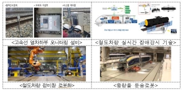
Smart technologies like IoT and drones are improving railway safety.
Through the Internet of Things (IoT), train conditions are monitored in real-time to prevent train failures in advance, and drones are utilized to manage facilities in dangerous sections such as bridges and transmission towers. The Ministry of Land, Infrastructure and Transport has established a "Basic Plan for Building a Smart (SMART) Railway Safety Management System (2018-2027)" to proactively introduce fourth industrial revolution technologies in the railway safety field and improve the level of railway safety. Although the number of accidents and fatalities in the railway safety field has been decreasing, the rate of decrease has reached its limit, making it difficult to achieve safety improvements through conventional safety management methods alone. Accordingly, this plan has been established to improve safety management methods by utilizing advanced technologies.
2018.01.17by 김지혜 기자
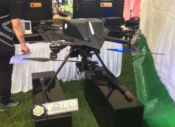
Smart City/Autonomous Vehicle/Drone Deregulation Accelerates Growth
The Ministry of Land, Infrastructure and Transport has announced the direction and tasks for regulatory innovation regarding △smart cities △autonomous vehicles △drones, which are leading innovation growth initiatives. As new technologies and industries are being introduced, there are concerns about safety and security. Taking these points into consideration, measures have been reviewed to establish safety standards and enable their timely introduction. In particular, in the process of establishing these systems, the Ministry plans to have opportunities for exchanging opinions with the private sector, including industry and civic organizations, in order to build public consensus.
2018.01.23by 김지혜 기자
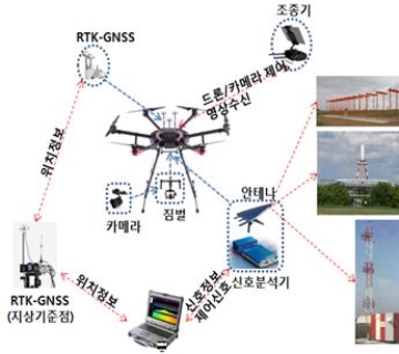
Drones are also used in the aviation sector for airport inspections, bird control, and more.
Drones are expected to be utilized in airport facility management and bird control and other aviation-related fields. The Ministry of Land, Infrastructure and Transport and Incheon International Airport Corporation announced that they will establish and promote measures for drone utilization in six aviation operations: navigation facility inspection, bird control, airport perimeter security, obstacle limitation surface management, aviation obstruction light management, and drone countermeasures. Navigation safety systems, by virtue of their characteristics as equipment that radiates radio waves into the air using radio frequencies, had limitations in performing inspections through manual measurement of radio waves from the ground by personnel.
2018.02.09by 김지혜 기자

Korea Instrument, KOLAS Accredited Calibration Agency First to Simultaneously Acquire ISO/IEC 27,001·27,701
Korea Instrument has become the first among KOLAS accredited calibration agencies to simultaneously acquire ISO/IEC 27,001 and ISO/IEC 27,701 certifications. Through its proprietary platforms CWIZ Enterprise and CWIZ Partners, the company has embedded information security and personal data protection requirements across all business processes including customer information, equipment data, and calibration reports, with plans to continuously advance its management system through regular audits and security inspections.
2026.10.12by 배종인 기자
TeamViewer One, IT Incident Automation Workflow and Resolution Center Enhanced
TeamViewer has added IT incident automation capabilities and an advanced Resolution Center to its integrated digital workplace management platform 'TeamViewer ONE'. Recurrent service disruptions, configuration errors, and capacity shortages are automatically handled according to preset policies, and device status verification through script deployment can be managed in a unified interface, significantly reducing repetitive tasks for IT teams.
2026.10.12by 배종인 기자











