



Mobiltech, “Will Present a Paradigm Beyond Spatial Recording”
 Published2022.11.08 10:41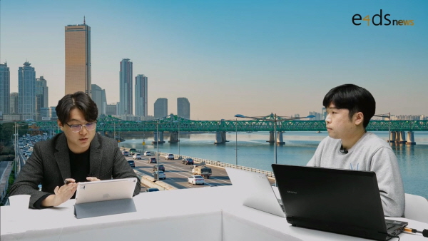
▲ 유형곤 모빌테크 본부장(오른쪽)
보행자 레벨 데이터 생성 항공사진·라이다 데이터 융합
모빌테크, 자체개발 MMS장비 통해 최신성·확장성 확보
e4ds는 지난 28일 2022 e4ds 오토모티브 테크 콘서트에서 ‘실감형 스마트시티 구현을 위한 3D 공간정보 갱신 및 활용 기술’을 주제로 모빌테크의 유형곤 본부장을 초청해 웨비나를 진행했다.
모빌테크는 ‘레플리카 시티’라는 실감형 디지털 트윈 서비스를 공급하며 공간 기록을 넘어서는 패러다임을 제시하겠다는 목표로 한다.
자체 제작한 장비를 차량에 장착하여 매일 도시를 스캔하고, 이때 얻어진 도시 객체 정보 (POI) 들이 매일 DB로 구축된다.
이러한 데이터들을 기반으로 자동 모델링 후처리를 거쳐 실감형 3차원 모델로 만들어진다.
모빌테크는 지도 제작에 큰 비용과 시간을 차지하는 데이터 수집과 가공을 AI 자동화를 통하여 해결해 나가고 있으며, 취득된 데이터를 기반으로 AI 인공지능을 학습하여 공간정보의 변화 탐지 및 자동 갱신 기술을 개발하여 3차원 공간정보를 매일 갱신해 나가고 있다.
레플리카 시티는 각 기관(B2B, B2G)에서 원하는 맞춤형 메타버스의 핵심 인프라로 사용될 수 있으며, 기존 지도에서는 제공되지 않았던 다양한 도시 객체에 대한 POI(Point of Interest) 빅데이터를 제공할 수 있다.
더 나아가 모빌테크는 고정밀지도를 자율주행, 디지털 트윈에만 그치지 않고 △버추얼 프로덕션 △시뮬레이션 △UAM 등 다양한 서비스로의 확장이 가능하다.
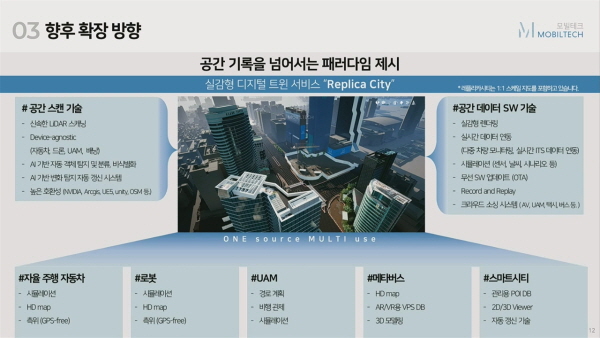
▲ 모빌테크 레플리카 시티 (자료 출처: 모빌테크)

기존 디지털 트윈은 사진을 기반으로 공간을 표현하고 일회성 구축이 대부분이기 때문에 실제 디지털 트윈과는 연동이 어렵다는 한계가 있다.
또한, 항공사진과 라이다를 기반으로 상공에서 찍게 되면 지면 부분과 같은 보행자 수준의 데이터는 낮은 디테일의 폐쇄형 구조로 이루어진다.
제작 방식에서도 자동화나 디테일을 정밀화하기 보다 수작업 기반의 반자동으로 진행되어 가려짐과 광량 등의 오차가 발생할 수 있기 때문에 이를 기반으로 시각화를 구현하면 사진 텍스처 기반의 시각화와 PBR 요소의 부재로 정밀하지 않은 디테일이 생기는 현상이 일어난다.
위와 같은 문제점과 한계를 극복하기 위해 모빌테크는 지도의 가장 중요한 성격인 △정밀성 △최신성 △효율성 △호환성에 집중하고 있다.
이 기업은 정밀성을 해결하기 위해 해외의 고가 장비 대신 자체 개발한 장비를 다수 배포해 데이터를 취득하고 있다.
도심지의 원활한 데이터를 제작하기 위해 고가의 INS를 활용할 수밖에 없었지만 모빌테크는 보행자 레벨의 정밀한 데이터를 생성하기 위해 항공사진과 라이다 데이터를 융합했으며, 자체개발한 MMS 장비로 최신성과 확장성을 갖췄다.
Veolodyne과 같은 글로벌 라이다 제조사와 협력해 모빌테크 자체 장비를 개발해 AI 처리에 특화된 데이터 수집 장비를 운영 중이며 초당 10장 이상의 사진을 촬영해 AI로 처리를 하고 있다.
안전에 직결되는 최신성을 위해서는 수집 빈도를 늘리기 위한 생태계를 마련했고, 효율성과 속도를 위해서는 수동 작업 대신 AI를 기반으로 자동화 처리하고 있다.
도심지 드라이버의 평균 주행거리는 40km 내외로 전국 도로를 커버하는 것은 불가능하다.
이러한 문제점들의 해결방안으로 모빌테크는 자체드라이버와 크라우드 소싱 드라이버를 구분했다.
자체 드라이버는 기준 지도로 활용할 고정밀 데이터를 취득하는 데 중점을 두며 택시 및 택배사와의 전략적 제휴를 통해 인·보도 등 데이터 확장을 꾀하고 있다.
모빌테크는 또한 △항공사진과 라이다 데이터를 활용한 보정 자동화 △AI 활용 객체 추출로 처리 효율성을 극대화하고 있다.
기존 MMS의 자료로 제작 시 현장 측량에 많은 시간과 비용이 소모된다는 문제를 해결하기 위해 서울시 등의 항공사진과 라이다 데이터를 활용했으며, 차량 수집 데이터와 비교해 빌딩숲에서도 정확한 위치 보정이 가능토록 구축했다.
AI 활용 객체 추출을 통해 디지털 트윈 배치 객체 중 도로 환경 객체에 대한 분류, 위치를 추정할 수 있다.
도로 환경에 반복적으로 배치된 나무, 교통 시설물 등 100여 종을 90% 이상의 검출률로 처리하며 동기화된 라이다, 카메라, GPS 데이터를 종합적으로 분석하고, PBR(Physically based Rendering)을 도입해 광택, 반사 등을 나타낼 수 있어 실감형 표현이 가능하도록 구축했다.
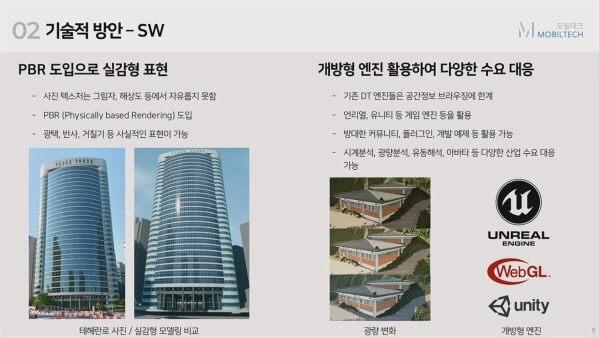
▲ 모빌테크의 디지털 트윈 문제점 해결 방안 (자료 출처: 모빌테크)
유형곤 본부장은 “현실을 기반으로 한 공간 정보의 수요가 다양한 산업계에서 급격하게 증가하고 있다”며 “실감형 공간 정보라고는 하나 실제 데이터와 연동이 되지 않는 단점이 있기 때문에 모빌테크는 레플리카 시티를 통해 단점과 부재를 해결해 나갈 것”이라고 전했다.
지하도로, 산악 지대와 같은 공간 정보 업데이트가 쉽지 않은 경우 주변 환경에 따른 보정 방안이 있는지에 대한 질문에 유 본부장은 “아무리 좋은 GPS를 사용하더라도 터널 같은 공간에서는 오차가 발생할 수 있다”며 “DMI라는 휠 센서로 차량 바퀴 회전 수 데이터를 융합하거나 널 시작점과 끝점 등과 같은 기준점을 융합해 전체적인 터널 데이터를 확보하는 방법도 활용하고 있다”고 전했다.
Comments
Related news
[Interview] Jin-Geun Park, Director of iNavi Systems, “We will develop maps and solutions for various purposes in the autonomous driving era”
We held the '2022 e4ds Automotive Tech Concert' with precision mapping as its theme, and we interviewed Park Jin-geun, Director at iNaviSystems, who participated as a speaker, to discuss his presentation topic and the company's strategy.
2022.09.07by 성유창 기자
Moray to Present Autonomous Driving Simulation at the 2022 e4ds Automotive Tech Concert
Morai will share the relationship between simulation and precision road maps, how precision map data was utilized, and technical pipelines and work accomplished through a free online webinar.
2022.09.23by 성유창 기자
Morai: "Currently Collaborating with Domestic Automotive OEMs and Tier 1s"
At the 2022 e4ds Automotive Tech Concert, Park Hyun-jin, Group Manager of Morai Software, who presented on "Precision Road Map Utilization and Seoul Autonomous Vehicle Simulator" on the 7th, has provided answers to questions that could not be addressed due to time constraints.
2022.10.13by 성유창 기자

[Interview] Yoo Hyeong-gon, Head of Mobiltech Headquarters, “Mobiltech Road Facility/Object Detection Technology Reduces Precision Map Update Speed”
We invited Mobil Tech, which possesses a point cloud map comparison update algorithm and technology capable of extracting only changed portions by comparing with previously constructed point clouds, to the '2022 e4ds Automobit Tech Concert,' and spoke with Yoo Hyung-gon, Head of the Mobil Tech Division, who participated as a speaker.
2022.10.20by 성유창 기자
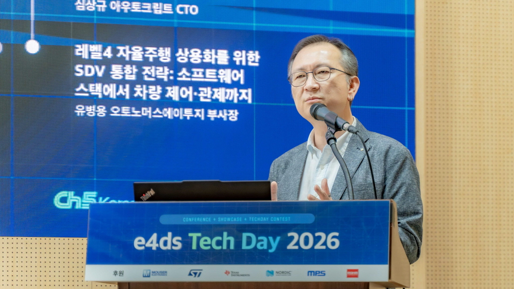
[e4ds Tech Day 2026 ⑨] Sim Sang-gyu, Autocrypt CTO: "In the Physical AI Era, Automotive Security Must Extend Beyond the Vehicle"
At e4ds Tech Day 2026, Sim Sang-gyu, CTO of Autocrypt, explained automotive cybersecurity strategies in the era of Physical AI and SDV (Software-Defined Vehicle). Automobiles are evolving as part of an ecosystem connected to AI, cloud, chargers, IoT, and robots, and he emphasized that the scope of security must expand beyond the vehicle interior to the entire connected environment. In particular, AI model tampering, adversarial attacks, OTA updates, and EV charger hacking were identified as major threats. He explained that response measures require zero trust, AI model integrity protection, intrusion detection, Security by Design and Default, and full lifecycle security management, and that proactive security system establishment beyond regulatory compliance is critical for securing future mobility competitiveness.
2026.10.12by 배종인 기자











