


[Serial] ST Yuji Kawano, Engineer (28) - Using GNSS Modules to Challenge Map Tracking! - GUI Edition (3)
 Published2023.04.17 12:31
NMEA message monitor/record transmission possible
[Editor's Note] When people think of semiconductors, they typically think of familiar semiconductors like computer CPUs and memory. Conversely, MCUs (Micro Controller Units), the core semiconductors that power electronic devices, are widely used in virtually every electronic device we encounter, yet they remain relatively unfamiliar to the general public. Recently, MCUs have been highlighted in the media due to the semiconductor shortage, and are beginning to attract the attention of the general public. Accordingly, this magazine has prepared a place to learn about MCUs through a series of articles by Yuji Kawano, manager at STMicroelectronics, a company specializing in MCU semiconductors.
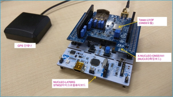
 Let's try tracking on a map using STMicroelectronics' general-purpose 32-bit microcomputer development board 'NUCLEO-F401RE' and the function expansion board 'X-NUCLEO-GNSS1A1' equipped with a GNSS positioning IC (Global Navigation Satellite System).
The vehicle-mounted GNSS positioning IC mounted on the expansion board is called the "Teseo III," and is equipped with ST's "Teseo-LIV3F" GNSS module. This time, we'll use a simple GUI tool for detailed configuration, up to tracking and logging your location on a map.
■ First, prepare the hardware
Connect NUCLEO-F401RE and X-NUCLEO-GNSS1A1. NUCLEO-F401RE already has the target application built into the GUI tool.
Additionally, the antenna included with X-NUCLEO-GNSS1A1 is connected when checking operation (it is OK even if it is not connected here).
■ Next, prepare the software
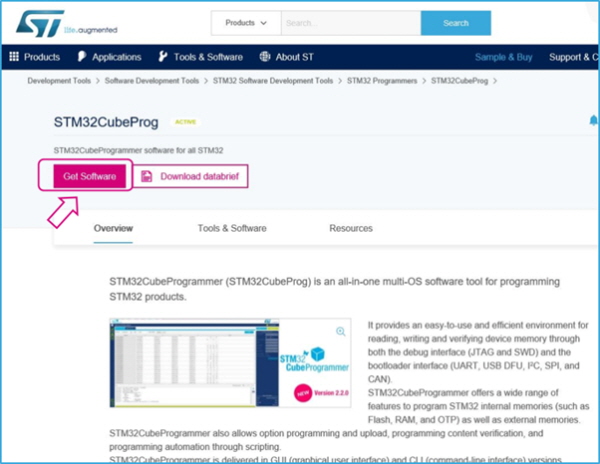
○ Install STM32CubeProgrammer (skip if installation is already complete)
If you are using the STM32NUCLEO board on a PC for the first time, install STM32CubeProgrammer (formerly ST Link Utility) and prepare COM port drivers, etc.
This tool is required to write firmware programs on the STM32 board.
After unzipping the downloaded file, open the executable file and follow the instructions to install. If you have already installed STM32CubeProgrammer, you do not need to do this.
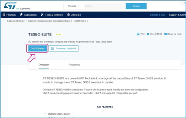
○ Preparation of GUI tool (TESEO-SUITE)
Download the tool's installation file from this page and install it on your PC.
■ Launch TESEO-SUITE
○ Writing firmware to STM32 NUCLEO
Once TESEO-SUITE installation is complete, connect the STM32 Nucleo board (+X-NUCLEO-GNSS1) to the PC via USB and start TESEO-SUITE.
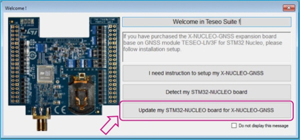
Since NUCLEO-F4O1RE does not yet have firmware, we will write the firmware that operates as VirtualCOMport to connect the Teseo-LIV3F module and PC via UART using the following operations.
From the menu bar, select Tools>X-NUCLEO-GNSS1.
Click 'Update my STM32-NUCLEO board for X-NUCLEO-GNSS' in the pop-up window.
In the firmware selection screen, click on the image of your STM32 Nucleo board where Upload is, with STM32_Nucleo64-xxxxx_UARTBridge.bin selected (you can also select STM32_Nucleo64-xxxxx_I2CBridge.bin. Here, UART/I2C selects the interface between the GNSS module and STM32. Both will work).
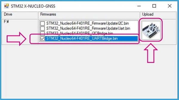
This completes the recording. Here, close and terminate TESEO-SUITE once.
■ Check operation
Connect the board to the PC via USB, and restart TESEO-SUITE with the antenna connected.
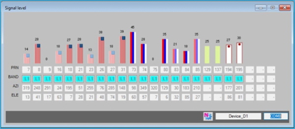
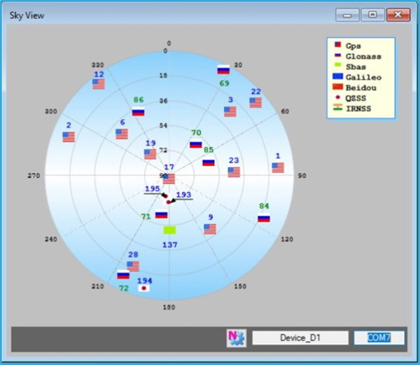
If it is operating normally, TESEO-SUITE is automatically recognized and the Signal Level window and Sky View window are displayed.
In addition to these two, various information windows can be displayed or hidden using icons below the menu bar.
Signal Level: Displays information about the satellite currently being supplemented.
Sky View: Shows which satellites are located relative to you on a celestial map.
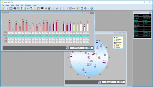
Satellite signal level
○ Check your location on the map/record a log
Clicking the 'Open Map' icon below the menu bar will display the map window.
I want to record logs while moving In this case, use the 'Start/Stop Recorder Control Port' icon. Clicking it starts recording, clicking it again stops recording.

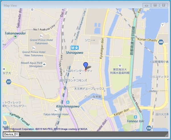
Log files are saved by default in C:\Users(user name)\Documents\ST_Teseo_Suite\Logs. To change the save path, select File > Preferences from the menu bar. You can set the 'NMEA/BINARY/DEBUG log path' in the Preferences window.
.jpg)
Right-click on the map and select 'View Settings' from the menu. A settings frame will appear on the right side of the map. If you want to display the movement trajectory, check 'History'.
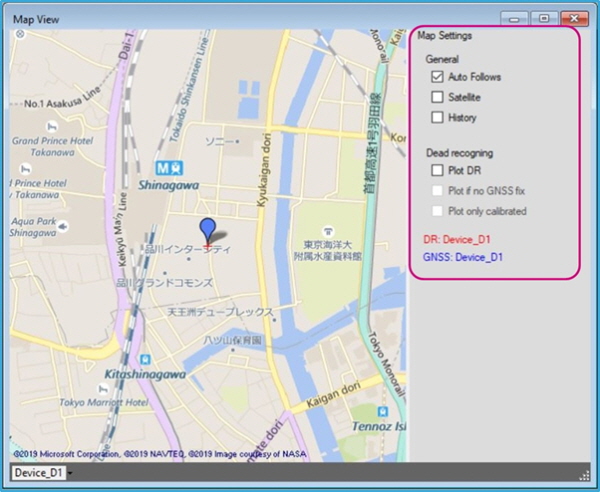
You can check the trajectory on the map and record it as an NMEA log using the above operations.
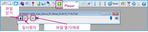
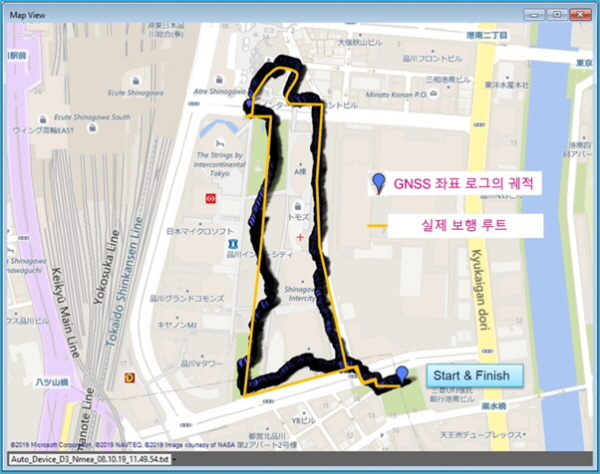
Saved log files can be played in the player window. When playing, you can check the trajectory by keeping the map window open.
○ Walking around the building
This is the trajectory I took while walking between buildings in a city center. Data was acquired with GPS, GLONASS, and QZSS turned on.
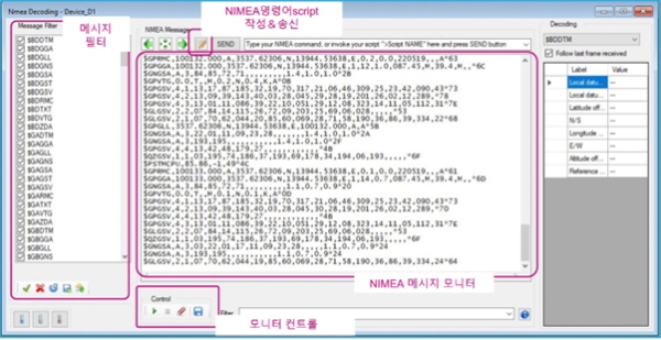
○ Check NMEA messages
You can monitor NMEA messages directly by clicking the 'View Monitor' icon under the menu bar.
Decoded information is displayed, allowing you to directly monitor latitude and longitude data, etc. NMEA commands can also be recorded and transmitted as a script. The File Settings screen on the right allows you to filter which messages are displayed.

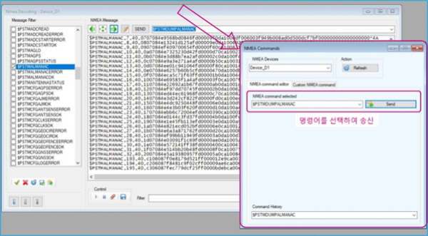
You can also send commands from the NMEA Command window. Click the Send commands icon.
By sending the $PSTMDUMPALMANAC command (reading satellite orbit data in memory),
Example of receiving the $PSTMALMANAC message

■ Conclusion
How about this? Next, let's look at how to change the settings within the GNSS module.
Comments
Related news
[Serial] ST Yuji Kawano Engineer (25) - Let's acquire latitude and longitude data using the GNSS module - Terminal Monitor Edition
Microcontrollers are unfamiliar compared to CPUs or GPUs, but they are among the most widely used semiconductors. Let's hear from Yuki Kawano, Manager at ST System Solutions Lab, about the versatility and potential of MCUs.
2023.01.17by 명세환 기자
.jpg)
[Serial] ST Yuji Kawano Engineer (26) - Using the GNSS module, challenge yourself with tracking on the map! - GUI version (setting change 1)
MCUs are unfamiliar compared to CPUs or GPUs, yet they are among the most widely used semiconductors. Let's hear from Yuki Kawano, Manager at ST System Solutions Lab, about the versatility and potential of MCUs.
2023.02.07by 명세환 기자
.jpg)
[Serial] ST Yuji Kawano, Engineer (27) - Using a GNSS Module, Challenge Map Tracking! - GUI Edition (Settings Change 2)
MCUs are unfamiliar compared to CPUs or GPUs, yet they are among the most widely used semiconductors. Let's hear from Yuki Kawano, Manager at ST System Solutions Lab, about the versatility and potential of MCUs.
2023.02.28by 명세환 기자
Intel Unveils Next-Generation 'Core Ultra Series 3' and vPro Platform for Enterprise PCs
Intel has officially unveiled the "Intel Core Ultra Series 3" for next-generation enterprise PCs and the latest vPro platform, addressing a wide range of demands from enterprise notebooks to high-performance workstations.
2026.03.26by 배종인 기자
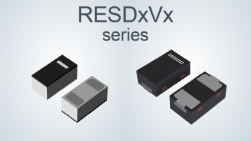
ROHM Launches ESD Protection Diode Compatible with High-Speed Interfaces of 10Gbps or Higher
Semiconductor specialist ROHM has developed the 'RESDxVx series' of ESD (electrostatic discharge) protection diodes capable of responding to next-generation high-speed data communication environments exceeding 10Gbps, simultaneously enhancing both signal quality maintenance required in high-speed interfaces and IC protection performance.
2026.03.26by 배종인 기자











