



Iceeye Wins NASA Mission
 Published2023.08.18 15:13
NASA will receive a new data source for Earth science research through SAR radar imagery from Iceeye US, a global leader in the field of continuous Earth observation using radar imaging satellites.
ICEYE US announced on the 18th that it has secured its first task order under the Blanket Purchase Agreement (BPA) with NASA announced earlier this year.
This mission is intended to collect IceEye’s Synthetic-Aperture Radar (SAR) data to support scientific and academic evaluations in order to determine its suitability for advancing NASA’s Earth science research goals.
This BPA is funded by NASA's Science Mission Directorate, Earth Science Division.
NASA’s Commercial Smallsat Data Acquisition (CSDA) program has been identifying, evaluating, and collecting data from commercial satellite sources that align with NASA’s Earth Science Division objectives since 2020.
Will McCarty, a NASA CSDA program scientist, stated, “NASA is pleased to evaluate IceEye data as part of its portfolio of Earth science research, analysis, and applications,” adding that “commercial sources like IceEye “With the advent of SAR satellites, NASA is focusing on ways to complement existing NASA data sets and capabilities through these small satellite constellations. Ultimately, the goal is to utilize this data to provide a new perspective for determining scientific research priorities in the Earth sciences,” the statement said.
The agreement between Iceeye US and NASA will be recorded as a significant milestone in the field of commercial SAR in the United States. This marks an instance where NASA has been granted access to radar imaging satellite constellation data, including tens of thousands of Iceeye image records. This access will provide significant benefits to measurement fields, such as advanced time-series analysis of the Earth's surface, which have previously been unavailable to the NASA community. Furthermore, extensive licensing rights for Iceeye's SAR data are provided to maximize collaborative utility for research. Iceeye's SAR data also includes satellite data from other types of commercial remote sensing systems, which have proven to be critical capabilities that complement NASA's expertise.
Eric Jensen, CEO of Iceeye US, said, “Iceeye is honored to have the opportunity to provide radar satellite imagery that supports NASA’s Earth science goals through this inaugural mission. The Iceeye sensor provides a continuous source of information, particularly for critical research areas such as geology, topography, and climate change. The CSDA program is a prime example of NASA utilizing private sector investment for the public good, focusing on enhancing societal resilience through a deep understanding of Earth’s evolution.”
Iceeye US operates satellites from the Missions Operations Center located in Irvine, California. This company owns and operates a constellation of SAR satellites, each weighing about 100 kg, and continuously observes all regions of the Earth in near real-time.
SAR offers distinct advantages over conventional electro-optical (EO) imaging. While EO imaging requires a light source to capture an area, much like a camera, SAR constructs images using electromagnetic waves. Consequently, SAR satellites can clearly detect events occurring on land or at sea under any weather conditions, whether day or night, or even when covered in clouds, dust, or smoke.

Comments
Related news
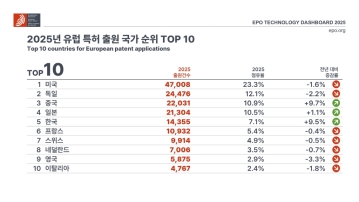
European Patent Applications Surpass 200,000 for the First Time… South Korea Maintains 5th Place, Led by Batteries and Telecommunications
According to the European Patent Office (EPO)'s 'Technology Dashboard 2025', European patent applications last year reached 201,974, surpassing 200,000 for the first time. Korean companies and inventors filed 14,355 applications, representing a 9.5% increase from the previous year and maintaining 5th place by country. Battery, digital communication, and semiconductor technologies led the growth, with Samsung ranking as the top EPO applicant for the second consecutive year and LG reaching 3rd place. The presence of major domestic cities such as Seoul, Suwon, and Yongin was also confirmed. It was also revealed that Korea's European patent strategy is expanding beyond individual technologies to span the entire industry.
2026.03.24by 명세환 기자

SK Telecom First Applies AI-Based Network Operations at Gwanghwamun K-Pop Concert
SK Telecom announced that it applied an AI-based network operation system for the first time at a large-scale K-pop concert held in the Gwanghwamun area of Seoul on March 21st, managing communication quality throughout the event. Mobile data usage during the three hours before and after the concert reached 12.15TB, approximately doubling compared to the same time slot the previous weekend. SK Telecom monitored traffic using the AI system 'A-One' in five-minute and 50-meter units to respond to potential overload situations, while also operating temporary communication facilities and on-site personnel in parallel. This case is interpreted as confirmation of the practical applicability of AI-based autonomous network operation in an environment where demand from dense events and foreign users increases simultaneously.
2026.03.23by 명세환 기자
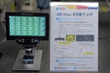
ETRI Develops 200Gbps Photodetector… Initiates Localization of Optical Receivers for AI Data Centers
The Electronics and Telecommunications Research Institute (ETRI) has developed a photodetector device that processes optical signals of approximately 200Gbps per channel for the first time in Korea. This device is a component that converts optical signals into electrical signals and determines the reception performance of AI data centers and 5G/6G communication networks. ETRI achieved bandwidth of 70GHz or higher and optical responsivity of 0.75A/W or higher, and integrated an indium phosphide lens on the rear of the chip to enhance optical reception efficiency and alignment convenience. The technology was presented at OECC 2025 and was recently published in the international academic journal 'Optics Express'.
2026.03.19by 명세환 기자

SKT and Ericsson Expand Joint Research on AI Networks… Preparing for 6G Beyond 5G Advancement
SK Telecom and Ericsson are expanding AI-based mobile network collaboration. On the 19th, the two companies signed a memorandum of understanding covering 5G advancement through 6G standardization, and agreed to undertake joint research and verification in the areas of AI-RAN, open and autonomous networks, security, and future communication technologies. This collaboration is interpreted as a move to enhance current 5G operational efficiency while preparing for a 6G environment where AI becomes embedded throughout the network. The scope also includes network operations automation, multi-vendor environment response, energy efficiency improvements, and review of communication-sensing fusion technology.
2026.03.19by 배종인 기자
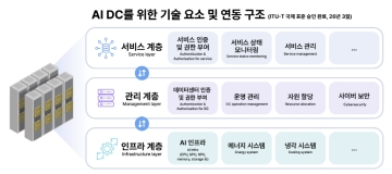
SKT Receives International Standard for AI Data Center Interconnection Structure… Establishes Operating System Standards
SK Telecom's proposed AI data center interworking architecture has received final approval as an international standard at the International Telecommunication Union Telecommunication Standardization Sector (ITU-T) conference. The core of this standard is the classification of AI data centers into three layers—service, management, and infrastructure—and the organization of signaling requirements between layers. As AI service proliferation increases the importance of interworking among various systems within data centers such as computation, power, cooling, storage, and security, this standard is significant in that it presents a common architecture for operations and service delivery. SK Telecom stated that it initiated the relevant standardization project in 2024 and achieved this approval following approximately two years of discussion.
2026.03.18by 명세환 기자











