



KTH and Jeju National University Collaborate on Development of GIS-based Jeju Tourism Services
 Published2016.01.08 18:17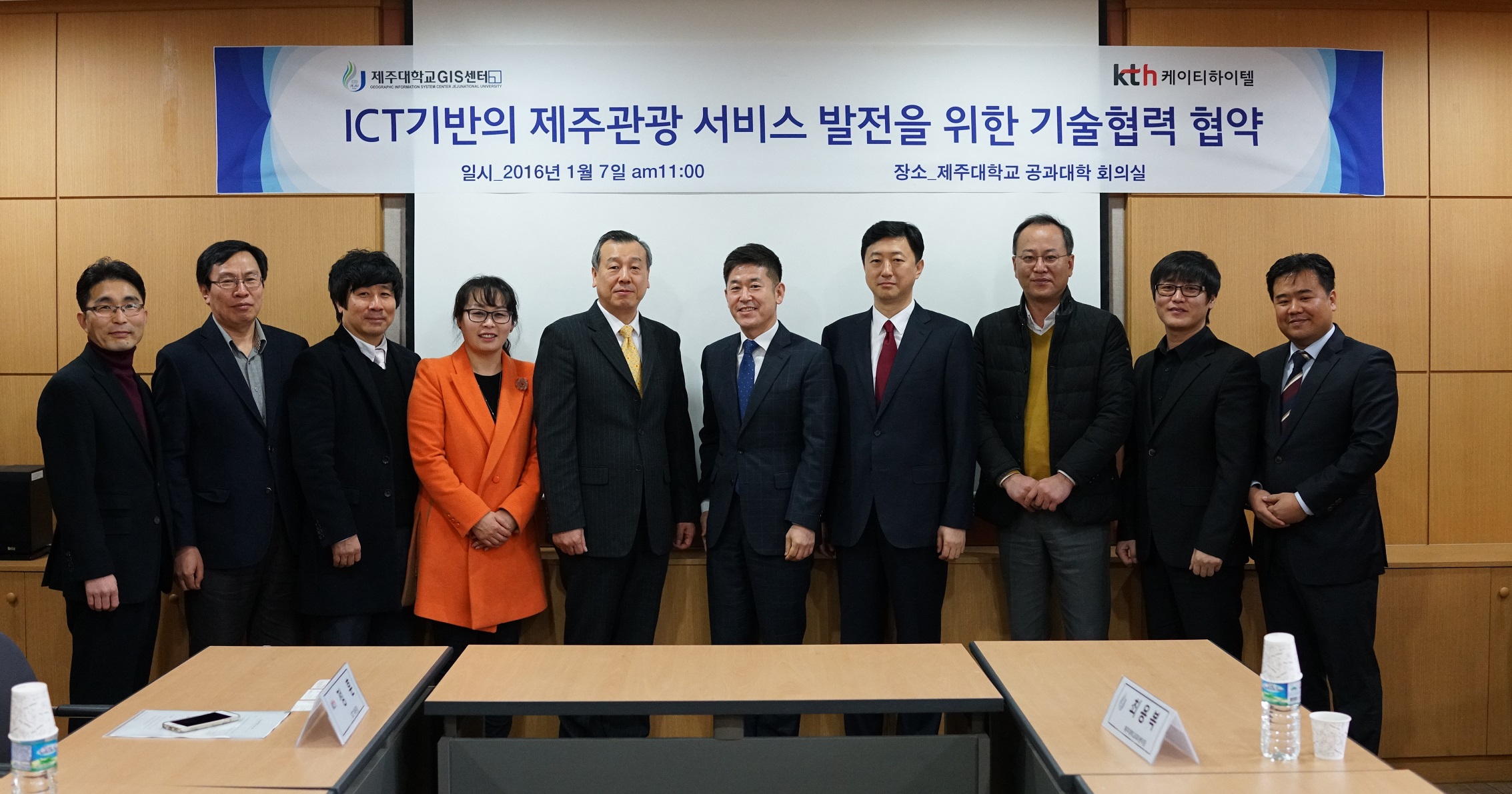
Jeju National University (President, Heo Hyang-jin) and KTH (CEO Oh Se-young) announced on the 8th that they have signed an agreement on technology cooperation and joint business development in the field of GIS-based smart tourism and agreed to cooperate for the development of ICT-based GIS services and the advancement of Jeju tourism services.
Through this agreement, the two companies have agreed to jointly utilize their expertise and information in the fields of ICT and tourism development to develop and implement ICT-based GIS (Geographic Information System) services. Key areas of exchange and cooperation include: ▶ establishing GIS and tourism platforms for smart tourism services; and ▶ identifying and cooperating on GIS-based business projects.
KTH plans to actively utilize its proprietary GIS capabilities, such as the operation of Olleh Map and Olleh Navi, to build a GIS for Jeju tourism. KTH builds and operates the Olleh Map data and platform, and has developed solutions specialized in geographic information and spatial data, such as 'Geotrend' and 'Daisy', a large-scale data analysis and recommendation solution, which it provides to various public institutions and companies.
Jeju National University established the GIS Center in 2004 for the purpose of training GIS education personnel. As a hub university designated by the Ministry of Land, Infrastructure and Transport, it conducts personnel training projects and carries out spatial information exchange and cooperative research through industry-academia collaboration. In 2016, we plan to actively develop GIS-based tourism service discovery projects.
Both companies expect that by combining KTH’s GIS implementation capabilities and Jeju National University’s know-how in developing local and tourism information, they will be able to actively participate in various GIS-related business sectors necessary for tourism businesses in the Jeju region.
"Expanding GIS-based infrastructure and services is crucial for the development of the tourism industry in Jeju Island, the largest tourist destination in Korea visited by over 13 million people annually," said Jeong Hoon, Head of the ICT Division at KTH. "Through the cooperation between the two companies, we will contribute to Jeju Island's tourism industry by developing various business models that integrate ICT-based GIS technology with tourism."
Comments
Related news
European Patent Applications Surpass 200,000 for the First Time… South Korea Maintains 5th Place, Led by Batteries and Telecommunications
According to the European Patent Office (EPO)'s 'Technology Dashboard 2025', European patent applications last year reached 201,974, surpassing 200,000 for the first time. Korean companies and inventors filed 14,355 applications, representing a 9.5% increase from the previous year and maintaining 5th place by country. Battery, digital communication, and semiconductor technologies led the growth, with Samsung ranking as the top EPO applicant for the second consecutive year and LG reaching 3rd place. The presence of major domestic cities such as Seoul, Suwon, and Yongin was also confirmed. It was also revealed that Korea's European patent strategy is expanding beyond individual technologies to span the entire industry.
2026.03.24by 명세환 기자

SK Telecom First Applies AI-Based Network Operations at Gwanghwamun K-Pop Concert
SK Telecom announced that it applied an AI-based network operation system for the first time at a large-scale K-pop concert held in the Gwanghwamun area of Seoul on March 21st, managing communication quality throughout the event. Mobile data usage during the three hours before and after the concert reached 12.15TB, approximately doubling compared to the same time slot the previous weekend. SK Telecom monitored traffic using the AI system 'A-One' in five-minute and 50-meter units to respond to potential overload situations, while also operating temporary communication facilities and on-site personnel in parallel. This case is interpreted as confirmation of the practical applicability of AI-based autonomous network operation in an environment where demand from dense events and foreign users increases simultaneously.
2026.03.23by 명세환 기자
ETRI Develops 200Gbps Photodetector… Initiates Localization of Optical Receivers for AI Data Centers
The Electronics and Telecommunications Research Institute (ETRI) has developed a photodetector device that processes optical signals of approximately 200Gbps per channel for the first time in Korea. This device is a component that converts optical signals into electrical signals and determines the reception performance of AI data centers and 5G/6G communication networks. ETRI achieved bandwidth of 70GHz or higher and optical responsivity of 0.75A/W or higher, and integrated an indium phosphide lens on the rear of the chip to enhance optical reception efficiency and alignment convenience. The technology was presented at OECC 2025 and was recently published in the international academic journal 'Optics Express'.
2026.03.19by 명세환 기자
SKT and Ericsson Expand Joint Research on AI Networks… Preparing for 6G Beyond 5G Advancement
SK Telecom and Ericsson are expanding AI-based mobile network collaboration. On the 19th, the two companies signed a memorandum of understanding covering 5G advancement through 6G standardization, and agreed to undertake joint research and verification in the areas of AI-RAN, open and autonomous networks, security, and future communication technologies. This collaboration is interpreted as a move to enhance current 5G operational efficiency while preparing for a 6G environment where AI becomes embedded throughout the network. The scope also includes network operations automation, multi-vendor environment response, energy efficiency improvements, and review of communication-sensing fusion technology.
2026.03.19by 배종인 기자
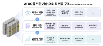
SKT Receives International Standard for AI Data Center Interconnection Structure… Establishes Operating System Standards
SK Telecom's proposed AI data center interworking architecture has received final approval as an international standard at the International Telecommunication Union Telecommunication Standardization Sector (ITU-T) conference. The core of this standard is the classification of AI data centers into three layers—service, management, and infrastructure—and the organization of signaling requirements between layers. As AI service proliferation increases the importance of interworking among various systems within data centers such as computation, power, cooling, storage, and security, this standard is significant in that it presents a common architecture for operations and service delivery. SK Telecom stated that it initiated the relevant standardization project in 2024 and achieved this approval following approximately two years of discussion.
2026.03.18by 명세환 기자











