


Can self-driving cars operate without precise maps, V2X, or road infrastructure?
 Published2016.03.28 16:01
Cooperation between relevant ministries, including the Ministry of Land, Infrastructure and Transport, is urgently needed, and C-ITS for autonomous driving is in full swing.
As the development of autonomous vehicles accelerates domestically and internationally, interest in vehicle-to-X (V2X) wireless communication that links roads and vehicles and precision maps for autonomous driving is increasing.
A commonly referred to autonomous vehicle is a human-friendly vehicle that can recognize its surroundings, assess risks, plan its own driving route, minimize driver intervention, and drive safely on its own. Accordingly, when autonomous vehicles are categorized into levels, they are divided into Level 0 (driver is aware, in control, and responsible) to Level 4 (car is aware, in control, and driver is not available for driving), and a fully autonomous vehicle refers to Level 2 (driver is aware, car is in control) or higher.
However, automotive experts emphasize that the role of intelligent roads, as well as the cars themselves, is paramount in transitioning from Level 2 to Level 3 (cars perceive and control). The closest example is the Google self-driving car accident that occurred last year (during a test run in Mountain View, California). The accident occurred when the car detected a sandbag near a road drainage ditch while attempting to make a right turn and slowed down. The autonomous car, which was attempting a wide detour at 3.2 km/h, judged that a bus approaching from behind would slow down, so it made a turn and collided with the bus.
The car detected the sandbags while making a right turn and made a sharp detour into the adjacent lane, but still collided with the bus. This suggests that if a V2X communication system had been installed at the intersection, the car and bus could have received the information and avoided the accident. In this way, road-vehicle linked V2X high-reliability communication provides communication technology for constant connection between cars and roads for autonomous cooperative driving, and real-time, reliable transmission and reception of traffic safety data.
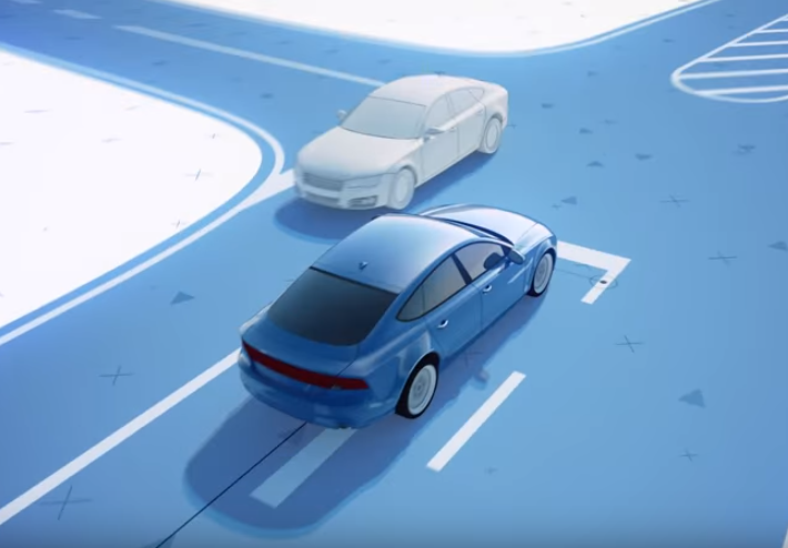
▲ Capture from map service company 'Here'.
V2X highly reliable communication also plays a crucial role in preventing smart car hacking accidents. In the US, a terminal that can hack a connected car system that sends rescue requests or provides real-time navigation services when a vehicle has a problem can be made for $100 using a 4G LTE network. In addition, a demonstration was made of the possibility of hacking the OBD-II, which diagnoses the vehicle's condition and records driving information, through an internet connection to take control of the vehicle's control unit and operate the vehicle's brakes with a mobile phone, causing a rollover accident while driving.
Accordingly, overseas, the automotive security standard EVITA (E-safety Vehicle Intrusion Protected Applications) defined the security requirements of the vehicle's internal network as a security level, and the Preserve project for V2X security was implemented. Preserve (Preparing Secure V2X Communication Systems) is a project that integrated vehicle security projects conducted in Europe, proposed a security structure that guarantees V2X security and privacy, and performed V2X verification.
In Korea, the next-generation Cooperative Intelligent Transport Systems (C-ITS) project plans to finalize communication standards, including V2X, by early next year. Since launching a pilot project in 2014, the project has been in full swing since last year. The Ministry of Land, Infrastructure and Transport announced a joint plan to support the commercialization of autonomous driving in May of last year, and will begin R&D on a smart autonomous cooperative driving road system by 2020.
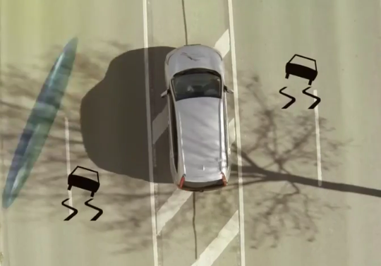
▲ NXP Semiconductors' V2X RoadLINK allows drivers to 'see' ahead of traffic obstacles such as corners or large trucks. (NXP homepage)
C-ITS is a system that exchanges road condition information, such as accidents and traffic congestion, with vehicles behind and roadside base stations via vehicle-mounted terminals. Using a dedicated frequency band (5.9 GHz), information can be exchanged even at high speeds. Furthermore, safety information, such as falling objects and pedestrians, is shared in real time with vehicles behind and roadside base stations. Existing ITS systems collect traffic information from detectors and CCTVs and provide it to vehicles via a video message system (VMS).
Along with improving traffic safety, C-ITS focuses on supporting the commercialization of autonomous vehicles. The plan is to improve the accuracy and reliability of autonomous driving information, minimize positioning errors, support safe autonomous driving, and secure vehicle sensor functions such as cameras and radars to provide an environment where inexpensive sensors can be used, thereby expanding the distribution of autonomous vehicles.
Kim Chang-ki, an official at the Ministry of Land, Infrastructure and Transport, said, “Autonomous driving is possible with vehicle sensors alone, but if we fuse vehicle sensor information with the help of C-ITS, we can realize autonomous driving technology early.” He added, “Under the goal of three-stage autonomous driving by 2020, we plan to gradually establish a leading autonomous driving project on highways and C-ITS on national highways starting in 2017.”
However, some question whether the realization of an intelligent transportation system is possible given the lack of Wave chip (next-generation automotive communication modem) technology essential for V2X implementation. While the Electronics and Telecommunications Research Institute (ETRI) and other organizations are currently developing Wave chips and preparing for mass production, they are considered to fall short of world-class chip technology. This means it will take considerable time for domestic companies to verify and implement these chips.
Urgent need to develop precision maps for autonomous driving
Furthermore, the development of precision maps for autonomous driving is urgently needed to ensure safe and accurate autonomous driving. Precision maps must offer higher accuracy than conventional navigation maps (which typically offer accuracy of tens of meters), achieving an accuracy of 0.5 meters. Leveraging precision map information, map-based ADAS functions must be implemented and vehicle positioning performance for autonomous driving must be improved. Map-based ADAS enhances ADAS functions by leveraging road geometry (curvature/slope, etc.) and complements vehicle-mounted sensors such as cameras, lidar, and radar to enhance recognition capabilities.
As autonomous driving becomes more visible, diversification of map content for it is necessary. At the same time, ensuring accuracy and up-to-date information is crucial. Increasing the automation rate of object information extraction is crucial, and a driving path shape improvement module should be applied to improve the quality of key attributes in precision maps.
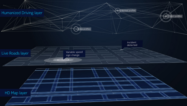
▲ Here's HD Live map is a cloud-based real-time map technology that utilizes precision GPS and 3D surface detection technology.
“Currently, high-precision maps centered on highways are only capable of up to Level 3 autonomous driving,” said Sanghak Seo, head of the Hyundai MNSoft Research Institute. “Going forward, we still have the task of including in high-precision maps for autonomous driving how to create roads in the city, how to create and provide maps of alleyways, and how to detect people on pedestrians and bicycle paths.”
As part of this government project, the Electronics and Telecommunications Research Institute (ETRI) is developing cloud-based, progressively evolving precision map generation and driving situation recognition software technologies. The Autonomous Cooperative Driving Road System Development Research Group is also promoting the "Development of a Smart Autonomous Cooperative Driving Road System." This project includes the development of a precision electronic map-based dynamic information system, a GPS correction information provision system, and a multimodal V2X communication system.
For example, the development of a smart autonomous cooperative driving road system is also pursuing a plan to apply technologies such as HD Live Map from 'Here', a map service company famous for its location-based information. HD Live Map is a cloud-based, real-time mapping technology that leverages precision GPS, 3D surface detection, and other technologies to support autonomous and cooperative driving. The plan is to enhance convenience for drivers and road operators by building a domestically-designed Live Map that integrates real-time road condition information.
Noh Hyeong-ju, team leader at the Korea Automotive Technology Institute, said, “IEEE predicted that autonomous vehicles will account for 75% of all vehicles worldwide by 2040. However, autonomous vehicles require not only automobiles but also road infrastructure as a foundation, so a fully autonomous vehicle will be possible only after that.”
Comments
Related news

[Reporter's Notebook] The Current State of Self-Driving Cars: A Technology That Has Made Imagination a Reality
Google has passed autonomous vehicle safety testing in Las Vegas and other locations, and California is in the process of revising autonomous vehicle operation laws. Nevada has permitted autonomous vehicle operation and issued licenses for the first time in the world. Meanwhile, IT companies were advancing on the road. As is well known, Google has been focusing on autonomous driving technology development since 2009. Google's autonomous vehicle, which garnered more attention due to minor accidents (14 incidents total) in June, has traveled approximately 2.896 million kilometers from 2009 to the present. Google stated that it is traveling an average of 16,000 kilometers per week through autonomous driving mode in its autonomous vehicles. Additionally, Apple, which announced autonomous driving technology development in 2015, is aiming for fully autonomous driving.
2015.08.03by 명세환 기자
Where Are We in Core Sensor Element Development? ② “Development of 79GHz Automotive Radar Sensor to Preempt the Autonomous Vehicle Market”
Following last week's updates on smart motion sensors, metabolic rate measurement sensors, harmful gas sensors, and optical sensors, we introduce the following technologies: ▲automotive shunt resistance current sensors ▲lidar sensors for autonomous vehicles ▲automotive 79GHz radar sensor technology.
2015.11.23by 신윤오 기자
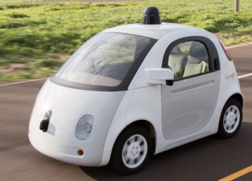
Domestic push for autonomous vehicles on actual roads is in its infancy, while overseas markets are racing to fully apply artificial intelligence.
As the government has decided to implement autonomous vehicle road tests, attention is once again focusing on core autonomous driving technologies. The Ministry of Land, Infrastructure and Transport (Minister Kang Ho-in) announced its '2016 Business Plan' on the 28th of last month, selecting autonomous vehicle industry development as one of the seven new industries in land, infrastructure and transport. This development plan includes technology development support projects such as real-road testing of autonomous vehicles, designation of pilot operation zones, and construction of experimental cities.
2016.02.01by 신윤오 기자
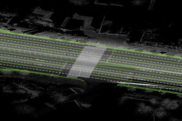
Get the 'Precision Road Map' needed for developing self-driving cars
High-precision road maps created to usher in the autonomous vehicle era will be provided free of charge starting from the 29th. High-precision road maps include electronic maps (with 3D coordinates) produced at 25cm accuracy containing lane information necessary for autonomous driving (regulatory lines, road boundaries, stop lines, lane center lines), road facilities (median barriers, tunnels, bridges, underground underpasses), and marking facilities (traffic safety signs, road surface markings, traffic signals).
2016.02.29by 신윤오 기자
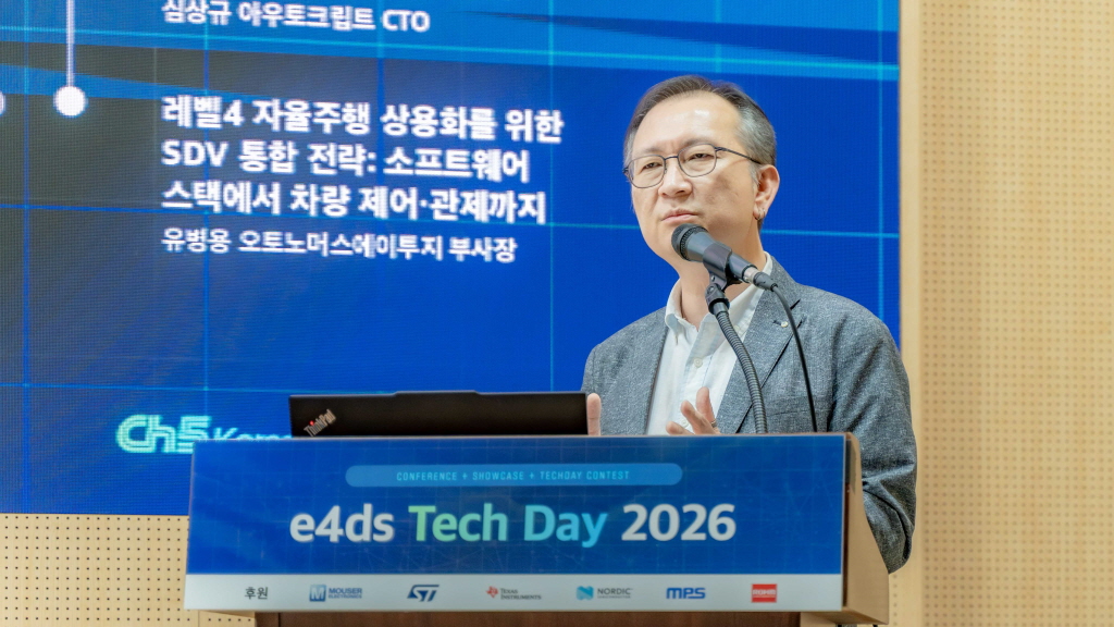
[e4ds Tech Day 2026 ⑨] Sim Sang-gyu, Autocrypt CTO: "In the Physical AI Era, Automotive Security Must Extend Beyond the Vehicle"
At e4ds Tech Day 2026, Sim Sang-gyu, CTO of Autocrypt, explained automotive cybersecurity strategies in the era of Physical AI and SDV (Software-Defined Vehicle). Automobiles are evolving as part of an ecosystem connected to AI, cloud, chargers, IoT, and robots, and he emphasized that the scope of security must expand beyond the vehicle interior to the entire connected environment. In particular, AI model tampering, adversarial attacks, OTA updates, and EV charger hacking were identified as major threats. He explained that response measures require zero trust, AI model integrity protection, intrusion detection, Security by Design and Default, and full lifecycle security management, and that proactive security system establishment beyond regulatory compliance is critical for securing future mobility competitiveness.
2026.10.12by 배종인 기자











