



Can domestic LiDAR technology, the eyes of autonomous vehicles, drastically lower prices?
 Published2016.07.04 14:47
Successful technology development centered on government-funded research institutes laid the foundation for localization and significantly lowered prices.
Autonomous vehicles have once again become the center of controversy following reports last May of a fatal accident involving a Tesla electric vehicle using its autonomous driving function (Autopilot).
This is because the U.S. National Highway Traffic Safety Administration (NHTSA) considers this accident the first fatal accident to occur in autonomous driving mode. This accident is serving as an opportunity to comprehensively re-examine autonomous vehicle technology, from the role of sensors to commercialization.
Accordingly, we examined the forward sensing technology for autonomous vehicles through the current status of domestic technology regarding LiDAR and related technologies, which can be considered the 'eyes' of autonomous vehicles.
LiDAR (Light Detection and Ranging) is a technology that acquires distance information by using a high-power pulsed laser to measure the time it takes for a laser beam to reflect back from an object. Lidar, which can be utilized in various fields such as autonomous vehicles, global environment observation, atmospheric analysis, and unmanned vehicles, uses the high density and short period of lasers to observe physical properties in the atmosphere with precision and measure distances.
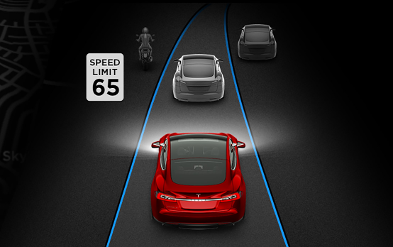
▲ A recent fatal accident involving a Tesla vehicle's autonomous driving function has served as an opportunity to re-evaluate forward sensing technology. (Photo: Tesla website)
Recently, 3D spatial scanning technology based on LiDAR technology has emerged and is being applied in laser-based fields such as autonomous vehicles, distance measuring devices, and 3D imaging systems. Currently, Velodyne (USA), IBEO (Germany), and ASC (USA) lead the global market with rotating body, rotating mirror, and fixed optical system types, respectively, while the domestic market relies 100% on imports. The global market for LiDAR sensors is growing rapidly at an average annual rate of 29%, rising from $900 million in 2015 to $3.3 billion in 2020.
KETI Develops Scanning LiDAR Optical Engine Platform, 'First Localization'
Domestic LiDAR technology is primarily held by government-funded research institutes such as the Korea Electronics Technology Institute (KETI), the Electronics and Telecommunications Research Institute (ETRI), and the Korea Institute of Industrial Technology (KITECH), and some of this technology is being transferred to domestic companies.
First, the Electronics Components Research Institute announced last January that it had developed a scanning LiDAR sensor optical engine platform, a core component of autonomous vehicles, using purely domestic technology. Scanning LiDAR sensors are sensors that acquire three-dimensional shape information and recognize the distance to surrounding vehicles or moving objects.
The scanning lidar optical engine platform developed by KETI was designed with commercialization in mind from the start. By utilizing a mirror rotation method advantageous for miniaturization, the structure was simplified through the integrated design of the lens optical system, and low-cost design was achieved by reducing optical components by half. This resulted in a shortened production process, thereby increasing reliability and lowering production costs.
The researchers stated that the technology is technically on par with overseas products. It recognizes all objects within a distance of 200 meters at a speed of 30 frames per second, with a recognition error of 10 cm and a horizontal field of view of 140°. Considering that an average person's field of view is 100° at 40 km/h and 40° at 100 km/h, these figures are sufficient to guarantee safety.
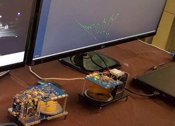
▲ The scanning lidar optical engine platform developed by KETI uses a mirror rotation method advantageous for miniaturization and simplifies the structure through the integrated design of the lens optical system.
This technology can be utilized in sensors and collision avoidance systems for autonomous vehicles, as well as in subway screen door safety and a wide range of security systems for buildings and homes, and also in sensors and small marine collision avoidance systems for unmanned surface vessels, 3D terrain information acquisition and drone navigation systems.
Choi Hyun-yong, head of the IT Convergence Components Research Center at KETI, said, “If this technology is commercialized, the cost of LiDAR systems, which currently amounts to tens of millions of won, can be lowered to less than a few million won.”
In addition, KETI has also developed 'urban driving vehicle collision avoidance LiDAR technology' utilizing invisible laser fence technology. This lidar system is a sensor system that uses a single laser light source to detect vehicles approaching from the front and left and right sides up to a distance of up to 50m and transmits the sensing results to the vehicle control unit via CAN communication.
The invisible laser fence consists of an invisible fence 3 meters high and 100 meters long that detects the location of an intrusion with centimeter precision when an intruder occurs. By utilizing this, it can be applied to non-visible boundary security fences or major building perimeter systems, such as vehicle collision avoidance systems, 3D terrain search, and LRF for CCTV autofocus.
ETRI Secures Core Source Technology for 3D Image Sensors
ETRI (Electronics and Telecommunications Research Institute) also succeeded in developing core source technology for 3D image sensors for future automobiles through the Active 3D Photodetector and Signal Processing Technology Project in 2015, and developed element technology for automotive 3D LiDAR sensors as a related project.
While sensor technologies from Audi or Google that use a rotating method with a scanner raise concerns regarding performance degradation and reliability issues due to vibrations during vehicle operation, the technology developed by ETRI adopts a method that obtains 3D images without a scanner by using a focal plane array.
ETRI’s 3D image sensor technology for smart cars for unmanned autonomous driving includes high-sensitivity photodetector array technology based on InGaAs material, ROIC (Read-out IC) technology with a 100um pitch spacing capable of measuring distance and intensity, and 3D Flash camera technology.
In response, ETRI stated, “We have secured reliability by using a flash method that does not utilize a scanner, addressing issues such as shaking during movement and scanner operation in the direction of travel,” adding, “The acquisition of proprietary technology for focal plane array InGaAs photodetector chips enables the development of system-customized and optimized cameras.”
These core source technologies can dramatically improve the recognition of vehicles, lanes, pedestrians, and obstacles, which are essential for unmanned autonomous driving, thereby accelerating the opening of the era of driverless cars. Furthermore, when combined with vision sensors and radar, they are expected to provide robust recognition capabilities against weather and environmental changes.
animationWon secures 3D image acquisition technology using a 3D scanning system
The Korea Institute of Industrial Technology has secured 3D image acquisition technology using a 3D scanning system.
This technology is a scanning system for acquiring high-resolution 3D images and a 3D image acquisition technology using the same. It is a sensor system technology that acquires high-precision, high-resolution 3D images by emitting pulsed light from a rotating 3D scanning system and receiving reflected light reflected from a target, and measuring near-field wide-angle distance data and far-field data with high vertical resolution.
This sensor system technology acquires high-speed, high-resolution 3D image data using line-shaped pulsed laser light and an array detector. With the same laser light output, wide-angle 3D image data can be obtained at close range, and 3D image data with high vertical resolution can be obtained at long range. It can be used as a sensor for acquiring and processing high-resolution 3D point cloud data for unmanned vehicles, such as high-speed automobiles or field robots.
An official from the Korea Institute of Industrial Technology stated, “The domestic market for LiDAR systems and sensors is recording a high annual growth rate of 50%,” adding, “3D image acquisition technology can be utilized in various fields such as process automatic control in construction or civil engineering, design or drawing generation for bridges or plant facilities, field modeling or drawing work, process quality control, and road design.”
Comments
Related news
Why did Google's self-driving car spend 3.85 million kilometers on road tests?
Dr. Cha Won-yong, a representative futurologist in Korea and CEO/Director of ASPEC Future Technology Management Research Institute, revealed this through his recently published book titled "Intensive Patent Analysis of Google's AI-based Autonomous Vehicles," stating that "most of Google's patents are aligned with Levels (L) 3 and 4 as defined by the American SAE," and "patents related to software design capabilities for artificial intelligence (AI)-machine learning (ML)-deep learning (DL), which is the core of autonomous vehicles, and patents regarding situations, responses, and learning that occur during actual road testing based on this foundation." Dr. Cha identified 250 Google patents from 2009 through December 31, 2015, related to Google's Self-Driving Car (SDC) project, specifically semi-autonomous cars (Self-Autonomous Car) and autonomous cars (Autonomous Car), and analyzed 110 important patents among them. Most of these patents are sensor systems (Sensor System), autonomous driving computer systems (Autonomous Driving Computer System), which are core to autonomous vehicles, and authentication systems between users and autonomous vehicles when commercialized.
2016.05.02by 신윤오 기자
[CPU Planning ②] The goal is to expand the application of domestic cores in the field of autonomous vehicle image recognition
The Aldebaran CPU core is a core independently developed by the Electronics and Telecommunications Research Institute (ETRI). The name is derived from Aldebaran, the first-magnitude star representing Taurus in the constellations. This processor provides integrated ADE (Application Development Environment) that includes a CPU core based on power consumption minimization microarchitecture and an open source (GNU)-based software toolchain to enhance interoperability with enterprises. As computational functionality and learning capability for optimization in given situations are required, the development of hardware-based MCUs capable of efficiently calculating intelligent algorithms is increasingly demanded. To meet these requirements, the Electronic Components Research Institute developed the MENSA core.
2016.05.16by 신윤오 기자
Localization of key components is necessary for the commercialization of autonomous vehicles
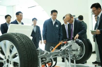
Choi Jeong-ho, Vice Minister of Land, Infrastructure and Transport, visited Hyundai Mobis's Mabok Research Institute on the 3rd, which became the first automotive parts supplier to receive temporary autonomous vehicle operation approval. He was briefed on the autonomous vehicle-related research and development initiatives being pursued at the institute. At a roundtable discussion attended by Hyundai Mobis Executive Vice President Jeong Seung-gyun and research institute officials, Vice Minister Choi encouraged them, stating, "I appreciate the efforts of those who have worked on technology development to make today's Hyundai Mobis possible."
2016.06.07by 명세환 기자
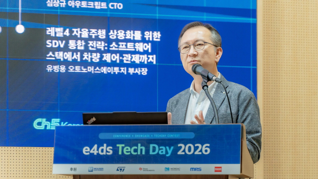
[e4ds Tech Day 2026 ⑨] Sim Sang-gyu, Autocrypt CTO: "In the Physical AI Era, Automotive Security Must Extend Beyond the Vehicle"
At e4ds Tech Day 2026, Sim Sang-gyu, CTO of Autocrypt, explained automotive cybersecurity strategies in the era of Physical AI and SDV (Software-Defined Vehicle). Automobiles are evolving as part of an ecosystem connected to AI, cloud, chargers, IoT, and robots, and he emphasized that the scope of security must expand beyond the vehicle interior to the entire connected environment. In particular, AI model tampering, adversarial attacks, OTA updates, and EV charger hacking were identified as major threats. He explained that response measures require zero trust, AI model integrity protection, intrusion detection, Security by Design and Default, and full lifecycle security management, and that proactive security system establishment beyond regulatory compliance is critical for securing future mobility competitiveness.
2026.10.12by 배종인 기자

Practical HIL Construction Strategy for Automotive and Off-Highway Controller Validation
As vehicle E/E architecture transitions to zonal structures and shifts to software-defined vehicles (SDV), the number of controllers (ECUs) requiring validation and software complexity are surging dramatically. Meanwhile, real vehicle testing cannot provide repeated verification under identical conditions and entails lead time and safety concerns. This white paper explains the principles of HIL (Hardware-in-the-Loop) validation and the structure of the NI platform composed of PXI, SLSC, and VeriStand, and through two actual implementation cases—Camera Record & Replay HIL for In-Cabin Monitoring Controller (ICMU) and Forklift Controller (VCU) HILS—describes how controller-level regression testing becomes possible. Additionally, it explicitly states application boundaries and limitations, such as lack of A2B support.
2026.10.12by 편집부











