



Applying NB-IoT technology to land registration and cadastral surveying projects
 Published2017.08.08 14:58
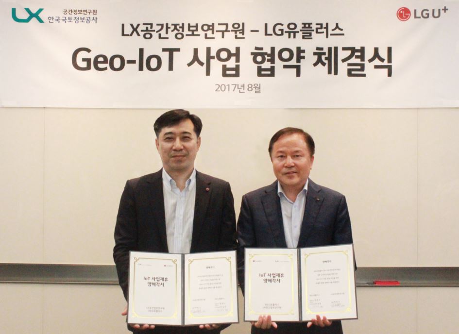
LG Uplus announced that it has signed a land and transportation IoT business agreement with the Spatial Information Research Institute of LX Korea Land Information Corporation and decided to apply NB-IoT technology to facility management businesses, such as cadastral surveying and management of aging houses and buildings. Cadastral surveying is also called the resident registration of the land, as it records all information about the national territory.
LX Korea Land Information Corporation is pursuing the so-called 'Geo-IoT commercialization,' which involves integrating cutting-edge sensors and IoT technology into existing cadastral surveying businesses to provide not only precise land surveying but also collected spatial big data information to the private sector.
LX Korea Land Information Corporation has decided to collaborate with LG Uplus on the Geo-IoT business and plans to jointly build an IoT platform that can manage cadastral work more efficiently by applying NB-IoT technology to the facility monitoring system currently under development.
By equipping NB-IoT modules on 'cadastral reference points,' which are reference points for conducting cadastral surveys accurately and efficiently, and 'boundary markers,' which are markers used to restore the boundaries of cadastral maps on the ground, it becomes possible to remotely and precisely check the status and location of cadastral reference points and to identify in real time whether the boundary markers have been lost due to landslides or heavy rain, or if their location has been changed artificially.
In particular, NB-IoT boundary markers equipped with various sensors such as acceleration, tilt, temperature, and humidity can not only determine whether they are lost but also monitor the movement status of facilities and atmospheric environment information of the installation area in real time.
Through this agreement, both companies expect to improve the precision of cadastral surveying, while also quickly identifying environmental information from all over the country and clarifying the land property rights of the people.
In addition, by utilizing various cadastral and spatial information collected through the NB-IoT monitoring system, not only national land surveying but also △management of vacant houses and prediction of aging building collapses △establishment of building emergency evacuation systems △high-tech applications for autonomous vehiclesThe plan is to expand the application of NB-IoT technology to various land information and spatial information projects, such as quality map production.
Meanwhile, LG Uplus completed the construction of commercial NB-IoT networks in most cities and provinces nationwide last month and is rapidly expanding its business scope by building remote gas meter reading and smart pipeline network management systems with major city gas companies and applying NB-IoT technology to solar power generation systems managed by local governments.
“It is meaningful to have established a smart land management system with LX Korea Land Information Corporation for the first time in the industry, having been recognized for our technological capabilities as a pioneer in IoT,” said Ahn Seong-jun, Executive Vice President and Head of the IoT Division at LG Uplus. “We expect this agreement to serve as an opportunity to secure a leading position in the Geo-IoT market by combining advanced sensors and IoT technology.”
Comments
Related news
LG U+ to Hold "Supplier Proposal Day" Quarterly to Strengthen Mutual Growth Management
LG U+ announced that it held a "Supplier Proposal Day" to strengthen mutual growth management with small and medium-sized partner companies. Supplier Proposal Day is a mutual growth program where small and medium-sized partner companies propose ideas for developing affordable and highly efficient telecommunication equipment or solutions, and LG U+ guarantees purchases of a certain quantity or more of the adopted idea products after going through a review process. At this proposal day, partner companies proposed various ideas in three fields: ▲telecommunication equipment and materials ▲construction (installation) ▲devices, and LG U+ adopted 9 ideas including cost-saving IP phones and NB-IoT-based circuit breaker monitoring devices.
2017.07.11by 김자영 기자
KT and LG Uplus to Build NB-IoT Ecosystem
KT and LG U+ are strengthening cooperation to foster an NB-IoT (Narrowband-IoT) ecosystem. KT and LG U+ have decided to collaborate on ▲sharing NB-IoT open labs ▲providing one-stop services for development support, network interoperability testing, and training ▲jointly developing core IoT technologies including standards, chipsets, and modules. They announced the expansion and opening of NB-IoT open labs at two locations: Sangam-dong, Seoul (LG U+) and Pangyo, Gyeonggi Province (KT). The open labs have established a commercial NB-IoT network testing environment, enabling IoT device developers to conduct network interoperability testing with both carriers' networks at either of the two centers. As a result, IoT device developers can simultaneously receive network interoperability testing with both carriers, USIM support, and device development assistance at the NB-IoT open lab. This not only improves development convenience but also creates market expansion opportunities to supply devices to both carriers.
2017.07.17by 김지혜 기자
KT-Hyundai Marine & Fire Insurance Join Hands to Develop IoT Insurance Products
KT and Hyundai Marine & Fire Insurance announced that they signed a memorandum of understanding (MOU) on joint development of IoT-based convergence insurance products at KT's Gwanghwamun Building East in Seoul on the 27th. At the signing ceremony, key officials from both companies including Kim Hyung-wook, Head of Platform Business Planning at KT, and Jo Yong-il, Head of Corporate Insurance Division at Hyundai Marine & Fire Insurance, attended and pledged mutual cooperation for developing various products based on narrow-band IoT (NB-IoT) and Internet of Things. KT plans to provide narrow-band Internet of Things technology and service platforms, while Hyundai Marine & Fire Insurance plans to develop and activate various sales channels.
2017.07.27by 김자영 기자
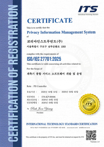
Korea Instrument, KOLAS Accredited Calibration Agency First to Simultaneously Acquire ISO/IEC 27,001·27,701
Korea Instrument has become the first among KOLAS accredited calibration agencies to simultaneously acquire ISO/IEC 27,001 and ISO/IEC 27,701 certifications. Through its proprietary platforms CWIZ Enterprise and CWIZ Partners, the company has embedded information security and personal data protection requirements across all business processes including customer information, equipment data, and calibration reports, with plans to continuously advance its management system through regular audits and security inspections.
2026.10.12by 배종인 기자
TeamViewer One, IT Incident Automation Workflow and Resolution Center Enhanced
TeamViewer has added IT incident automation capabilities and an advanced Resolution Center to its integrated digital workplace management platform 'TeamViewer ONE'. Recurrent service disruptions, configuration errors, and capacity shortages are automatically handled according to preset policies, and device status verification through script deployment can be managed in a unified interface, significantly reducing repetitive tasks for IT teams.
2026.10.12by 배종인 기자











